
Guidelines for Rehabilitating Cultural Landscapes
Spatial Organization + Land Patterns

Identify, Retain, and Preserve Historic Features and Materials
![]()
Identifying, retaining and preserving the existing spatial organization and land patterns of the landscape as they have evolved over time. Prior to beginning project work, documenting all features which define those relationships. This includes the size, configuration, proportion and relationship of component landscapes; the relationship of features to component landscapes; and the component landscapes themselves, such as a terrace garden, a farmyard, or forest-to-field patterns.
![]()
Undertaking project work without understanding the effect on existing spatial organization and land patterns. For example, constructing a structure that creates new spatial divisions or not researching an agricultural property’s development history.
Protect and Maintain Historic Features and Materials
![]()
Protecting and maintaining features that define spatial organization and land patterns by non-destructive methods in daily, seasonal and cyclical tasks. For example, maintaining topography, vegetation, and structures which comprise the overall pattern of the cultural landscape.
![]()
Allowing spatial organization and land patterns to be altered through incompatible development or neglect.
Utilizing maintenance methods which destroy or obscure the landscape’s spatial organization and land patterns.
Repair Historic Features and Materials
![]()
Repairing materials that define the spatial organization and land patterns by use of non-destructive methods and materials when additional work is required. For example, repairing structures or regenerating vegetation which comprise the individual spaces or overall patterns of the cultural landscape.
![]()
Failing to undertake necessary repairs resulting in the loss of spatial organization and land patterns.
Replacing a feature that defines spatial organization and land patterns when repair is possible.
Replace Deteriorated Historic Materials and Features
![]()
Replacing in kind an entire feature that defines spatial organization and land patterns that is too deteriorated to repair.
![]()
Removing a feature that is beyond repair and not replacing it; or, replacing it with a new feature that does not respect the spatial organization and land patterns.
Design for the Replacement of Missing Historic Features
![]()
Designing and installing new features which respect or acknowledge the historic spatial organization and land patterns. It may be an accurate restoration using historical, pictorial and physical documentation; or be a new design that is compatible with the spatial organization and land patterns. For example, installing a new shrubplanting which defines the edge of a missing historic boundary.
![]()
Creating a false historical appearance because the replacement feature is based on insufficient historical, pictorial and physical documentation.
Introducing new features that are incompatible with the spatial organization or land patterns.

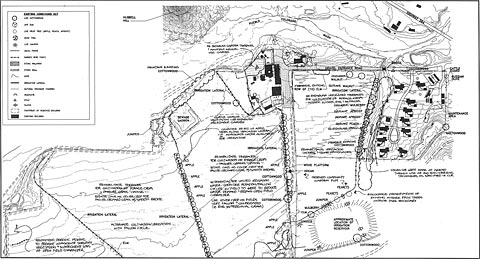
At the Hubbell Trading Post National Historic Site, Ganado, Arizona, the spatial organization and land patterns will be reinstated and the agricultural fields returned to active cultivation and forage crops. To re-establish the lost spatial relationships, apple trees along the irrigation canals will be replaced and the terraces they define will be returned to pasture grasses and haying. (Landscape Systems/Peggy Nelson)
Alterations/Additions for the New Use
![]()
Designing new features when required by the new compatible use to assure the preservation of the historic spatial organization and land patterns.
Removing non significant features which detract from or have altered the spatial organization and land patterns.
![]()
Adding a new feature that detracts from or alters the spatial organization and land patterns. For example, constructing a new farm house wing over a kitchen garden.
Placing a new feature where it may cause damage to, or be intrusive in spatial organization and land patterns. For example, inserting a new visitors center that blocks or alters a historic view or vista.
Introducing a new feature that is visually incompatible in size, scale, design, materials, color and texture.
Removing historic features which are important in defining spatial organization and land patterns.
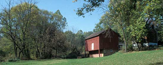
[top] The significance of Waterford is conveyed in its history, topography, architecture and integrity. The relationship between people and the land, as reflected in the topography, as well as the pristine character and integrity of the landscape, are of paramount importance when considering alterations or additions to the Village’s spatial organization and land patterns.
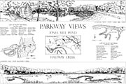
Colonial Parkway was first designed in 1930-31 and developed over a period of thirty years. The historic corridor embodies modern parkway design standards with its curvilinear alignment and scenic intent. The approach used in developing the views was to frame them with native vegetation collected and planted on-site, while also maximizing the visual contact with the York and James rivers. Research and analysis findings have verified the high level of integrity of the overall design, without any significant changes to the parkway’s engineering. (HABS)
