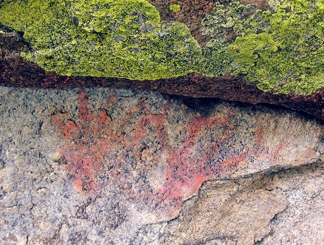
NPS American Indians in the City of RocksAt the northern edge of the Great Basin, the area surrounding City of Rocks has been home to the Shoshone, Paiute, and their ancestors for thousands of years. This landscape has witnessed a deep and evolving history, beginning with the earliest human migrations at the end of the Pleistocene and continuing to the present day. Early InhabitantsAs the Ice Age ended and the ice sheets receded, humans followed game animals across the continent into what is now the Great Basin. The melting ice sheets left vast pluvial lakes, such as ancient Lake Bonneville, which once covered parts of southern Idaho and the Great Salt Lake region. Early human groups were mobile hunters and gatherers, relying on megafauna like mastodons and mammoths. These early peoples used large fluted spear points to hunt these massive animals. As the climate warmed and dried, megafauna became extinct, leading to significant changes in tools and practices. Smaller spear points, atlatls, and later bows and arrows were developed to hunt smaller game as people adapted to the changing environment of the Holocene. Fremont InfluenceArtifacts found at City of Rocks also show the influence of the Fremont people, who were primarily based farther south in present-day Utah. One key sign of their presence is the discovery of Fremont-style grayware ceramics in the region. Shoshone and Bannock PresenceCity of Rocks was an integral part of the homeland of several Shoshone bands. These bands were often identified by their primary food sources, including:
The Bannock people, who trace their lineage to the Northern Paiute, also used this area. The pinyon pine forests in and around City of Rocks provided an essential food source—pine nuts—which the Shoshone and Bannock harvested annually each fall. This traditional practice continues today among members of the Fort Hall Reservation, connecting the past with the present. Cultural Significance TodayCity of Rocks remains a deeply important cultural and historical site for local tribes. Visitors are encouraged to respect the land, avoid collecting artifacts, and help preserve cultural sites. For those interested in learning more, pictographs can be viewed at nearby Castle Rocks State Park, and the Reserve offers history programs during the summer season to share the rich indigenous history of the area. By respecting the land and the traditions of its first inhabitants, we honor their enduring connection to this remarkable place. 
The California Trail EraThe California Trail’s establishment through City of Rocks ushered in a pivotal chapter of American history, marking the arrival of the first significant wave of European-Americans to the area now known as the Reserve. While early visitation occurred during the fur trade and exploration era, it was the mass migration along the trail that left an indelible mark on this rugged landscape. Following paths originally forged by American Indians and fur trappers, emigrants crossed the continent in pursuit of a better life, driven by the ideals of Manifest Destiny. This migration gained momentum with the discovery of gold at Sutter’s Mill in 1848, inspiring tens of thousands to venture west in search of opportunity. Between 1848 and 1869, when the transcontinental railroad was completed, approximately 240,000 people traveled the overland trails, enduring hardships and uncertainty in their quest for a brighter future. City of Rocks became a landmark along the California Trail, offering rest and refuge for weary travelers. Today, it stands as a symbol of perseverance and the transformative era of westward expansion. 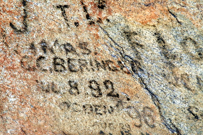
NPS A Landmark of the Westward MigrationCity of Rocks National Reserve holds the designation of a National Historic Landmark, preserving its role as a key waypoint during the mass overland migration westward. As emigrants traveled the California Trail, they would arrive at Circle Creek in City of Rocks to rest, “noon” for a midday meal, or camp before continuing their arduous journey. Many of these travelers left their mark—names written in axle grease—on the granite rocks along the trail within the Reserve. These historic inscriptions remain visible today, offering a tangible connection to the emigrants who passed through, driven by hope and determination. In the southern portion of the Reserve, the Salt Lake Alternate Trail merged with the California Trail. This alternate route connected emigrants traveling from Salt Lake City to the main trail heading west. The Salt Lake Alternate Trail was first documented in 1847 by Mormon Battalion soldiers, who traveled through the area on their way to Salt Lake after serving in the Mexican-American War in California. 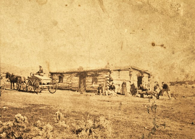
The Boise Kelton Stage RouteAfter the decline in overland migration due to the completion of the transcontinental railroad, the Salt Lake Alternate Trail found new purpose as part of a vital stage route. Known as the Boise Kelton Stage Route, it connected the railroad in Kelton, Utah, with Boise, Idaho’s growing mining hub. This route played a crucial role in Idaho’s early economic development, helping to lay the foundation for the territory’s eventual statehood in 1890. The stage route passed through City of Rocks, where a stage station was established near the junction of the California Trail and the Salt Lake Alternate Trail. This station served as a key waypoint for stagecoaches carrying passengers, mail, and goods along this essential corridor of commerce. 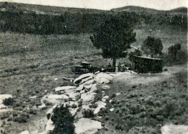
Homesteading in City of RocksBetween 1910 and 1919, a total of 29 land patents were filed within what is now City of Rocks National Reserve. Of these, 19 were dry land farms, where settlers attempted to cultivate crops despite the challenges posed by limited water availability and poor soil quality. Unfortunately, these hardships led to the abandonment of most farms by the 1920s. After the collapse of dryland farming, much of the land transitioned to rangeland for cattle and sheep grazing. This shift in land use shaped the area’s economy and landscape, a legacy that continues today as ranchers use the surrounding lands for cattle grazing. To learn more about homesteading in City of Rocks go here 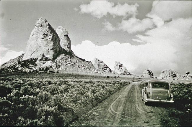
Recreation in City of RocksRecreation and tourism began to thrive in City of Rocks National Reserve during the 1960s, as visitors were drawn to the area’s historic emigrant signatures and its uniquely sculpted granite formations. This early interest grew exponentially when rock climbers from Utah discovered the granite spires, forever changing the Reserve's trajectory. By the 1980s, the increasing popularity of climbing and camping underscored the need for active management to protect the Reserve’s historic and natural resources. In response, Congress designated City of Rocks as a National Reserve in 1988, granting joint management to the National Park Service and the Idaho Department of Parks and Recreation. Today, City of Rocks remains a destination for outdoor enthusiasts, balancing recreation with the preservation of its rich history and stunning landscapes. A Window into the PastStep back in time and explore the rich history of City of Rocks through a collection of historic photographs. These images offer a glimpse into the lives, landscapes, and events that shaped the Reserve and the stories of those who traveled or lived here. View more historic photos here and uncover the legacy of this remarkable place. Resources for ResearchersCity of Rocks has long inspired those who traveled its trails. Emigrants on the California Trail often recorded their impressions of the unique landscape in their journals. Click here to explore some of these historic journal entries and gain insight into their experiences. For those interested in the individuals who left their signatures on the rocks, click here to learn more about their stories and the legacy they left behind. The Reserve preserves 22 rocks within the California Trail corridor that feature emigrant signatures. A comprehensive database of signatures is maintained by the Reserve. To inquire whether a specific name is included, contact the cultural resources department at 208-824-5915. These resources offer an unparalleled glimpse into the history and humanity of this iconic trail. |
Last updated: November 22, 2024
