|
Sign up for text alerts by texting NPSOBX to 333111. Subscribers to the text alert service can easily unsubscribe from receiving text messages by texting STOP to 333111. Standard text message and data rates may apply

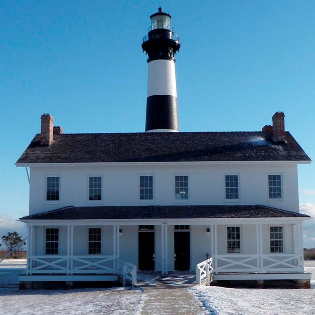
National Park Service Where Land and Sea Merge A thin, broken strand of islands curves out into the Atlantic Ocean and back again in a sheltering embrace of North Carolina's mainland coast and offshore sounds. For thousands of years these barrier islands—North Carolina's Outer Banks—have survived onslaughts of wind and sea. Their long stretches of beach, sand dunes, marshes, and woodlands are set aside as Cape Hatteras National Seashore. The treacherous waters off the coast of the Outer Banks is known as the Graveyard of the Atlantic, a grim but fitting epithet. Over 600 ships wrecked here as victims of shallow shoals, storms, and war. Diamond Shoals, a bank of shifting sand ridges hidden beneath the turbulent sea off Cape Hatteras, has never promised safe passage for ships. In the past 400 years the graveyard has claimed many lives, but island villagers saved many. As early as the 1870s, villagers served in the US Life-Saving Service. Others staffed lighthouses built to guide mariners. Few ships wreck today, but storms still uncover the ruins of the old wrecks that lie along the beaches of the Outer Banks. Cape Hatteras National Seashore protects parts of three barrier islands: Bodie Island, Hatteras Island, and Ocracoke Island. Beach and sound access ramps, campgrounds, nature trails, and lighthouses can be found and explored on all three islands.
|

Last updated: November 10, 2021