Last updated: December 2, 2025
Article
SECN Highlights May 2020

COVID-19 halts April Field Work
Field work was suspended during April, but our continuous monitors were hard at work at Congaree National Park, and for a portion of April at six of our coastal parks. We will be in touch with park contacts about our plans going forward. In the meantime, you can contact us with your questions.
- Continuous water quality data at Congaree National Park and coastal parks, groundwater data at Cumberland Island National Seashore, and wadeable stream monitoring, Eric Starkey.
- Shoreline monitoring, Lisa Cowart Baron.
- Landbird and vocal anuran community monitoring and ARD retrieval, Michael Parrish.
- Vegetation community monitoring, Forbes Boyle.
- All other inquiries, Brian Gregory

NPS photo / Forbes Boyle
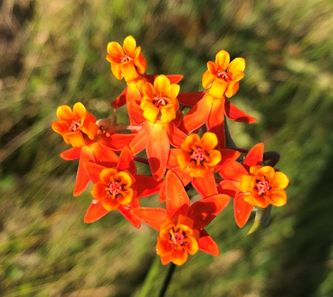
Vegetation Community Database is Complete
The Southeast Coast Network's vegetation monitoring project reached another milestone this past month, with the final development of its database system. Between February and April, the network partnered with independent contractor Michael Lee—who developed the forest monitoring database for the Cumberland Piedmont Network (CUPN). The database allows for efficient and secure data storage, data entry, quality control and assurance queries, and data output for ease of reporting. In addition to providing data management and storage tools, the new SECN vegetation database is linked to the latest version (2019) of Alan Weakley’s Flora of the Southern and Mid-Atlantic States—recognized by most plant scientists as the taxonomic standard of the Southeastern United States.

NPS photo / Forbes Boyle
Publications
The Southeast Coast Network has published the following reports in 2020:
- Shoreline change at Canaveral National Seashore: 2018–2019 data summary. Available at: https://irma.nps.gov/Datastore/Reference/Profile/2271794
- Shoreline change at Cumberland Island National Seashore: 2018–2019 data summary. Available at: https://irma.nps.gov/Datastore/Reference/Profile/2271827
- Vegetation mapping at Canaveral National Seashore: Photointerpretation key and final vegetation map. Available at: https://irma.nps.gov/Datastore/Reference/Profile/2272048
- Vegetation mapping at Timucuan Ecological and Historic Preserve: Photointerpretation key and vegetation map. Available at: https://irma.nps.gov/Datastore/Reference/Profile/2271909
- Wadeable stream habitat monitoring at Horseshoe Bend National Military Park: 2019 baseline report. Available at: https://irma.nps.gov/Datastore/Reference/Profile/227174
In addition, updated Standard Operating Procedures for the Vegetation Community Monitoring Protocol were published in April. These updates were based on our internal operational review and will make protocol implementation more efficient, accurate and safe going forward.
- Standard Operating Procedure 1.4.07 Field Season Preparation—Version 1.1. Available at: https://irma.nps.gov/Datastore/Reference/Profile/2272409
- Standard Operating Procedure 1.4.10 Site Selection, Plot Establishment, and Return Visits—Version 1.1. Available at: https://irma.nps.gov/Datastore/Reference/Profile/2272410
- Standard Operating Procedure 1.4.16 Soil Measurements—Version 1.1. Available at: https://irma.nps.gov/Datastore/Reference/Profile/2272411
- Standard Operating Procedure 2.4.05 Data Management, Quality Assurance and Quality Control—Version 1.1. Available at: https://irma.nps.gov/Datastore/Reference/Profile/2272432

NPS photo
Park Staff to Assist with Sonde Retrieval
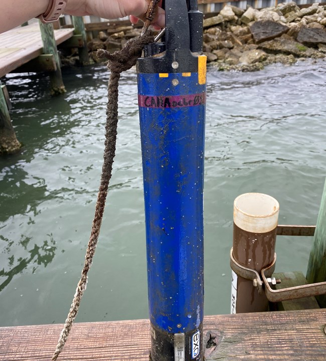
The NPS Inventory and Monitoring Division's suspension of field work due to the COVID-19 pandemic kept network hydrological technician Daniel McCay in his office and put continuous water-quality data collection on hold. Sondes at Congaree National Park and Cumberland Island National Seashore were determined to be safe for the time being and were left deployed. Those sondes will eventually run out of battery life and sit in place until the network receives further guidance and revises its travel plans. Keys and instructions for removal were sent to Amy Thompson at Cape Hatteras National Seashore, Kurt Foote at Fort Matanzas National Monument, Kristen Kneifl at Canaveral National Seashore and Laura Waller at Fort Pulaski National Monument. These sites were determined to have a higher potential for equipment damage from excessive biological growth. At Cape Lookout National Seashore, both sondes will continue operating. Brandon Puckett from the North Carolina Department of Environmental Quality was granted permission to continue field work so he will maintain them. Additionally, the network is in the process of repairing the protective pipe for one of the sondes at Timucuan Ecological and Historic Preserve (Kingsley Plantation). The other TIMU sonde at Clapboard Creek is still collecting data. The Southeast Coast Network is extremely grateful for this assistance from our parks and partners during this difficult time.
Tags
- vegetation mapping
- vegetation community monitoring
- shoreline change monitoring
- cape lookout national seashore
- cape hatteras national seashore
- fort pulaski national monument
- congaree national park
- cumberland island national seashore
- timucuan ecological and historic preserve
- canaveral national seashore
- fort matanzas national monument
- continuous water-quality monitoring
- michael lee
- cumberland piedmont network
- alan weakley
- flora of the southern and mid-atlantic states
- secn network highlights
