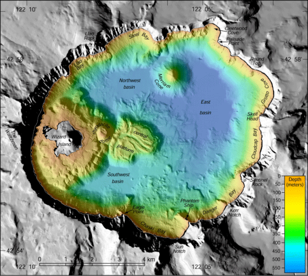
US Geological Survey, USGS The underwater landscape of Crater Lake was mapped in 2000. this collection imagery and data was a cooperative effort between the U.S. Geological Survey's Pacific Seafloor Mapping Project, the National Park Service, and the Center for Coastal and Ocean Mapping at the University of New Hampshire. A state-of-the-art multibeam sonar system collected high-resolution bathymetry, and calibrated co-registered acoustic backscatter to support both biological and geological research in the area (aquatic biology, geochemistry, volcanic processes, etc). This survey collected over 16 million soundings and the resulting data portrays the bottom of Crater Lake at a spatial resolution of 2 meters.

US Geological Survey, USGS The above information is copied from the USGS website. Additional photos and explanations of underwater formations as seen through the Crater Lake bathymetry study can be found on the USGS website. The requested video is no longer available.
|
Last updated: October 27, 2022