Last updated: June 17, 2024
Article
NPS Geodiversity Atlas—Arches National Park, Utah
Geodiversity refers to the full variety of natural geologic (rocks, minerals, sediments, fossils, landforms, and physical processes) and soil resources and processes that occur in the park. A product of the Geologic Resources Inventory, the NPS Geodiversity Atlas delivers information in support of education, Geoconservation, and integrated management of living (biotic) and non-living (abiotic) components of the ecosystem.

Geologic Features and Processes
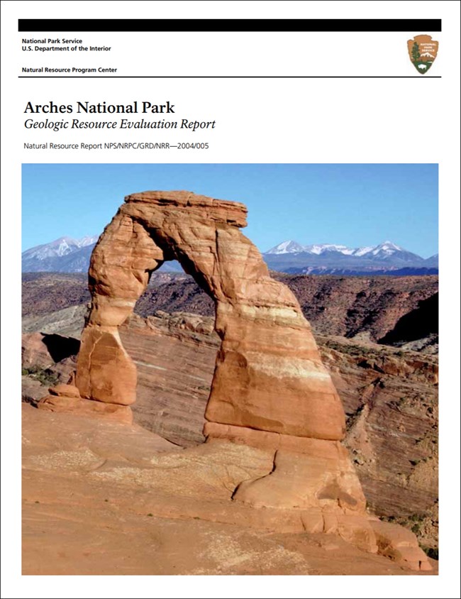
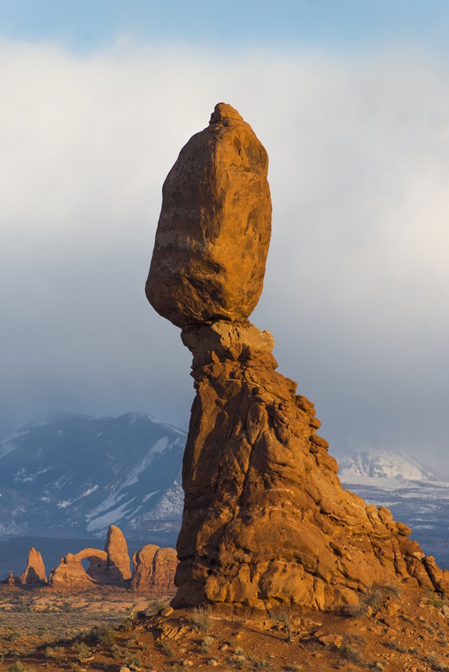
Over two thousand natural sandstone arches, the greatest concentration of rock arches in the world, are preserved in Arches National Park. Most arches are formed in three named geologic units (the Dewey Bridge Member of the Carmel Formation, the Slick Rock Member of the Entrada Sandstone, and the Moab Member of the Curtis Formation). In addition to the arches, Arches National Park is home to an extraordinary collection of balanced rocks, salt dissolution structures, folds resulting from salt tectonics, petrified dune fields, and a maze of deep narrow canyons.
The arches are a result of a unique geologic history. This history involves the formation of salt deposits (back in Middle Pennsylvanian to Late Triassic time; circa 300 million - 228 million years ago), and other sedimentary deposits (from Middle Pennsylvanian to Late Cretaceous time; circa 300 million to 70 million years ago), as well as the folding and faulting of these deposits in Tertiary time (circa 65 million to 2 million years ago) and finally to Quaternary (last 2 million years) erosion and salt dissolution. At Arches, the proper conditions for arch formation all coalesce. These include the following:
-
Presence of massive hard brittle sandstones jointed by faulting activity
-
Resting on or containing soft layers or partings
-
Located near salt-cored anticlines experiencing dissolution
-
A dry climate
Arches National Park contains many "classic" or “iconic” geological sites. Among these are the following:
-
Delicate Arch
-
Landscape Arch
-
The Windows Section
-
Balanced Rock
-
Park Avenue
-
Devils Garden
-
The Great Wall
-
Klondike Bluffs
-
Moab Fault
-
Fiery Furnace
-
Cache Valley
-
Elephant Butte Folds
-
Petrified Dunes
-
The La Sal Mountains viewpoint (though well south of Arches NP; it is an important viewshed feature)
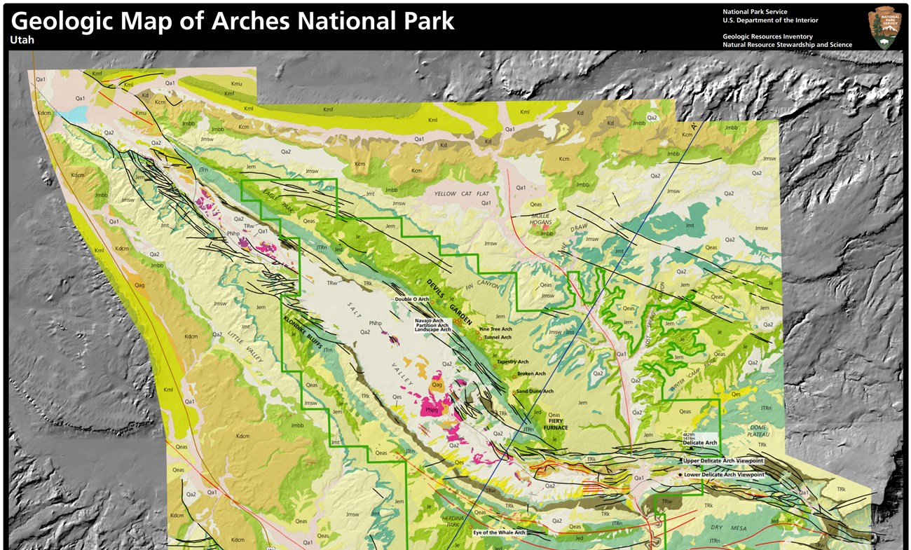
Also see the park Geologic Resources Inventory Report for more information on these features.
Arches National Park is located centrally in the geologic "fault and fold belt' of the Pennsylvanian-aged (circa 318 million to 299 million years ago) Paradox Basin. Its most important related geologic feature is the Salt Valley anticline (Salt Valley-Cache Valley salt wall or diapir) that showcases the geologic process of salt tectonics and salt dissolution contrasted beautifully with the colorful Mesozoic-aged (circa 251 million -65 million year old) strata of the Moenkopi, Chinle, Wingate, Kayenta, Navajo, Carmel, Entrada, Curtis, Morrison, Dakota, Cedar Mountain and Mancos Formations.
Arch Formation
The arches and fins at Arches National Park are the result of the dry climate, the massive brittle sandstones and their susceptibility to weathering, the vertical joints in the sandstones produced by folding, and the proximity of the sandstones to salt- cored anticlines undergoing dissolution. Most of the arches and fins are associated with the Entrada Sandstone and form where the formation overlies an anticline on which closely spaced parallel fractures developed. Good examples of solution- induced anticlines and Entrada Sandstone arches can be found at Klondike bluffs, Devils Garden, Fiery Furnace, and Herdina Park. Elephant Butte, in the Windows section of Arches National Park, is a remnant of Entrada Sandstone that arched over an anticline that was probably not formed by dissolution (Doelling, 1985).
Because the Entrada Sandstone is a massive crossbedded sandstone, it is highly susceptible to a style of weathering called exfoliation wherein slabs of sandstone peel from the bedrock in a series of concentric layers (Harris et al., 1997). The Slick Rock member of the Entrada Sandstone also is composed primarily of quartz grains that are cemented together by calcium carbonate (CaCO3). Rain water, charged with atmospheric carbon dioxide (CO2), forms weak carbonic acid that is very effective at dissolving CaCO3. When the cement dissolves, the individual sand grains accumulate on the surface of the parent Entrada Sandstone.
Wind and water erosion focuses along the large joints, widening the gaps between the linear cracks, and carves fin- like structures in the large slabs of rock (figure 2). Further erosion of the fins creates large holes and arches out of the fins. The fins are assumed to have formed in response to the compressional tectonic forces during the Laramide Orogeny (Doelling, 2000). A discussion of the jointing in Arches National Park is found in Dyer (1983), Cruikshank (1993), and in Cruikshank and Aydin (1993).
Water also seeps into fractures in the Entrada Sandstone and along the contacts with the Moab member of the Curtis Formation or the Dewey Bridge member of the Carmel Formation. Thin openings form along these partings. Fractures, created by tensional stresses in the rock, propagate upward into the overlying rock. Groundwater further dissolves the cement along these fractures until the roof of the opening collapses forming the typical stable arch form, neutralizing the stress, and inhibiting further collapse. Delicate Arch is an example of an arch formed by the contact of the Moab member with the Slick Rock member while Skyline Arch formed along a parting entirely within the Slick Rock member. The Windows Arch formed along the Dewey Bridge- Slick Rock contact. This arch enlarges with the erosion of the soft Dewey Bridge member (Doelling, 1985).
Also see Arches—Geology of Arches Video
Moab Fault
The Moab fault is a major fault that parallels the Moab anticline just south of the Visitor’s Center. Drill holes have shown that this fault cuts through and parallels the middle of the 3.2 km (2 mile) wide Moab Valley salt wall. The block of rock on the northeast side of the Moab fault has dropped down relative to the block on the southwest side. At the Visitor’s Center, the Pennsylvanian Honaker Trail Formation rests against the Jurassic Entrada Sandstone, or in terms of ages, rocks deposited about 295 million years ago (Pennsylvanian) rest against rocks deposited about 150 million years ago (Jurassic). For such a situation to occur, displacement across the Moab fault was at least 732 m (2,400 ft) (Doelling, 2000). From the Visitor’s Center, two branches of the fault can be seen. Like the Moab fault, the primary movement along the swarm of normal faults located on the Moab anticline is down to the northeast relative to the southwest blocks (Doelling, 1985, 2000).
The northern block has dropped down relative to the southern block on the normal fault located on the crest of the Elephant Butte anticline, also. Along the borders of Salt Valley and Cache Valley, normal faults are mapped on the surface with their down- dropped blocks on the valley side of the fault. Major normal faults, with displacements down to the northeast, have also been interpreted to exist in the subsurface along the crest of the salt- cored anticlines in Moab and Salt Valleys (Doelling, 1985, 2000). Where the normal fault in Salt Valley is exposed at the surface, isolated protrusions of Paradox Formation caprock, covered by the upper Chinle Formation, form the southwest block of the fault, and these strata are juxtaposed against collapsed Mesozoic rocks on the northeast side of the fault (Doelling, 1985, 2000). Salt dissolution events have deformed Triassic through Cretaceous strata on the northeast side of the fault so displacement caused only by this fault cannot be accurately determined.
Aeolian (Dunes) Landforms
Sand is weathered out of many bedrock units and creates local dune fields much like in the Devils Garden area of the park. Additionally, ancient petrified dunes are preserved in the park from Mesozoic Wingate, Navajo, and Entrada Sandstones.
Biological soil crusts
Biological soil crusts in Arches NP contribute to a number of functions in soil ecosystems. Because they are typically concentrated in the top 1- to 4 mm of the surface of the soil, they affect processes that occur at the land surface or soil-air interface. These include improving soil aggregate stability and ability to resist forces of erosion, facilitate atmospheric fixation of nitrogen, provide nutrient contributions to plants, enhance soil-plant-water relations, increase infiltration of water into the soil, and help to preserve soil resistance and resiliency to numerous stressors.
Disturbances to plant communities and the biological soil crusts, through either natural or anthropogenic factors, can ultimately increase the amount of bare soil and increase the potential for accelerated erosion by wind and water, increase the potential establishment of invasive and exotic plant species, and can alter the nutrient cycling capacity of the soil, and significantly impact the soil’s ability to properly function.
Paleontological Resources
Arches NP is geographically situated in one of the most paleontological rich areas of North America, representing a thick sequence of terrestrial Mesozoic-age rocks from the “Age of the Dinosaurs” (251 – 65 million years ago). Hundreds of fossil localities have been documented around the boundaries of Arches NP. Paleontological field work conducted within the park since 2000 has yielded new and significant fossil localities in Arches NP. Fossil specimens from Arches include vertebrates, invertebrates, plants and trace fossils.
All NPS fossil resources are protected under the Paleontological Resources Preservation Act of 2009 (Public Law 111-11, Title VI, Subtitle D; 16 U.S.C. §§ 470aaa - 470aaa-11).
Regional Geology
Arches is a part of the Colorado Plateaus Physiographic Province and shares its geologic history and some characteristic geologic formations with a region that extends well beyond park boundaries.
- Scoping summaries are records of scoping meetings where NPS staff and local geologists determined the park’s geologic mapping plan and what content should be included in the report.
- Digital geologic maps include files for viewing in GIS software, a guide to using the data, and a document with ancillary map information. Newer products also include data viewable in Google Earth and online map services.
- Reports use the maps to discuss the park’s setting and significance, notable geologic features and processes, geologic resource management issues, and geologic history.
- Posters are a static view of the GIS data in PDF format. Newer posters include aerial imagery or shaded relief and other park information. They are also included with the reports.
- Projects list basic information about the program and all products available for a park.
Source: NPS DataStore Saved Search 2709. To search for additional information, visit the NPS DataStore.
A NPS Soil Resources Inventory project has been completed for Arches National Park and can be found on the NPS Data Store.
Source: NPS DataStore Saved Search 2699. To search for additional information, visit the NPS DataStore.


