Last updated: February 2, 2023
Article
The Sierra Nevada Monitor: Fall 2021
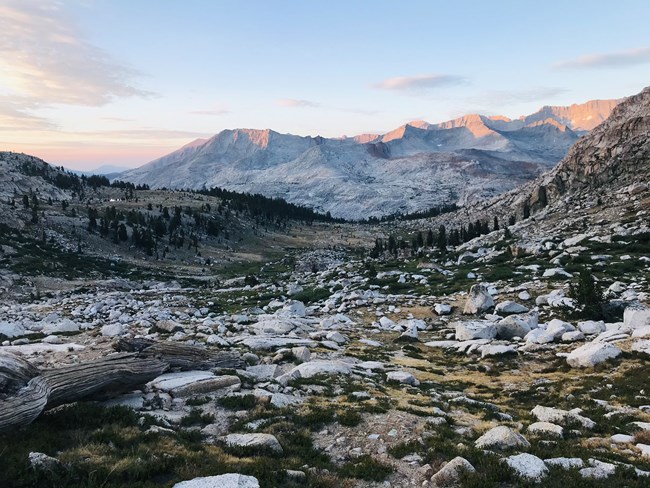
Photo courtesy of Lee Bryant, The Institute for Bird Populations
The Sierra Nevada Monitor is the newsletter for the Sierra Nevada Inventory and Monitoring Network. This issue features stories on: a year bookended by severe wildfires; field season highlights for birds, forests, and river hydrology monitoring; staffing updates; new publications, reports, and books; and a feature on two field staff who have migrated between the Sierra Nevada and Antarctica field seasons.
NPS / Tony Caprio
A Year Bookended by Fire
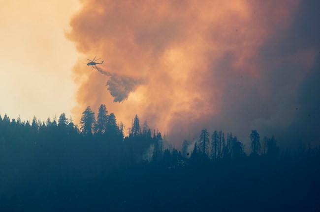
This past year was defined by disruption: the coronavirus continued to hold the world in its grip; two fires ignited during late summer of 2020—the Creek Fire, on the Sierra National Forest, and the Castle/SQF Complex Fire, on the Sequoia National Forest and Sequoia National Park—burned through the fall, touching each of our network parks and impacting over 500,000 acres; while the deepening drought became the singularly most severe in California’s >100-year record. When lightning swept over the southern Sierra early this September, fuel moisture levels were at historic lows and the stage was set for another extreme fire event. Two separate ignitions eventually merged to form the KNP Complex Fire in the Kaweah River watershed, which burned almost 90,000 acres. To the south the Windy Fire, in the watershed of the Tule River, burned over 97,000 acres on U.S. Forest Service and Tule River Indian Reservation lands. Taken together these fires have had devastating consequences for many giant sequoia groves and are expected to transform montane forests of the western slope of the Sierra Nevada.
NPS / Christy Brigham
Being Nimble in the Face of Adversity
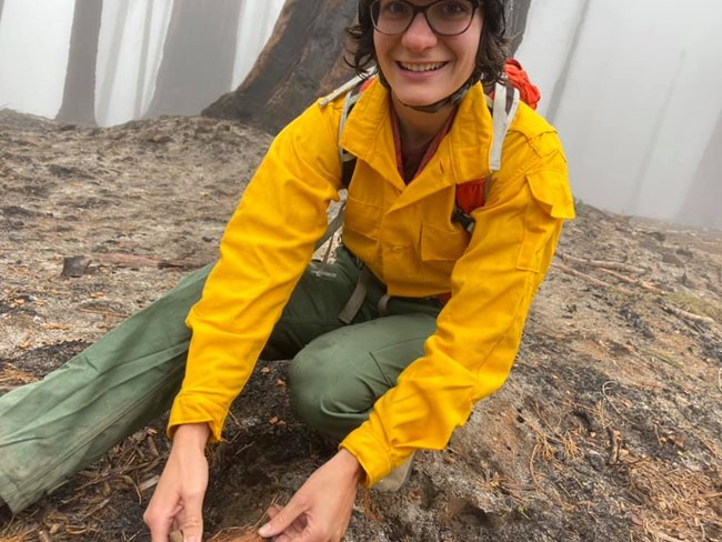
We are learning to be nimble in the face of adversity. Unable to work safely in Sequoia National Park, displaced crews were swiftly redirected to help assess the health of giant sequoia trees in Yosemite National Park's three groves. The USGS Forest Demography crew, Scientist-in-Parks intern Ana Tobio, and local staff and volunteers, all led by Yosemite's Vegetation and Ecological Restoration staff, assessed giant sequoia health and crown condition in all three of the groves in Yosemite (Mariposa, Tuolumne and Merced).
A call for Resource Advisors (specialists who advise on minimizing fire-fighting impacts on cultural and natural resources and guide and evaluate rehabilitation of firelines and other impacts post-burn) went out for assistance on the KNP Complex and Windy fires. And Yosemite staff willingly answered, sharing their expertise on the line and with the Burned Area Emergency Response teams on the KNP Complex and Windy Fires.
Due to a fortunate coincidence of monitoring crew end dates preceding these fires, they did not impact our 2021 field season. However, what we've learned from these two years of large, severe wildifires is helping us be better prepared for our future field seasons, in case extreme events intervene.
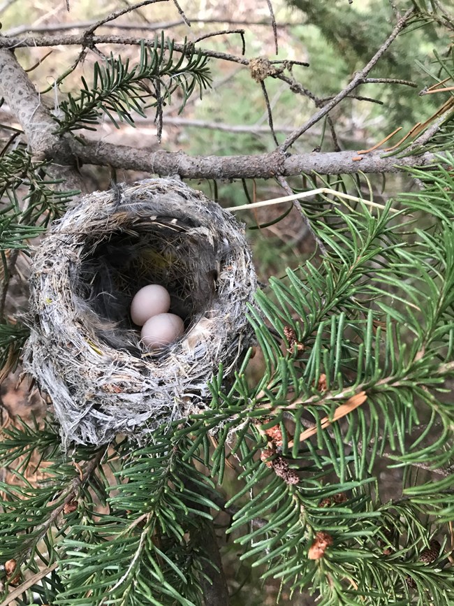
Photo courtesy of Lee Bryant, The Institute for Bird Populations
2021 Field Season
We cancelled wetland and lake monitoring field seasons due to COVID-19 safety concerns and staffing capacity. Both our data manager and ecologist positions remained vacant through the field season. While this impacted the long-term continuity of two important datasets, we were able to conduct fieldwork for three key program areas: birds, high-elevation forests, and river hydrology. We provide field season and product highlights below.
Birds
Following a planned pause in data collection in 2020, we were delighted to welcome our partners with the Institute for Bird Populations (IBP) back to the Sierra Nevada Network (SIEN) to resume our bird monitoring. After spending the 2020 season with IBP in the North Coast and Cascades Network (NCCN), Quinn McMahon returned as SIEN crew lead and worked closely with us on early season planning and virtual bird identification sessions. Preparation started early this year, as we adapted our training and field operations to the ongoing pandemic. Quinn and Gaby Bedeian made up the Yosemite (YOSE) crew, which was based out of Mariposa. Joining us from Arizona, Lee Bryant and Jared Swenson came on board as the Sequoia & Kings Canyon (SEKI) crew. All four team members brought extensive backcountry and birding experience, with the new members passing the required bird identification exam with ‘flying’ colors before beginning fieldwork in mid-May.
All our planning paid off with a highly successful season! The low snowpack meant that all the sites could be reached safely, and because the bird monitoring season ends in late July (when the breeding season is over, and identifying birds is confounded by noisy young birds learning to sing) the crews were minimally impacted by a lack of reliable water sources. We were able to sample all 42 points at Devils Postpile National Monument (DEPO), and 26 of 27 sites at both YOSE and SEKI. Notable observations included flammulated owls in YOSE and SEKI, a canyon wren on top of Colby Pass in SEKI, and orange-crowned warblers at mid-elevation transects in both YOSE and SEKI.
These data mark the start of the third 4-year cycle of our rotating panel design. During the scheduled pause between each full panel, our attention turns to analysis. IBP staff scientist Dr. Chris Ray has been working on a trend analysis of 8 years, or two cycles, of SIEN bird monitoring data. Based on results from similar work at NCCN, we expect this analysis to begin to reveal trends in bird density in our parks. Initial results are coming in, and we are looking forward to sharing the report in the coming months following peer review.
This kind of success takes a village: thanks go to NCCN data managers Kristen Bonebrake and Katherine Braun, who provided data management training and were ‘on call’ all season to put out data entry and device management fires; Dustin Garrison with the YOSE Wildlife program, who created detailed maps and itineraries for all tours in SEKI and YOSE; Breezy Jackson who welcomed the crews to the UC Merced Field Station; IBP staff members Jerry Cole, Dayna Mauer, Rodney Siegel, and Bob Wilkerson who donned packs and binoculars to conduct surveys in DEPO and YOSE; and park wildlife biologists Sarah Stock and Tyler Coleman for helping orient and track crews in YOSE and SEKI.

USGS / Nate Stephenson
High Elevation Forests
In collaboration with four other Inventory & Monitoring networks, we implement a shared high-elevation white pines monitoring protocol. In our network, we target whitebark pine and foxtail pine, but all tree species in a plot are monitored. A two-person crew, Sean Auclair, Crew Lead, and Emma Kahle, first-time forest crew member, sampled 32 of 36 planned plots. They also evaluated five plots for potential future sampling. Monica Buhler, Resource Management Specialist at Devils Postpile National Monument (DEPO), supervised the crew in absence of a SIEN ecologist, making it possible for us to conduct forest monitoring this season. DEPO also provided housing for the crew while they staged trips from the east side, where their keen eyes discovered a previously undocumented occurrence of whitebark pine not far from the postpile formation.
Good news from the field season is that Sean and Emma observed little recent sign of either white pine blister rust or mountain pine beetle activity in our long term monitoring plots. However, while backpacking in a remote area of Kings Canyon, USGS emeritus ecologist Nate Stephenson discovered and documented recently dead clumps of whitebark pine and dieback on still living trees. This mortality did not appear to be related to white pine blister rust or insect impacts and raises the concern that the drought, which is most severe in the southern part of the range of whitebark pine, is a contributing factor. We are working with our USGS partners and the NPS regional plant ecologist to seek funding to assess the extent and determine the cause of this die-off.
Prior to the start of white pines monitoring season, Sean and Emma provided support to a giant sequoia project in Sequoia National Park. They completed raking around giant sequoias that are part of a prescribed burn research project in Giant Forest to assess the effectiveness of fuel reduction treatment around sequoia bases. With recent severe drought conditions, even low intensity prescribed fires may have greater impacts on giant sequoias than have previously been observed.
Products include: 2019 high-elevation white pine monitoring annual report and a status report of white pines across five western national park units. A related white pine blister rust project publication addresses shifts in rust infections related to climate change.
NPS / Yosemite National Park staff
River Hydrology
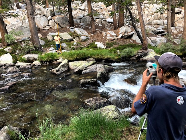
This project monitors the quantity and timing of discharge and water temperature in selected rivers using data from existing partner-operated stream gages and three gages supported by Sierra Nevada Network in Yosemite (Lyell Fork and Mainstem Tuolumne) and Devils Postpile (Middle Fork of the San Joaquin). At these three gages, NPS or USGS staff completed multiple site visits to collect flow measurements, download data, and conduct routine site maintenance.
SIEN Physical Scientist Andi Heard initiated an agreement with the UC Berkeley Data Discovery Program to give students an opportunity to update river hydrology trend analysis code, in support of SIEN’s upcoming trend report. Andi completed a river hydrology brief for water year 2020 (Oct 2019-Sept 2020), targeting park managers.
Staffing Updates
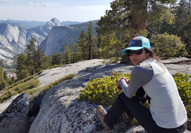
Sarah Wakamiya, Data Manager
Sarah joined the Sierra Nevada Network in August 2021. In her role, she designs and manages applications and workflows for storing, analyzing, and sharing network data. She has been a Data Manager with the I&M program for over a decade, previously working at the Mid-Atlantic Network, Northern Great Plains Network, and most recently the San Francisco Bay Area Network. She has a B.S. in Neurobiology and Physiology from the University of Maryland – College Park and a M.S. in Wildlife Ecology from Southern Illinois University – Carbondale. Her research as a graduate student focused on landscape-linked population dynamics for peregrine falcons and swamp rabbits. These days she is particularly drawn to the interaction of data and art through data visualization and loves learning about the different biological systems the I&M program monitors. When she’s not solving data puzzles, she enjoys trail running, rock climbing, art (drawing, watercolor, and photography), and trying not to injure herself while learning to ski. In September, Sarah and her husband welcomed their son, Evren to their family; we can’t wait to meet him.
Ana Tobio, Scientists in Parks Intern
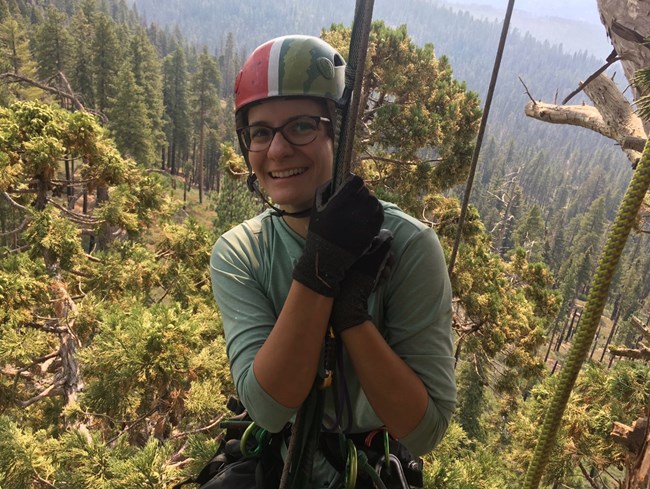
Ana came on-board not long after the KNP Complex fires became active in Sequoia National Park in September, and her ability to remain flexible about starting with remote work and having her work altered due to wildfire helped her internship be especially helpful to both Sequoia & Kings Canyon and Yosemite. Ana conducted assessments on the crown health of sequoias in Yosemite and the unburned parts of Sequoia. These assessments aimed to provide an early detection of changes in the population, establish a baseline for change in the population’s health, and update the original sequoia tree inventory. Additionally, she helped with determining the effects of the KNP Complex fires, by assisting with GIS mapping for the Burned Area Emergency Response team, and analyzing drone imagery to determine sequoia mortality. She was also able to work with other park programs to help them with their projects, such as conducting fuels monitoring with the fire effects team, and collecting and dissecting fish with the physical sciences team. Ana commented - “Despite how crazy this position has felt with the KNP Complex fires, I feel lucky to have been able to dip my toes into so many different aspects of the parks’ resource management and assist with so many critical projects. I am hopeful and eager to continue doing so in the future.”
Connor Gallagher, Water Monitoring Lead
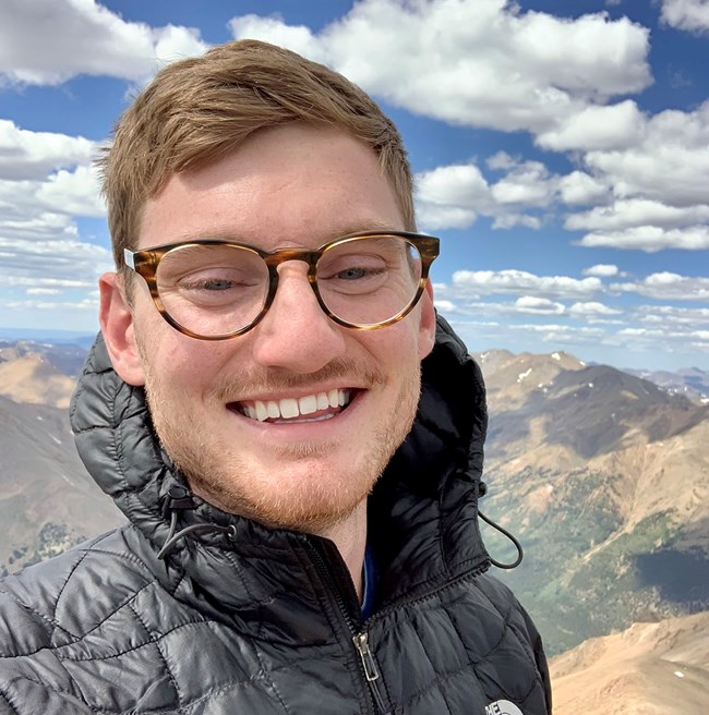
Connor joined the Sierra Nevada Network in a one-year position through the Great Basin Institute in November, 2021. As the Water Monitoring Lead, Connor handles continuous wetland and river datasets during the winter months, and helps lead the lakes and wetlands crews during the summer field season. Prior to joining SIEN, he worked as a Summer seasonal U.S. Forest Service Hydrologic Technician on the Front Range of Colorado since 2018, with Fall positions in Zion and Capitol Reef National Parks surveying desert springs. Connor has a B.S. in Earth Sciences from The Ohio State University, with a focus on surface water-groundwater connectivity. When not behind a computer or trekking in the backcountry, he enjoys cycling, baking, and exploring new cultures around the world.
Recent Reports and Publications
Charlton, C., A. M. Heard, J. Baron, S. Sadro, and A. Smits. 2020. Spatial Variation in Littoral Zone Benthic Algal Productivity in the Sierra Nevada, California. American Geophysical Union Fall Meeting, December 2020. Link to Abstract.
Dudney, J., C. E. Willing, A. J. Das, A. M. Latimer, J. C. B. Nesmith, and J. J. Battles. 2021. Nonlinear shifts in infectious rust disease due to climate change. Nature Communications 12, 5102 (2021) https://doi.org/10.1038/s41467-021-25182-6
Heard, A. 2021. Annual Brief – River Hydrology Monitoring: Water Year 2020. Sierra Nevada Network, Three Rivers, California.
Nesmith, J. C. B. 2021. Sierra Nevada Network high elevation white pine monitoring: 2019 annual report. Natural Resource Data Series NPS/SIEN/NRDS—2021/1330. National Park Service, Fort Collins, Colorado.
Reilly, M. J., J. C. B. Nesmith, S. B. Smith, D. S. Stucki, and E. S. Jules. 2021. Status of white pines across five western national park units: Initial assessment of stand structure and condition. Natural Resource Report. NPS/KLMN/NRR—2021/2232. National Park Service. Fort Collins, Colorado.
Sanders, S., L. Mutch, M. Wasser, J. Barnes, and S. Perles. 2021. Rising from the Ashes: The Role of Fires in National Parks. Front. Young Minds. 9:627635. doi: 10.3389/frym.2021.627635
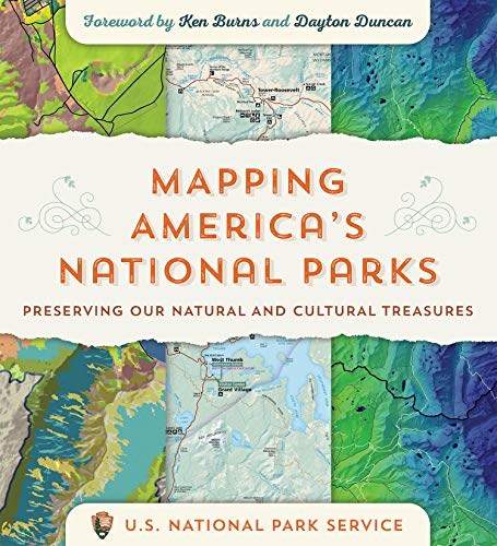
Network and Park Staff Contribute to Mapping America's National Parks Book
Sierra Nevada Network and Park staff contributed map-based feature articles to the recently published book, Mapping America’s National Parks: Preserving Our Natural and Cultural Treasures, Esri Press, Redlands, California. These brief articles illustrate the use of maps as effective ways to communicate what networks do, as well as different ways that mapping and geospatial analysis support NPS natural resource stewardship and science activities. Contributions include:
- Eddy, A., S. Haultain, A. Heard, J. Nesmith., L. Mutch, P. Hardwick, and E. Hale. Tracking Changes in Mountain Landscapes. 90-95.
- Eddy, A., P. Hardwick, G. Fauth, J. Tricker, and P. Landres. Mapping Travel Time in Sequoia and Kings Canyon National Parks. 149-151.
- Tricker, J., P. Landres, G. Fauth, P. Hardwick, and A. Eddy. Sequoia and Kings Canyon Wilderness Character Map. 176-179.

NPS / Tony Caprio
Communication Products Highlight Impacts of Severe Wildfires on Giant Sequoias
We worked with park staff and others to create products that communicate the recent impacts of hotter drought and severe wildfires on giant sequoias. The following two web articles highlight new threats to giant sequoias between 2015-2020, with particular attention to more severe wildfires:
Sequoia & Kings Canyon National Parks Head of Resources Management & Science, Christy Brigham, Visual Information Specialist contractor Hazel Galloway, and SIEN Science Communication Specialist Linda Mutch developed an infographic about recent fire impacts on giant sequoias, as well as the important ecological role fire plays for giant sequoias –
The following two briefs were created in response to a request from Yosemite National Park interpreters to provide information on giant sequoias and fire for seasonal interpretative training.
-
Giant Sequoia Ecology and Fire ̶ NPS/Department of Interior only
-
Threats to Giant Sequoias ̶ NPS/Department of Interior only
Much of this work was funded through a NPS Fire Education and Communication grant. These products will need to be updated with new giant sequoia impacts that resulted from this year’s KNP Complex and Windy fires. The 2020 Castle Fire killed an estimated 10-14 percent of the world’s giant sequoias, and the KNP Complex and Windy fires have brought that estimate up to 13-19 percent. See the parks’ web page for an overview of the KNP Complex fire and park response, or the Giant Sequoia Lands Coalition page for more specific information on giant sequoia mortality.

Photos courtesy of Allen Glazner and Greg Stock
Geologic Type Section Inventory for Sierra Nevada Network Parks
A recent NPS Geological Resources Division report for Sierra Nevada Network parks highlights specific geologic features (or “stratotypes”) of parks that serve as the standard, or type location, for identifying geologic units. Just as biologists use type specimens that provide a standard to define characteristics used in classification of plants and animals, geologists use type sections as a standard for recognizing and defining geologic units. Documentation of stratotypes (i.e., type sections/type localities/type areas) is a major portion of a geologic resource inventory. Stratotypes are important because they store knowledge, represent important comparative sites where past knowledge can be built up or re-examined, and can serve as teaching sites for students. Where can you go in Sierra Nevada parks to see examples of geologic type locations? Sequoia and Kings Canyon and Yosemite have a couple examples that are popular visitor destinations:
-
Moro Rock in Sequoia National Park’s Giant Forest is a type locality for the Giant Forest Granodiorite geologic unit
-
Sentinel Rock in Yosemite is a type locality for Sentinel Granodiorite geologic unit.
Park staff well-informed about the existence and importance of stratotypes will both be better able to monitor and protect them as well as share their value with partners and the public. Learn more about Sierra Nevada geology and the stratotypes in this web overview article, or link to the full report:
Henderson, T., V. L. Santucci, T. Connors, and J. S. Tweet. 2021. National Park Service geologic type section inventory: Sierra Nevada Inventory & Monitoring Network. Natural Resource Report NPS/SIEN/NRR—2021/2219. National Park Service, Fort Collins, Colorado.
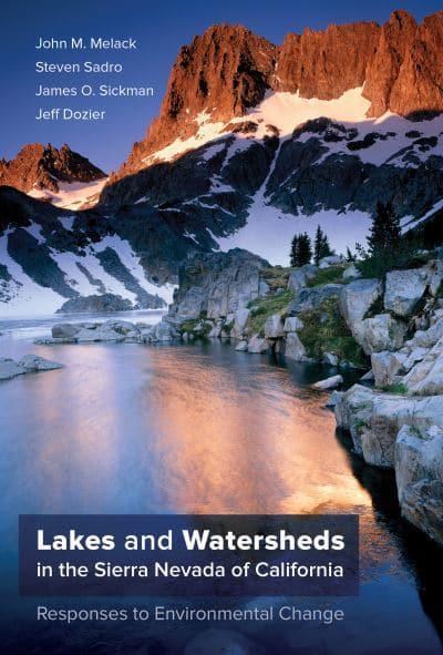
Recent Book Features Decades of Sierra Nevada Lake Research
Melack, J. M., S. Sadro, J. O. Sickman, and J. Dozier. 2021. Lakes and Watersheds in the Sierra Nevada of California: Responses to Environmental Change. University of California, Oakland, California. 202 pp.
Emerald Lake is a glacial cirque lake located in the headwaters of the Tokopah Valley of Sequoia National Park. This lake and watershed have been the focus of sustained research since 1983. Knowledge gained about snowmelt and hydrology, watershed chemical processes, biological responses to nutrient changes in lakes, and more has transformed our understanding of how the thousands of lakes and watersheds in the Sierra Nevada are responding to altered climate, changing snow regime, and changes in levels of atmospheric pollutants. A new book synthesizes over three decades of research on lakes and watersheds in the Sierra Nevada, with a focus on Emerald Lake. SIEN Physical Scientist Andi Heard has been involved in Emerald Lake research, both through her PhD studies at UC Riverside as well as through SIEN’s lake monitoring project. Learn more about the history of Emerald Lake research and the people involved at this Emerald Lake Watershed Study web page.
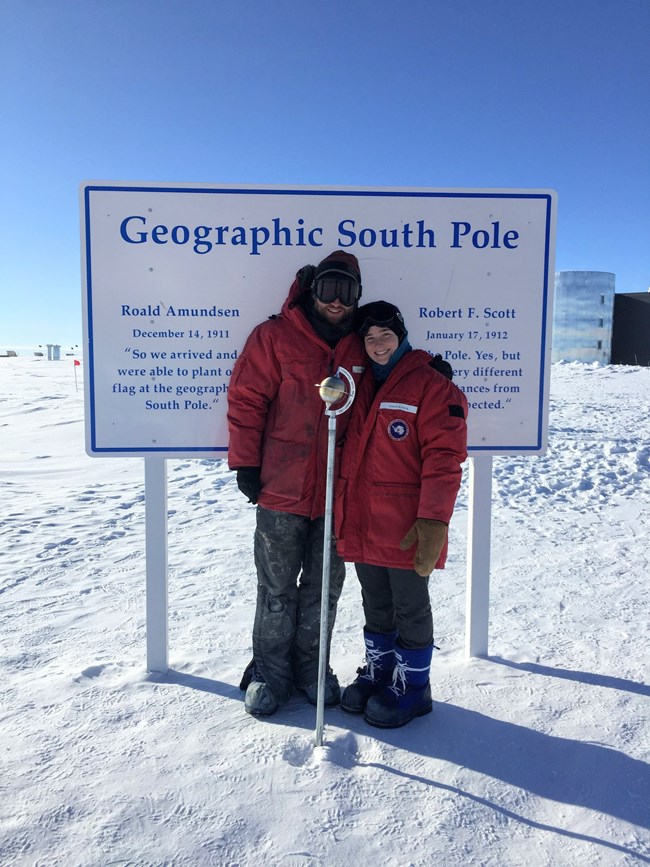
Two Field Staff Migrate between Warm and Frozen Summers
In mid-September, our forest monitoring crew of two, Sean Auclair and Emma Kahle, departed to work in Antarctica. Due to strict quarantine procedures to protect the remote Antarctic community against COVID-19, their journey included three weeks in quarantine, and multiple COVID tests. At the higher elevations where they work in the Sierra Nevada parks, temperatures typically range from the 20s to the low 70s in the summer. In Antarctica, the continent is bathed in 24 hours of daylight in the summer, but temperatures range from about 0 to -50oF (with an average of -20 to -30 oF) during these four “warmer” months. Winter temps can drop to -100oF!
Sean has worked seven seasons monitoring high-elevation white pines, most of those seasons as the SIEN forest crew lead, and has worked on amphibian restoration and other field projects in the Sierra Nevada since 2010. In between his Sierra Nevada field seasons, he has worked as Carpenter Foreman for the United States Antarctic Program at the Amundsen-Scott South Pole Station since 2009. What draws Sean back to this cold, frozen world each year?
I enjoy the challenge of working in the extreme cold with an amazing group of people and being one of the lucky few who get to work in the Antarctic every summer season. I work as a carpenter at the station and spend my time fixing everything the ice and cold have broken. The station sits atop 2 miles of ice that is constantly moving and shifting, so the buildings and equipment are constantly moving and shifting as well! The ice travels 33 feet a year, which doesn't sound like much, but the station has moved about 400 feet just during my time down there! There are many challenges –
-
Extremely limited internet
-
Working in temperatures of -50 F
-
The nearest Home Depot is VERY far away, so advanced planning, a lot of creativity, and a good sense of humor are needed to make everything work.
Emma joined SIEN this past season for her first summer of forest monitoring. She worked in Antarctica in 2015-2016 when she was part of a team that drilled an ice core at the South Pole, extending 1751 meters deep! This project was part of her PhD research, studying Antarctic ice core data to learn about ice sheet dynamics and past climate change.“The core spans the last 54 thousand years, providing a climate record reaching back into the last glacial period,” Emma explained. “One of our major questions was – ‘How much colder was the last glacial period than today?’”
They reconstructed a record of past temperatures based on water isotopes measured in the ice core. Their results agreed well with computer climate model simulations of past climate, increasing their confidence in the ability of climate models to project estimates of future climate change. You can learn more about her research in this summary Emma wrote. Emma completed her PhD in Earth and Space Sciences in March 2020 at the University of Washington and was lead author on a paper published in June 2021 – see the abstract here.
Emma is providing support to the South Pole Station, back in Antarctica for the first time in five years. In addition to her extensive fieldwork experience in national parks, Greenland, and Antarctica, Emma also enjoys outdoor education and outreach, which she wove into her graduate program –
Throughout my time in grad school, I was involved in many different outreach programs, including creating and presenting an original Antarctic ice core research talk in the public planetarium at the Pacific Science Center – a really fun presentation format. As a climate communication capstone project, I created an online computer game about climate change in national parks. In the future, I hope to reengage with the science outreach community, particularly with a focus on diversity, equity, and inclusion in science and the outdoors.
Emma and Sean hope to return for another season of forest monitoring for SIEN in 2022. After that, they have their sights on starting a regenerative farm in western Washington in the next few years, an approach to mitigating climate change, growing and raising healthier plants and animals, and restoring balanced ecosystems to farmland. And they see an educational component being an important part of their farm, connecting people more directly to their food and highlighting the importance of sustainable farming.
Oh, and by the way, Sean and Emma are engaged to be married – after a proposal on the top of San Joaquin Peak in the Sierra Nevada, on a personal backpack last summer. We congratulate them and look forward to hearing stories from their South Pole work and adventures.
