Last updated: December 1, 2025
Article
SECN Highlights February 2022


Starkey to Temporarily Lead the Southeast Coast Network
Program Manager Brian Gregory will start a temporary 120-day detail as I&M Division Chief while current Chief, Brian Mitchell, details as CESU coordinator in the Northeast Region. Eric Starkey, SECN aquatic ecologist, will assume the reigns of the Southeast Coast Network. Physical relocations will not be a part of these temporary details. It will be an opportunity for Eric and the Brians (Mitchell and Gregory) to gain experience and some additional perspective with minimal disruptions to their respective programs and personal lives. Details are scheduled to officially begin February 13.
Monitoring and ARDs at Cumberland Island National Seashore
Program manager Brian Gregory got his feet wet in the field (literally!) for the first time in 2022 by volunteering to assist Bird and Anuran protocol lead Michael Parrish and CESU intern Lily Martin at Cumberland Island National Seashore. Assisting with field operations is sometimes the only way a program manager can escape the desk and get reconnected with wilderness areas and park staff. “More field work please!” says Brian.
NPS photos / Mark Hynds
Survey Training for SECN
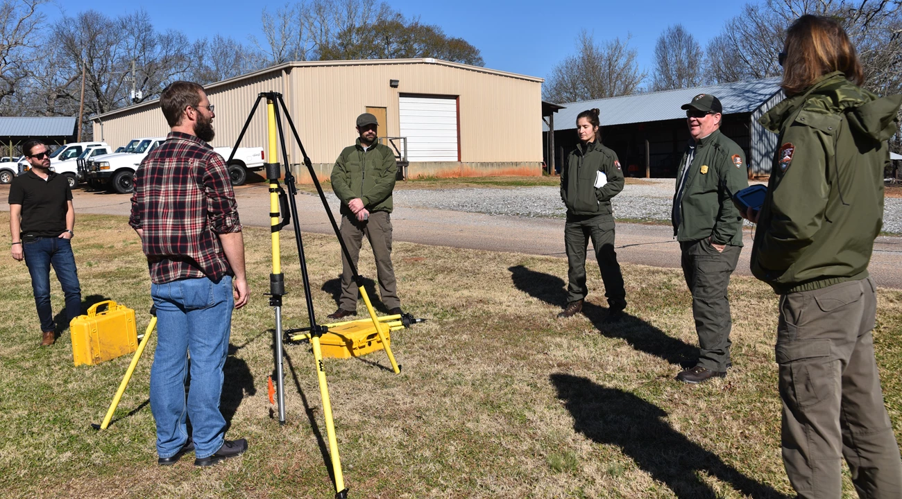
Dr. Jacob M. Bateman McDonald of the University of North Georgia’s (UNG) Institute for Environmental and Spatial Analysis presented Surveying Techniques Training, a three-day training course at the SECN office in Athens, Georgia in December. The course trained SECN staff in the use of global positioning systems (GPS), global navigation satellite systems (GNSS), real-time kinematic positioning (RTK), total station surveying, and integrated surveying techniques. Dr. Bateman-McDonald is a former post-doctoral researcher at the network, so he was able to tailor the course to the specific needs of each SECN monitoring protocol.Coastal Ecologist William “Ches” Vervaeke and Coastal Technician Claire Schmidt learned best practices to establish accurate benchmark locations, crucial to saltmarsh elevation and coastal shoreline change monitoring. SECN Aquatic Ecologist Eric Starkey and Hydrologic Technician Daniel McCay learned the values of GNSS base station and RTK static surveying to improve water level data at each datasonde deployment location. Stephen Cooper concentrated on total station surveying and integrated techniques in support of wadeable stream habitat monitoring.
The Southeast Coast Network would like to thank Dr. Bateman McDonald for taking the time to design a course specific to the SECN’s needs and for the time he spent both in the classroom and in the field over the three days. The training will improve the quality of geographic data collected by the network in future monitoring cycles.

NPS photo / Mark Hynds
New Employee Orientation to OBX Parks
The Southeast Coast Network's new coastal monitoring team, Ches Vervaeke and Claire Schmidt, were accompanied by SECN program manager, Brian Gregory, to Cape Lookout National Seashore and Cape Hatteras National Seashore January 17-21 to get the network's newest staff members acquainted with the park resources, key staff members and logistical concerns at these parks. Ches was able to take SET readings at stations that had been neglected during the pandemic and Claire worked with CAHA staff members so she can hit the ground running during spring surveys scheduled for March.

NPS photo / M. Forbes Boyle
SECN Supports Winter Shorebird Count
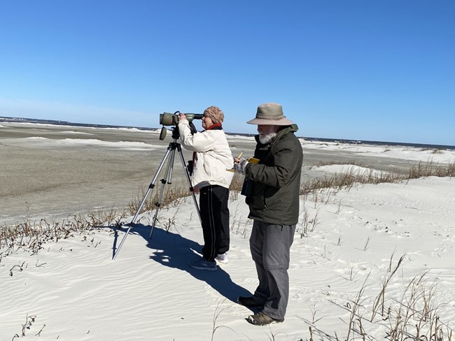
The Southeast Coast Network provided support in early January with the 2022 Mid-Winter Shorebird Count on Cumberland Island National Seashore. The annual survey occurs across many of Georgia's beaches and provides the park and the state an estimate of species presence, including those with elevated conservation status such as piping plover, red knot, and American oystercatcher. SECN Botanist Forbes Boyle assisted Pat and Doris Leary during the survey.
Shoreline Position and Water-Quality Data Available
All shoreline position data is being published in geodatabase format on the IRMA (NPS Integrated Resource Management Application) portal. To date, files from 2018-2021 have been uploaded for Canaveral National Seashore, Cumberland Island National Seashore, and Fort Matanzas National Monument. The geodatabases are available at https://irma.nps.gov/DataStore/Reference/Profile/2287235. For more information, contact Wendy Wright (Data Manager) or Claire Schmidt (Coastal Technician).
All water-quality discrete nutrient data from fixed-station sites for the years 2005-2020 has been published to EQuIS. For an electronic data deliverable of this data, contact Eric Starkey (Aquatic Ecologist) or Wendy Wright (Data Manager). Data is also available at https://www.waterqualitydata.us/.
Recent Publications
The Southeast Coast Network recently published the following reports:
- Terrestrial Vegetation Monitoring at Fort Pulaski National Monument: 2019 Data Summary. Available at: DataStore - Published Report - (Code: 2288716) (nps.gov)
- Terrestrial Vegetation Monitoring at Cape Hatteras National Seashore: 2019 Data Summary. Available at: DataStore - Published Report - (Code: 2290019) (nps.gov)
- Shoreline Change at Fort Matanzas National Monument: 2020-2021 Data Summary. Available at: DataStore - Published Report - (Code: 2290193) (nps.gov)
Tags
- cumberland island national seashore
- landbird community monitoring
- vocal anuran community monitoring
- automated recording devices
- global navigation satellite systems
- gnss
- university of north georgia
- real-time kinematic positioning
- rtk
- southeast coast network
- mid-winter shorebird count
- cape hatteras national seashore
- cape lookout national seashore
- canaveral national seashore
- fort matanzas national monument
- fort frederica national monument
- fort pulaski national monument
- timucuan ecological and historic preserve
- coastal wetlands monitoring
- surface elevation table
- shoreline change monitoring
- terrestrial vegetation monitoring
- horseshoe bend national military park
- moores creek national battlefield
- congaree national park
- chattahoochee river national recreation area
- ocmulgee mounds national historical park
- kennesaw mountain national battlefield park
- wadeable stream habitat monitoring
- water and sediment quality assessment
- water quality monitoring
- water quality data
- secn network highlights
