Last updated: May 19, 2023
Article
Southeast Coast Network News August 2020
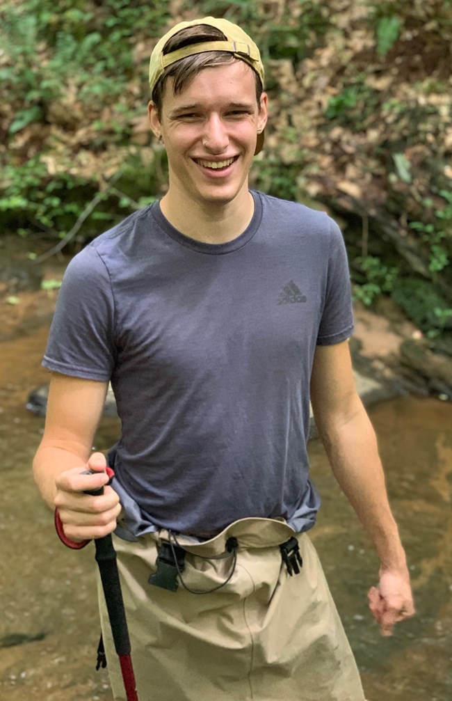
Studying Stream Temperature
Caleb Sytsma is working for the Southeast Coast Network as a graduate assistant at the Warnell School of Forestry and Natural Resources at the University of Georgia through the CESU program. He is studying the effects of land use on stream temperature in tributaries along the Chattahoochee River. Caleb is completing a Master of Science in Natural Resources Management and Sustainability with Dr. Rhett Jackson. He graduated in 2019 with a Bachelor of Science in the same field. Other professional interests include toxicology and phytoremediation (using living plants to clean up soil, air, and water contaminated with hazardous contaminants). A native of Dacula, Caleb enjoys hiking, reading, cooking and playing Dungeons and Dragons.
Field Work Updates
Field work for the remainder of 2020 is canceled due to COVID-19 travel restrictions. An update on each monitoring program's activities is below.
Vegetation Communities
Field work at Cumberland Island National Seashore, which began in May, is complete. The field work, conducted through a coordinated effort between regional, park, and network staff followed guidelines to minimize contact and spread of COVID-19. This field work was possible because vegetation monitoring staff are located at the seashore. Along with assistance from park interns, the vegetation team established plots across a broad range of island habitats, including maritime forests, open pine uplands, and foredune grasslands. Data collected from this effort are currently being processed by network staff. Cumberland Island is the only park scheduled for vegetation monitoring this year.
Water Quality
Cape Hatteras National Seashore and Cape Lookout National Seashore coastal assessments are postponed until next summer. Fixed station time-series data collection continues for all stations that were operational prior to March 2020. Nutrient data collection is on hold at Fort Pulaski National Monument and Cumberland Island National Seashore until travel can resume for Athens-based staff. The network greatly appreciates park and partner assistance with the sondes, including Brandon Puckett (NERS), Amy Thompson (NPS-CAHA), Kimberly Appleby (Florida DEP), Laura Waller (NPS-FOPU), Kurt Foote (NPS-FOMA), and Kristen Kneifl (NPS-CANA). While the aquatic team is tied to the office, they are working with Wendy Wright and student Ben Flanders to clean up and retire the legacy water-quality database, and complete testing on the new water-quality database, which will go into production late this fiscal year. They are also developing new code for the transition to the new Aquarius time-series database, which will streamline fixed station data reporting. In their spare time, they are working through quality assurance and quality control of 2017-2020 fixed station data.
Landbird and Anuran Communities
The network deployed recording devices prior to travel restrictions, and contacted park staff for assistance to collect the deployed units at Cape Hatteras National Seashore, Chattahoochee River National Recreation Area, Fort Pulaski National Monument , and Timucuan Ecological and Historic Preserve. The wildlife monitoring team is processing 2017 landbird data for Canaveral National Seashore, Congaree National Park, Fort Frederica National Monument, Moores Creek National Battlefield, and Ocmulgee Mounds National Historical Park. Reports for these parks will follow later this year. Additionally, the wildlife team is working with Wendy Wright and Ben Flanders to construct a new wildlife database that will house vocal anuran and landbird data.
Shoreline Monitoring
Spring shoreline data collection was completed at Cape Lookout National Seashore, Fort Matanzas National Monument, Cumberland Island National Seashore and Timucuan Ecological and Historic Preserve; and canceled at Canaveral National Seashore and Cape Hatteras National Seashore . The data collected was processed for reports to be published later this year. Fall data collection is canceled except for Cape Lookout National Seashore, where data collection is conducted by trained park staff. Shoreline staff have been working on 2019-2020 data summaries and developing a new tool to summarize storm data for parks. A shoreline report summarizing the effects of Hurricane Dorian on Cape Hatteras National Seashore has been submitted for publication this fiscal year.
Coastal Wetlands
Coastal wetland monitoring was not scheduled for FY20. Staff are working to revise this project so data collection can resume as soon as possible. A new coastal wetland monitoring protocol was drafted this summer, and an agreeement with the USGS was funded to install the new SET sites. These sites are currently in the permitting phase. Staff have also worked to ensure the previously developed DOI-SET database will support previous and future data collection efforts.
Wadeable and Non-Wadeable Streams
Field work at Chattahoochee River National Recreation Area is canceled and rescheduled for 2021. The aquatic team is working on wadeable stream reports for previously collected data at Kennesaw Mountain National Battlefield Park, Ocmulgee Mounds National Historical Park, and Congaree National Park, which will be published in August and September 2020. Additionally, they are reviewing non-wadeable high definition stream survey reports for Chattahoochee River National Recreation Area and Horseshoe Bend National Military Park which will be published next fiscal year.These surveys were completed by a private contractor and the usefulness of the information to the parks will be evaluated to determine if this work will continue as an I&M effort.
Publications
The Southeast Coast Network published the following reports since May:
- Shoreline change at Cape Hatteras National Seashore: 2018–2019 Data Summary. Available at: https://irma.nps.gov/DataStore/Reference/Profile/2275649
- Shoreline change at Cape Lookout National Seashore: 2018–2019 Data Summary. Available at: https://irma.nps.gov/DataStore/Reference/Profile/2275662
- Assessment of Estuarine Water and Sediment Quality at Canaveral National Seashore: 2019 Data Summary. Available at: https://irma.nps.gov/DataStore/Reference/Profile/2276843
Tags
- cape hatteras national seashore
- cape lookout national seashore
- cumberland island national seashore
- fort pulaski national monument
- chattahoochee river national recreation area
- timucuan ecological and historic preserve
- congaree national park
- ocmulgee mounds national historical park
- moores creek national battlefield
- fort matanzas national monument
- vegetation community monitoring
- water and sediment quality assessment
- water quality monitoring
- landbird community monitoring
- vocal anurans
- shoreline change monitoring
- wadeable stream monitoring
- canaveral national seashore
- warnell school of forest and natural resources
- secn
- southeast coast network
- inventory and monitoring
- southeast coast network news