Last updated: January 3, 2025
Article
NPS Geodiversity Atlas—Katahdin Woods and Waters National Monument, Maine

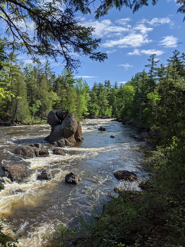
NPS Photo by Grace Kirk.
Introduction
Katahdin Woods and Waters National Monument is situated in the forestland of Maine’s North Woods on the eastern border of Baxter State Park approximately 130 km (80 mi) north of Bangor in Penobscot County. Established on August 23, 2016, in honor of the 100th anniversary of the National Park Service, the monument encompasses approximately 35,435 hectares (87,563 acres) and protects an area that was once the heart of Maine’s logging and papermaking industry. The landscape of the monument is dominated by the fluvial valleys of the East Branch of the Penobscot River, Wassataquoik Stream, and Seboeis River, and features rolling forests, mountains, wetlands, and a diverse biological community spanning three ecoregions. The forests of Katahdin Woods and Waters display the transition between northern boreal and southern broadleaf deciduous forests, providing a unique opportunity to study the effects of climate change across different ecosystems. The landscape of KAWW shares a cultural history that dates back nearly 11,000 years, inspiring Native Americans, lumberjacks, timber owners, artists, authors, scientists, recreationists, and others. (NPS Geologic Type Section Inventory, Henderson, 2022)
Geologic History and Features
Katahdin Woods and Waters' geology provides prominent evidence of large and powerful earth-changing events that have shaped the landscape as we know it today. Geologic formations throughout the monument provide striking visual evidence that marine waters covered the area in the periods immediately following the Cambrian period (over 500 million years ago). Owen Brook limestone, an outcrop of calcareous bedrock west of the East Branch containing fossil brachiopods, is of coral reef origin. Pillow lavas, near the summit of Lunksoos Mountain, were produced by underwater eruptions. Haskell Rock, the 20-foot-tall pillar in the midst of the East Branch, is conglomerate bedrock that suggests a time of dynamic transition from volcanic islands to an ocean with underwater sedimentation. In more recent geological history, glacial landforms, glacial scoured bedrock, and the lake sediments in the area, deposited only since the retreat of the last glaciers, record a history of intense change in climate that gave rise to the modern topography of the area. (NPS Foundation Document KAWW, 2016)
Fossil Resources
One of the resources mentioned in the presidential proclamation establishing the monument is fossils, making Katahdin Woods and Waters NM one of only 18 National Park System units that have paleontological resources specifically referenced in their establishing proclamation or enabling legislation.
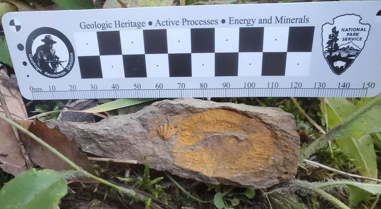
Many kinds of fossils have been reported from Katahdin Woods and Waters NM. They are either body fossils or trace fossils of marine invertebrates. Most of the diversity comes from corals and brachiopods. In terms of abundance, crinoid columnals (pieces of the “stems” of sea lilies) are frequently found, but columnals are hard to attribute to species so we know very little about the actual kinds of crinoids that they came from. Other kinds of fossils found in the monument include sponges, bivalves, snails, trilobites, graptolites (a kind of colonial invertebrate, with tiny worm-like animals living in tubes or cups in larger structures), and invertebrate burrows. (Paleontology of KAWW, Tweet, 2022)

NPS photo by Vincent Santucci.
Regional Geology
Katahdin Woods and Waters National Monument is a part of the New England Physiographic Province and shares its geologic history and some characteristic geologic formations with a region that extends well beyond park boundaries.
-
Tweet JS, Santucci VL, Ashton I. 2022. Katahdin Woods and Waters National Monument: Paleontological resource inventory (public version). Natural Resource Report. NPS/KAWW/NRR—2022/2472. National Park Service. Fort Collins, Colorado. https://doi.org/10.36967/2294810
-
Henderson TC, Santucci VL, Connors T, Tweet JS. 2022. National Park Service geologic type section inventory: Northeast Temperate Inventory & Monitoring Network. Natural Resource Report. NPS/NETN/NRR—2022/2475. National Park Service. Fort Collins, Colorado. https://doi.org/10.36967/2294876
