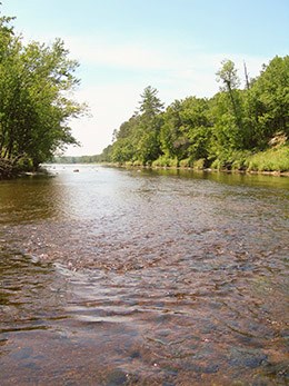
NPS/VanTatenhove Wild RiverTrip DetailsDistance: 8.0 Miles River DescriptionThe St. Croix River flows around several large islands near the confluence with the Kettle River as it runs through wild forests. The river forms two channels, one along each length of the islands. With Class I and II rapids in both the main channel (the channel on river left after the launch at Nelsons Landing) and the Kettle River Slough (river right), this is an exciting paddle. Where the slough and the main channel re-converge there is a longer stretch of step-rapids along a rock shelf. The river character takes on wider views and all the public land surrounding the Riverway adds to the sense of wilderness. St. Croix State Park provides facilities along the Kettle River and portions of the St. Croix River. River Level ConsiderationsThe main channel is generally floatable throughout the season however, the Kettle River slough is very sensitive to rainfall. In low water, the slough is practically unnavigable, requiring a lot of walking, while in high water, the rapids can be quite a bit tougher with some rolling portions of white-water. Go to the river conditions page for more. Along the WayMain Channel
Kettle River Slough
Multi-day ExtensionThis paddle can be extended up and down the river. Sandrock Cliffs, several miles below Soderbeck landing, is noteworthy because of the outcropping of sandstone exposed in a side-channel of the river. The area above Norway point, upriver from Nelsons landing, is much slower-paced water. Return to Ranger Recommended Paddles |
Last updated: January 14, 2025
