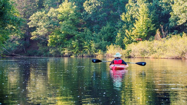
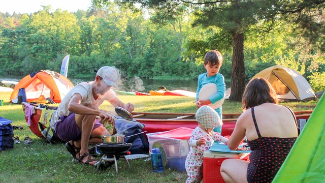
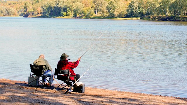
Skip to SearchSkip to NavigationSkip to BodySkip to Footer
National Park Service LogoU.S. Department of the InteriorNational Park ServiceNational Park Service
National Park Service:  U.S. Department of the InteriorNational Park Service Arrowhead
Saint Croix National Scenic Riverway White trillium flowers dot the green leafed ground with the river in the background
view map
text size: largest larger normal
printer friendly

A River to Explore

The St. Croix and Namekagon Rivers offer 255 miles of clean water gliding past a lush green landscape, with glimpses of a human presence. Choose to canoe and camp amid the northwoods, or boat and fish surrounded by wooded bluffs and historic towns. This river corridor provides a wealth of scenic views and a haven for wildlife near a major metropolitan area.

 
Close up of two boyscouts wearing orange lifejackets canoeing on the river.

Get on the Water and Canoe

Beginning as small intimate streams, both the St. Croix and Namekagon Rivers are ideal for canoeing. Easy, Class I, rapids encourage both beginning and novice canoeists to get out and explore.  To learn more about canoeing the rivers...

In 2012 park staff will have one blog site: River Currents. It will have information on river conditions, wildlife and happenings along both the St. Croix and Namekagon Rivers.

The Riverways previous blogs the 2011 St. Croix Currents focusing on the St. Croix River and Namekagon Meanderings, on the Namekagon River and the 2010 Namekagon blog are all still available if you want to check back and see what was being said. Take a look and let us know what you think. 

 
A light colored tent behind a fire ring with campstove on the grill.  Two logs are pulled up for seating

Camping along the Riverway

Over 100 primitive campsites are available for overnight use on a first-come, first- served basis. Most are only reachable by water and include a fire ring, picnic table and pit toilet. More...

Regulations for camping vary if you plan to camp north or south of Highway 8.  For the those camping south of Taylors Falls see... 

 
An adult bald eagle with white head and brown body sits in a tree

Maps and Brochures

A variety of handouts developed by park staff are available to help you prepare for your visit. These include maps for planning a canoe trip on the river. More...

In addition to maps and brochures it may be helpful to know about road construction.  We will post information as we learn of it, but there may be projects we miss so use caution and be patient.

 
A parade float carrying a national park ranger, fur trader, hiker and logger

Resources to enhance your visit

Looking for programs or special events to attend, other areas to visit and services you might need?

The Riverway offers scheduled activities you may wish to attend. More...

State or local tourism offices can help you locate lodging, restaurants and other visitor services available within the adjoining communities. Wisconsin and Minnesota Department of Natural Resources offer camping and other opportunities within the state parks and regulate hunting and fishing. More...


Write to

401 North Hamilton Street
Saint Croix Falls, Wisconsin 54024

E-mail Us

Phone

Visitor Information
(715) 483-2274

Main Park Number
(715) 483-3284

Fax

(715) 483-3288

Climate

Summers can be hot and humid with occasional thunderstorms.  Winters are cold and can be snowy.  Spring and Fall are changeable.
Skip to SearchSkip to NavigationSkip to BodySkip to Footer
A very narrow insect with skinny legs and a tail

Did You Know?
Water scorpions use their tails or siphons as a a "snorkel" thrusting it up through the surface film on the water to the air above. Their legs are not much use in swimming, so most water scorpions spend life near the shoreline.

Last Updated: August 25, 2011 at 15:37 MST

CANCEL

You are exiting the National Park Service website

Thank you for visiting our site.

You will now be redirected to:

We hope your visit was informative and enjoyable.