|
You are viewing ARCHIVED content published online before January 20, 2025.
Please note that this content is NOT UPDATED, and links may not work. For current information,
visit https://www.nps.gov/aboutus/news/index.htm.
NPS
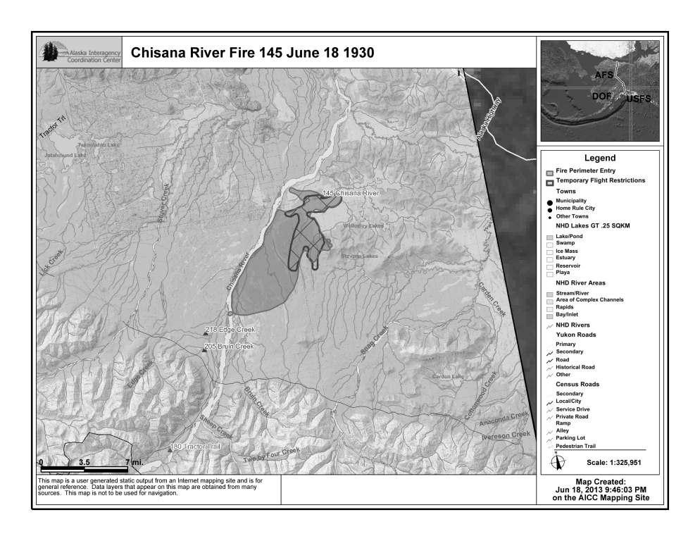
Copper Center, Alaska –– Smoke from the Chisana River Fire impacted the Copper River basin on the evening of July 18. Because the fire continues to grow anticipate varying levels of smoke impacting the area. The Chisana River fire grew from 7,718 acres on June 17 to 25,566 acres on June 18. The fire continued its growth to the south and west with some growth east - isolated tree torching and short range spotting was observed. Interagency fire staff provided protection to a structure that is southwest of the fire. The fire will continue to be monitored with planned flights today around 5:00pm. Smoke will be visible and even heavy at times, in both Alaska and Canada. In Alaska, smoke will be likely visible throughout the Copper River Basin, from the Alaska-Canada border crossing, and along portions of the Alaska Highway. Wildland fire smoke information is available at http://www.dec.state.ak.us/air/smokemain.htm. If smoke becomes an impact to the highway, motorists are asked to use caution by slowing down and driving with their headlights on. The fire is in a Limited suppression management option, per the Alaska Interagency Wildland Fire Management Plan. Wildfire is a natural process in the boreal forest. The fire is burning on U.S. Fish and Wildlife and National Park Service lands and agency personnel are allowing the wildfire to take its natural course.It is nature's way of renewing and revitalizing the landscape. Naturally-caused wildfires have on occasion burned in the northeastern portion of Wrangell-St. Elias and Tetlin National Wildlife Refuge. Interagency fire managers will take action if structures, natural or cultural resources are threatened. None are threatened at this time. Visit https://www.nps.gov/wrst/parkmgmt/loader.cfm?csModule=security/getfile&pageID=385664 to see a map of the area's wildfire history. Several fires are burning statewide. For interagency wildland fire information, visit http://fire.ak.blm.gov or call 907-356-5511. Information about fires burning on National Park Service lands throughout Alaska is provided athttps://www.nps.gov/wrst/parkmgmt/currentfireinfo.htm. For additional information, please contact Mark Keogh at 907-822-7223. |
Last updated: April 14, 2015