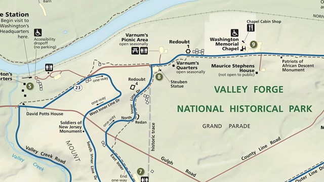
Maps
View maps of the park. 
Rent a Bicycle
The Encampment Store offers bike rentals seasonally. Call 610-551-7870 to confirm rentals are being offered before heading to the park. 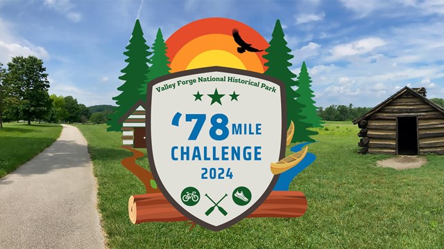
Take the '78 Mile Challenge
Walk, run, bike, or paddle 78 miles at Valley Forge between April and October 2024 to take the '78 Mile Challenge and earn a fun prize! Valley Forge National Historical Park has over 35 miles of designated trails! The paved Joseph Plumb Martin loop makes a circuit around the central Grand Parade and connects many of the key historic and interpretive sites in the park. This trail especially popular for walkers, joggers, and cyclists. There are also unpaved (dirt and gravel) trails through the forests on Mount Joy and Mount Misery, next to Valley Creek and the Schuykill River, and through the beautiful meadows of the Grand Parade. Hiking is permitted in most open areas of the park. Please keep your pets on a leash at all times and throw waste in the provided trash and recycling receptacles. 
NPS Graphic Trail DescriptionsTrails authorized for pedestrians only are marked as yellow on the map above. 18.2 miles of authorized bicycle trails within the park are marked as green and purple on the trail map above. Authorized horse trails are marked as green and blue. Joseph Plumb Martin Trail8.7 miles total (5-mile inner loop) Hilly with limited shade. 5-mile inner loop follows much of the Encampment Tour route and connects many of the park's historic sites. Named for a young Continental Soldier who camped at Valley Forge in 1777-78. Paved multi-use trail. Chapel Trail2.5 miles (one-way) Shady trail with lengthy level stretches. Some steep sections with great views of the Schuylkill River. Unpaved. Trails on Mount JoyHilly wooded trails with great views. Unpaved. Trails on Mount MiseryMount Misery TrailSteep wooded trails with great views and experiences. Unpaved. Valley Creek TrailMostly level trail along Valley Creek. Unpaved. Wolfinger TrailVery steep and wooded trail. Unpaved. Horse-Shoe TrailSteep woodland trail. Begins in park and connects with Appalachian Trail. Unpaved. Trails on the North Side of the Schuylkill RiverRiver Trail3 miles (one-way) Shady level trail meandering along the Schuylkill River. Unpaved. Commissary Trail1 mile (one way) Level trail that circles part of the historic Pawling Farm. Unpaved. Schuylkill River TrailWide multi-use trail that extends southeast to Philadelphia and northwest to Phoenixville. Connects with the Perkiomen Trail and Audubon Loop Trail. Can be accessed from points beyond the park. Paved. Trail RegulationsTo ensure your safety and to protect sensitive historic and natural resources in the park, you must abide by these common sense regulations:
|
Last updated: March 2, 2026