Last updated: April 23, 2024
Thing to Do
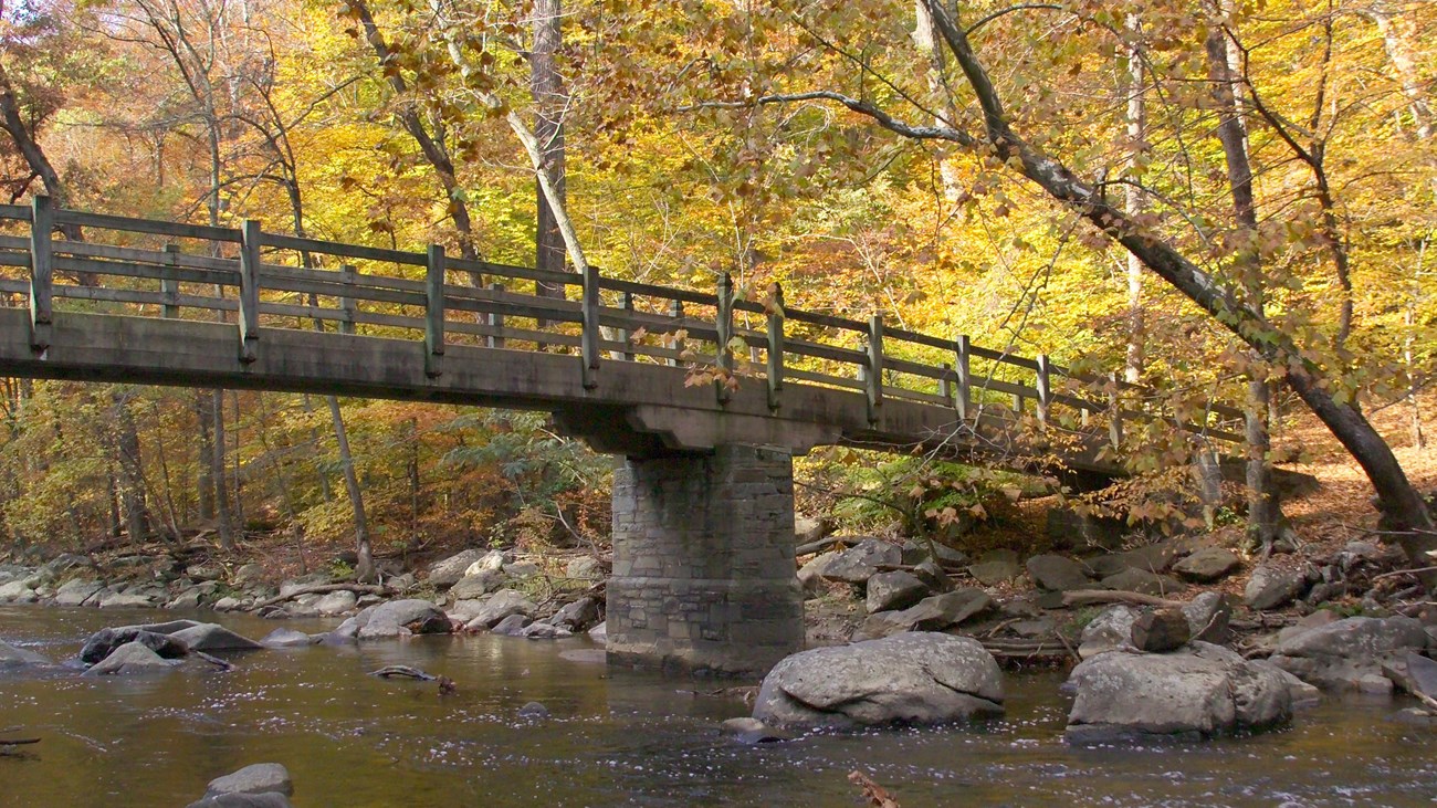
Rapids Bridge Hike
NPS Photo
For your convenience this hike is blazed in bright orange tape wrapped around sign posts.
- Exit left or walk south/back through the parking lot toward the Horse Center.
- Take a sharp left into the Horse Center and keep left.
- Walk past the small parking lot. Look for the dirt trail to the left of the corral fence. This is the beginning of the White Horse Trail.
- Hike to the creek. Take a right just before the bridge that crosses Rock Creek.
- Heading downstream, listen to the fast-flowing water—i.e., rapids. This is the fall zone, a geologic transition zone where the Piedmont Plateau (harder rock) meets the Atlantic Coastal Plain (softer, sedimentary rock).
- After 3/5-mile, you will see Rapids Bridge. Be sure and enjoy the view from the footbridge.
- Do not cross Rapids Bridge. Continue hiking 165-feet south. Take the unmarked trail to the right uphill.
- In ¼ mile, at the trail fork, keep right and go under the bridge.
- In ¼ mile, the dirt trail comes to a fork at the horse center. Take the trail to the right to rejoin the bridle trail you started on.
- Turn left and return through the Horse Center parking area to the Nature Center.
Details
Activity
Hiking
Rapids Bridge is a two mile hike that takes visitors from the Nature Center to the creek. The half mile descent down to the creek uses a bridle trail that exits from the Rock Creek Horse center. The descent is gradual and the trail is wide and relatively smooth. The walk along the creek follows the natural contours of the ground above the creek, dipping and rolling with the landscape. Rapids Bridge overlooks rocky rapids that are visible when water is low. When water is high the rocks are obstructed. The return to the nature center comes up a steep ascent along the ridge on a trail that can be slippery, rocky and uneven. Visitors are asked to remain on the trail and to avoid going through the Horse Center stable area and access road. Please use the bridle trail to go around the barns and exit through their parking area.
Pets Allowed
Yes
Pets are allowed on trails within Rock Creek Park but must adhere to the B.A.R.K. Ranger Principles. Dogs must always be on a leash within the park. Waste must be carried out and disposed of in trash receptacles.
For more information on B.A.R.K. Ranger visit the Pets section of the National Park Service website.
For more information on B.A.R.K. Ranger visit the Pets section of the National Park Service website.
Activity Fee
No
Entrance fees may apply, see Fees & Passes information.
Location
Rapids Bridge
Rapids Bridge overlooks rocky rapids that designate a geologic fall zone within the park. The bridge connects a bridle trail to Beach Drive and the Valley Trail on the other side of the road.
Reservations
No
Season
Year Round
Visibility is increased in the late autumn and winter months when leaves have fallen, opening the landscape to deeper view sheds and better viewing of the creek. Trails are not cleared of snow and can have ice and compacted snow on them. Use caution.
Spring and summer rains can flood the creek quickly. Seek higher ground if the water comes up to the trail level.
Spring and summer rains can flood the creek quickly. Seek higher ground if the water comes up to the trail level.
Time of Day
Day
Rock Creek Park is only open from sunrise to sunset.
Accessibility Information
Rapids Bridge Hike uses the wide bridle trail known as the White Horse Trail for it's initial descent. This trail is 6-8 feet wide and is relatively smooth and free of obstructions. The trail continues along the edge of the creek to Rapids Bridge, which is roughly four feet wide and sixty feet across. The trail that returns to the nature center can narrow in width to four feet and is steep and can have hazards, such as exposed roots and rocks.
For an accessible alternative, visitors can exit the Nature Center and make use of the paved multi-use trail that parallels Military Road to go to the creek. From there, Beach Drive is a paved alternative to get to Rapids Bridge. The ascent back to the Nature Center via the paved multi-use path is steep. Take your time and use caution. If you prefer not to make the descent and have to come back up the hill you can park your vehicle at Picnic Grove #6 to access Beach Drive.
Beach Drive is closed to motor vehicle traffic on Saturdays, Sundays and holidays.
Tags:
rock creek park,
hike,
hiking,
rapids,
rapids bridge,
forest,
creek,
rock creek,
white horse trail