Last updated: May 13, 2024
Thing to Do
Level 3 Trails at Fort Vancouver National Historic Site
Here, you can find information on Level 3 walking trails at Fort Vancouver National Historic Site. Level 3 trails and routes can be walked in 90 minutes with an elevation change of up to 50 feet.
The Lower River Road is not directly accessible by public transit, and is not wheelchair-accessible.
The Parade Ground and East Vancouver Barracks loops are not wheelchair accessible.
The Lower River Road is not directly accessible by public transit, and is not wheelchair-accessible.
The Parade Ground and East Vancouver Barracks loops are not wheelchair accessible.
Download a map of these Level 3 trail routes here
Level 3 Trails Basic Information
| Trail Name | Trail length (round-trip miles) | Walking time (in minutes) | Changes in elevation (feet) | Trail is wheelchair accessible | Trail accessed by C-Tran | Trail has benches |
| Parade Ground (loop route) | 1.0 | 30 | 25' | No. Trail crosses 300 feet of uneven grass. | Yes (32) | Yes |
| East Vancouver Barracks (loop route) | 1.0 | 35-45 | 25' | No. Trail crosses 300 feet of uneven grass. | Yes (32) | Yes |
| Lower River Road | 0.6 | 15-20 | No | No. Gravel trail. | No | No |
| Great Meadow (loop route) | 1.5 | 45 | 30' | Yes. Trails follows 300 feet of road shoulder. | Yes (32, 35) | Yes |
| Discovery Trail | 3.0 | 60-90 | 50' | No | Yes (3A, 3B) | Yes |
Trail Descriptions
Details
Duration
15-90 Minutes
Activity
Hiking
Age(s)
All ages.
Pets Allowed
Yes
Pets must be on a leash no longer than 6 feet at all times. Please pick up and dispose of pet waste. Learn more about bringing pets to Fort Vancouver here.
Activity Fee
No
Entrance fees may apply, see Fees & Passes information.
Reservations
No
Season
Year Round
Time of Day
Day, Dawn, Dusk
Trails are open from dawn to dusk.
Accessibility Information
The Lower River Road trail is not wheelchair accessible, and crosses areas covered by grass and gravel.
The Parade Ground and East Vancouver Barracks loop trails are not fully wheelchair-accessible. Both routes cross 300 feet of uneven grass.
The Great Meadow trail follows 300 feet of road shoulder.
The Parade Ground and East Vancouver Barracks loop trails are not fully wheelchair-accessible. Both routes cross 300 feet of uneven grass.
The Great Meadow trail follows 300 feet of road shoulder.

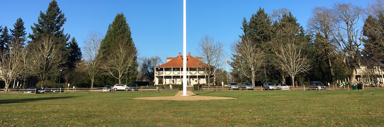
NPS Photo
Parade Ground trail
This stroll takes you around Officers' Row, East Vancouver Barracks, and the Parade Ground. In the late 19th and early 20th centuries, the Parade Ground and its large garrison flagpole served as a gathering center for military drills and demonstrations.
On this route, you can compare and contrast the homes where officers and soldiers lived at Vancouver Barracks. Officers lived in duplexes and homes on Officers' Row, on the north side of East Evergreen Boulevard, while the soldiers lived together in the large barracks buildings on the south side of the Parade Ground.

NPS Photo
East Vancouver Barracks
As an active military post for 150 years, Vancouver Barracks was an important center of military operations in the Pacific Northwest. In 2012, the east and south portions of this historic post were transferred to the National Park Service. Since then, the National Park Service has been working to transform these areas into a vibrant, multi-use public service campus.
This route takes you through the East Vancouver Barracks, where many improvements have been made already. Keep your eye out for active rehabilitation and construction projects!
On this route, you will see Officers' Row, the Parade Ground, the Clark County Veterans War Memorial, and the historic O.O. Howard House, where General Oliver Otis Howard lived while he commanded Vancouver Barracks.

NPS Photo
Lower River Road
The Lower River Road is one of the oldest roads in the Pacific Northwest, and appears on early 19th century maps of the Hudson's Bay Company's Fort Vancouver. The historic entrance to the fort was along the south wall, facing the river. On this trail, you can imagine entering the fort through this entrance, rather than the modern-day north side entrance. It's also a great place to watch planes take off and land at the municipal Pearson Field airport!
This trail can be accessed from Pearson Air Museum, or along the Land Bridge Trail, and can be easily combined with the Level 1 and Level 2 trails that cross the Land Bridge or pass throught the Village.

NPS Photo
Great Meadow
This walk gives you an opportunity to walk along beautiful Officers' Row, the East Vancouver Barracks, and the south end of the Great Meadow. On Officers' Row, stop by the historic Grant House, now a restaurant, and the Marshall House, where General George C. Marshall once lived.
In the East Vancouver Barracks, visit the O.O. Howard House, the former residence of General Oliver Otis Howard, and the Clark County Veterans War Memorial.
In the Great Meadow, enjoy wide open green spaces, picnic areas, and a children's playground.

NPS Photo
Discovery Trail
This loop skirts the east end of Pearson Field. Take a break or bring a snack to the picnic tables at the east end of this municipal airport and watch planes take off from one of the oldest continuously operating airfields in the United States! Then, stop by Pearson Air Museum to learn more about the history of aviation in Vancouver.
This trail also leads you over the Land Bridge and along the Columbia River waterfront. Inspired by famed architect Maya Lin, the Land Bridge is an earthen bridge designed by Native American architect Johnpaul Jones that crosses over State Route 14. As you walk along this beautiful bridge, you will see artwork by Warm Springs artist Lillian Pitt, learn about the connections that Indigenous people have to this landscape, read words in Native languages that were spoken by the residents of Fort Vancouver, and see northwest native plants. At the southern end of the Land Bridge, you will visit Old Apple Tree park, where, until 2020, the oldest apple tree in the northwest once stood. Learn more about the Old Apple Tree here.
The Land Bridge is a Confluence art installation and serves to reconnect the national park riverfront to the rest of the park, while sharing the site's history and offering a place to learn more about the connection that Indigenous people still have to this place.