Last updated: April 29, 2025
Thing to Do
Experience the Shafer Trail
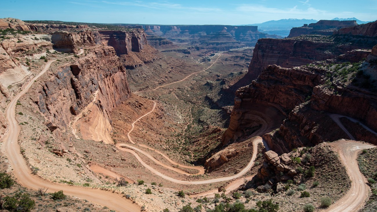
NPS Photo
The Shafer Trail at the Island in the Sky district of Canyonlands National Park is an iconic road that descends 1,500 feet (457 m) through a colorful, massive sandstone cliff. Its function has changed through the years; from a route made by Native Americans to access resources on the mesa top, to a trail for sheep herders moving flocks to better foraging in winter time, and then a road for trucks moving loads of uranium from the backcountry to market. Today, the Shafer Trail is a challenging, unpaved backcountry road for recreational users seeking the experience of a lifetime.
Driving Tips
-
High-clearance 4WD vehicles with a low range gear (4LO) are highly recommended. ATVs, OHVs, or UTVs are not permitted inside the park.
-
Backcountry driving conditions can change rapidly after rain or snow. Check the weather report before starting your trip and current road conditions before heading out.
- Buckle up! Seatbelts are required on all roads.
- Obey the 15 mph (24 kph) speed limit.
- Watch for low overhanging rocks.
- Uphill traffic has the “right-of-way.” Use berms and pull-outs to allow uphill traffic to pass safely.
- Please stay on the trail so as not to disturb biological soil crust. Damaged soils are prone to erosion and invasive species.
Details
Duration
1 Hour
Activity
Scenic Driving
Pets Allowed
Yes with Restrictions
Pets may be transported inside vehicles only.
Activity Fee
No
Entrance fees may apply, see Fees & Passes information.
Location
Shafer Canyon Trail
Take the first left after passing the Island in the Sky entrance station. The unpaved backcountry road winds 1,500 feet (457 m) down colorful sandstone walls, over roughly 5.2 mi (8.4 km) before joining the White Rim Trail.
Reservations
No
Season
Year Round
Accessibility Information
The Shafer Trail road can be accessed by anyone in a high-clearance 4WD vehicle with a low range gear (4LO) (recommended).
Service animals that have been individually trained to perform specific task(s) for the benefit of an individual with a disability are allowed in the park. The tasks performed by the animal must be directly related to the person’s disability.

Shafer Family
Shafer Trail History
The Shafer Trail is named after the Shafer family, who were Mormon pioneer settlers. Starting in 1916, John “Sog” Shafer, used this trail to move cattle from summer pastures on the mesa top to winter ground on the White Rim sandstone, several rock layers down into the canyon. John Shafer is credited for improving the trail and making access into the canyon easier. Many other trails at Island in the Sky also bear names for the families who worked them.
Expanding upon the work of Sog Shafer, the Atomic Energy Commission widened Shafer Trail and extended it to the White Rim Road to accommodate trucks moving loads of uranium-bearing rock from the backcountry and down to Moab for processing. Many backcountry roads in the Moab area used for recreation today were improved by the Atomic Energy Commission.

NPS Photo
From Ranching to Recreation
After Canyonlands was established as a National Park in 1964, the Shafer Trail transitioned from a ranching and mining road to a route used primarily for recreation. Each year, hundreds of visitors experience the thrill of driving down the winding sandstone cliff to the basin below.
While driving this unpaved road remains difficult to this day, with the right gear and technology, it's possible to safely traverse the Shafer Trail. Remember, unlike in the past, high-clearance, 4WD vehicles with low gear settings (4LO) are highly recommended to traverse this route. Visit our park website for more information on road conditions and safe driving.
Then and Now
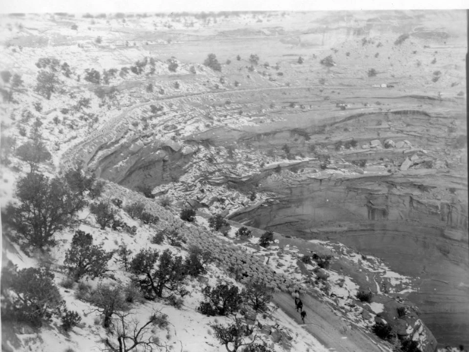
Left image
Sheep herders run sheep along the canyon, c. 1966.
Credit: NPS Photo
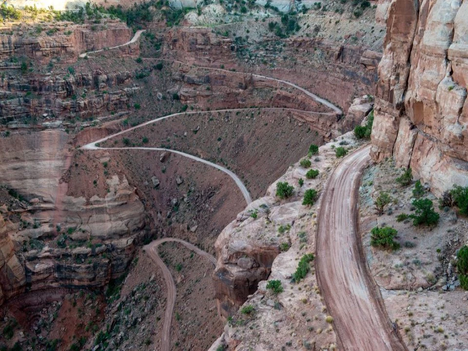
Right image
Today, the Shafer Trail is a challenging, unpaved backcountry road for recreational users seeking the experience of a lifetime
Credit: NPS Photo