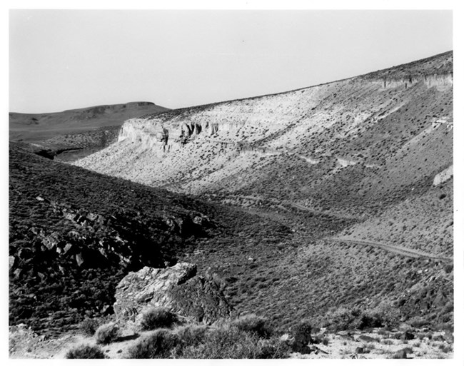
NPS Photo / National Register of Historic Places
The Applegate-Lassen Trail is a 130-mile long portion of the larger Applegate and Lassen Trails, which extends through Pershing, Humboldt, and Washoe Counties in northwestern Nevada. This section reaches from the trail’s parting with the California Trail at the Humboldt River and the northern end of the Rye Patch Reservoir to its exit west of Vya, Nevada. The trail is associated with the Oregon and California Trail, the longest, most significant, and most heavily traveled route of western migration in American history.
As the ‘Oregon fever’ spread after 1842, more and more people formed emigrant societies to circulate information about the West and to share advice on preparation for the journey. Over 100 emigrants left from Independence, Missouri, the start of the southern portion of the California trail, in 1842, and almost 900 followed in 1843—the historic year of the ‘Great Emigration.’ After this period, emigration boomed, with numbers of those making the journey reaching 1000 in 1844 and 3000 in 1845; it continued to swell in the 1850s with the California ‘Gold Rush.’ Indeed, the push for new settlers and shortcuts to reach the California gold fields encouraged the establishment of both the Applegate and Lassen Trails.
Nineteen historic sites associated with the overland migration to Oregon and California in the nineteenth century are located on the 130-mile stretch of the Applegate-Lassen Trail. The junction of the Applegate-Lassen Trail with the California Trail at Lassen’s Meadow (now Rye Patch Reservoir) is still visible, a grassy region where emigrants would stop to recruit their stock and send messages to those following behind them at a functional ‘post office.’
Several springs line this section of the trail, including Antelope (Willow) Springs, Rabbithole Spring, Black Rock Spring, Double Hot Springs, Stevens Spring, Emigrant Spring, and Fortynine Spring. Antelope and Rabbithole Springs proved inadequate sources of water for emigrants, many of whom chose to risk the Mud Lake Crossing (Black Rock Desert) to reach Black Rock and its namesake spring. Emigrants considered this crossing through sand dunes and desert playa the worst section of the trail, as many suffered the loss of stock and other tragedies along the way, despite its straight trajectory across the dunes to Black Rock. The traces of the Mud Lake Crossing that remain are the longest unbroken stretch of trail traces on the Applegate-Lassen Trail—a twenty-mile stretch. The large and impressive Black Rock Spring was the first adequate source of both water and grass that emigrants encountered on the approximately fifty miles of trail from the Humboldt River.

NPS Photo / Lassen Volcanic National Park
The Double Hot Springs, five miles from Black Rock, proved more difficult for followers of the trail. These springs were and are scalding, marking the beginning of the treacherous thirty-mile stretch along the trail through the Black Rock Desert to Mud Meadow (Soldier Meadow) that brought more strife to emigrants and their stock. Mud Meadow, with numerous hot and cold springs, became an important place of rest for emigrants on the Applegate-Lassen Trail. Camp McGarry (Soldier Meadow Ranch), still in use, also served as a safe place for emigrants, established during disputes with American Indians in the area in the mid-1860s to protect travelers.
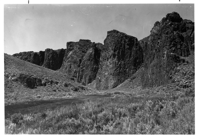
High Rock Canyon was an important milestone on the trail, a scenic ‘welcome highway’ through fifteen miles of volcanic tablelands mentioned in almost all emigrant journals. Emigrant names are painted and carved here on canyon walls and inside caves, well preserved, and trail traces remain throughout the canyon. While Fortynine Lake, a dry alkali lake 20 miles past Emigrant Spring, proved a cruel trick for travelers who left the trail to reach it only to find its water undrinkable, Fortynine Spring (Vya) gave the first usable water after Emigrant Spring. As it lies north of the natural pass through the Hays Canyon Ridge, emigrants would have to divert their course to reach it and could then use the Fortynine Pass over the divide to save time and mileage, as remaining traces show. The Fortynine Camp was the last place to camp with good water before crossing into the dry desert towards Surprise Valley and the Sierra Nevada (the Warner Range) in California, marked by a boulder with a large ‘49’ painted on it.

NPS Photo / National Register of Historic Places
The Applegate-Lassen Trail retains an exceptionally high degree of integrity, as its location and surroundings remain free of modern intrusions, and is therefore one of the best representations of the history of the Oregon and California Trails. On the 85th meeting of the National Park System Advisory Board Landmarks Committee in October 1981, the Committee found that the Applegate-Lassen Trail met the criteria of the National Historic Landmarks Program and recommended Landmark designation. However, as the ownership of the land included in the boundary of the proposed landmark was unclear, and therefore lacked owner consent for designation, the property was determined eligible. As this information has yet to be provided, the Applegate-Lassen Trail remains eligible for designation as a National Historic Landmark.
Last updated: July 9, 2021
