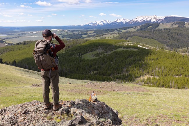
We learn about visibility in national parks by measuring aerosol particles in the atmosphere. These particles can scatter and absorb light, creating haze that impairs visibility making it harder to see. Haze affects how viewers perceive distant features by softening textures, fading colors, and obscuring distant features. The amount and type of haze depends on what the particles in the air are made of (composition), their size, and how many of them there are (concentration).

Photo courtesy of NPS
Common particles that scatter and absorb light, contributing to haze are:
- sulfates
- nitrates
- chloride (sea salt)
- organics
- elemental carbon (soot)
- fine soil
- coarse mass
Who is monitoring and where?
Visibility monitoring data are collected in 46 national parks (see map) by NPS staff and local partners. Park-based visibility monitoring sites are part of the Interagency Monitoring of Protected Visual Environments (IMPROVE) monitoring network, an EPA funded nation-wide network that tracks visibility conditions and trends in Class I Areas (parks designated by the Clean Air Act with higher levels of air quality and visibility protection). Partners from the University of California, Davis, Air Quality Research Center oversee network operations by providing monitoring materials, processing samples, and conducting site audits on behalf of the IMPROVE network. Laboratories at Desert Research Institute and RTI International also contribute to sample analysis.
What equipment do we use?
Parks monitor visibility using IMPROVE samplers, nephelometers, and webcams.
- Duration:
- 1 minute, 29 seconds
An air quality expert explains how we collect data to measure visibility.
How the IMPROVE sampler works:
IMPROVE samplers measure visibility indirectly by collecting particles from the air on filters. The filters are then sent to three laboratories to be analyzed for particle composition and concentration.
- Duration:
- 1 minute, 29 seconds
Animation showing that ambient air is pulled through the inlets and each of the four filters targets different pollutants.
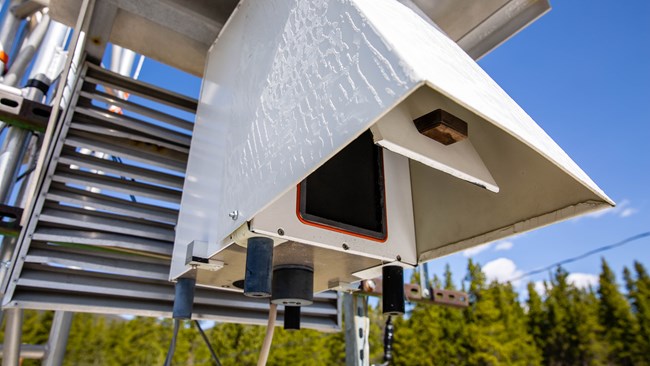
There are four inlets (air intake pipes) on the IMPROVE sampler. A pump pulls air through the inlets and corresponding filter packs located at the base of each module. The larger collector inlet on the right allows collection of both “fine” and “coarse” particles. Fine particles have diameters of 2.5 micrometers (μm) or less and are referred to as fine particulate matter or PM2.5. Coarse particles have diameters between 2.5 and 10 μm.
The three smaller inlets sample PM2.5, which is strongly associated with human-caused air pollution. These fine particles scatter light more efficiently than larger particles making the views look hazier.
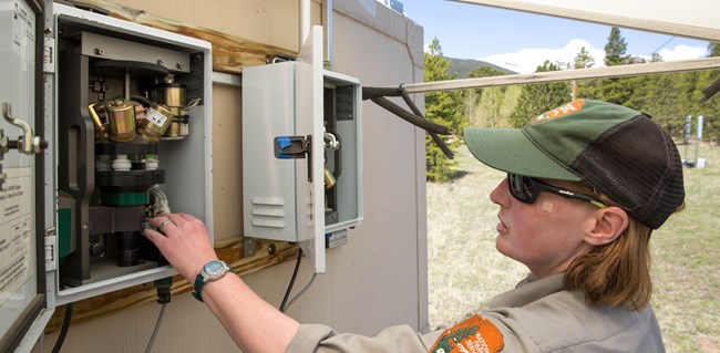
Each of the three inlets collecting PM2.5 leads to a different type of filter material that targets specific aerosol components. Measuring different types of particles separately can help identify sources of pollution. Different types of particles require specialized laboratory analysis that are compatible with certain types of filter materials. Also, some particles are collected more efficiently by specific filter materials.

Photo courtesy of Mackenzie Reed/NPS
The filter materials used are TeflonTM, nylon, and quartz.
-
TeflonTM is used to measure inorganic compounds, elemental absorption, and mass
-
Nylon is used to measure ions such as inorganics including nitrate, sulfide, and chloride
-
Quartz is used to measure elemental carbon and organic carbon compounds
How the Nephelometer works:
At 11 locations, the National Park Service uses nephelometers to measure visibility. A nephelometer provides direct, real-time light scattering measurements for particles of all sizes at the current temperature and humidity.

Photo courtesy of Mackenzie Reed/NPS
An automatic door opens on the front of the nephelometer and air is pulled into the chamber by a fan to measure the sample. A Light Emitting Diode (LED) illuminates the air sample in the chamber. Particles in the air scatter the emitted light in all directions. A detector located perpendicular to the light source measures the amount of scattered light that contacts it and total scattering is calculated. The data are reported in inverse Megameters (Mm-1) (total light extinction) or as haze index in deciviews (a measure of visibility that correlates to incremental changes in visual perception, similar to the decibel scale used to measure sound).
How the webcams work:
There are 20 National Parks in the NPS air quality webcam network. In these parks, webcams focus on long distance views with intermediate features so that changes in visual air quality can be documented over time.
- Duration:
- 15 seconds
Animation illustrating measurements of particles scattering light inside a nephelomenter.
How often are the data collected?
IMPROVE samples are automatically collected every three days. On sampling days, the system collects particles for a 24 hour period, from midnight to midnight local time. Once per week park staff or local partners change all of the filters and send them to IMPROVE laboratories for analysis.
Nephelometers collect continuous measurements every 15 minutes. The 15 minute measurements are then averaged hourly. Data from the 11 parks that collect nephelometer measurements are used to calculate light scattering, haze index, and the real-time Visual Range (V.R.), which is the greatest distance an observer can see a black object viewed against the sky.
High resolution webcam images are collected every 15 minutes and uploaded to park-specific webcam webpages where visitors can check out current images, along with weather and air quality conditions. Visitors can also visually compare the difference between a clear and hazy view and explore the distance to landmarks that can be seen from the webcam on clear days. Current air quality measurements including meteorology, visibility, ozone, sulfur dioxide, and PM2.5 are displayed in the Air Data & Weather section of park-specific webcam pages, where data are available. Older images can be searched and viewed through the Air Quality Webcam Archive.
What do the data mean?
IMPROVE data tells us the particle composition, size, and concentration in the air on each sampled day, which can be used to determine visibility conditions. These data document conditions in the park and can provide information about particle sources.
The nephelometer data give us a snapshot of how much light is being scattered by particles in the air in real-time, including the effects of humidity. The nephelometer measurements provide higher time resolution than IMPROVE (hourly vs 24 hour) and sample continuously rather than every third day. In addition, these data serve as a quality control check on calculated visibility measured determined from IMPROVE.
Data are also used for:
- Determining park specific visibility conditions and trends of the haziest and clearest days. You can also see how visibility conditions have changed over time with our national summary maps.
- Assessing progress toward with visibility goals.
- Research into trends in visibility and aerosol conditions in rural areas across the United States.
- As additional benefits, the data and analyses are used to advance the state of the science in aerosol and visibility research and to provide critical air quality data for use by the greater scientific community.
- Park visitors can use the data to make sure it’s a good day to visit the park by checking out park specific webcams. Clear views mean more people get to enjoy the vistas the parks are known for.
Last updated: August 7, 2025
