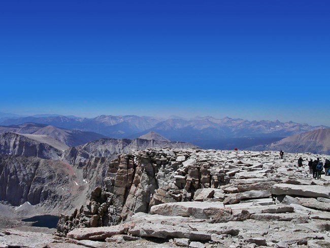
NPS Photo - R. Cain Sequoia and Kings Canyon National Parks are the home of awe-inspiring geological features and resources. The parks contain a significant portion of America's longest mountain range, the Sierra Nevada. Included in the Parks' mountainous landscape is the tallest mountain in the contiguous United States, Mt. Whitney, which rises to 14,491 feet (NAVD88) above sea level. Eleven additional peaks taller than 14,000 feet are also found along the parks' eastern boundaries at the crest of the Sierra Nevada. In Kings Canyon National Park, prominent ridges extend westward from the crest creating the Goddard and Monarch divides with mountains taller than 13,000 feet. In Sequoia National Park, a second prominent ridge of mountains, The Great Western Divide parallels the Sierran crest. It is the mountains of the Great Western Divide that greet visitors in Mineral King and that can be seen from Moro Rock and the Giant Forest area. Peaks in the Great Western Divide climb to more than 12,000 feet. 
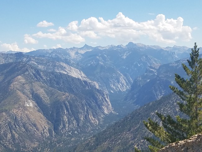
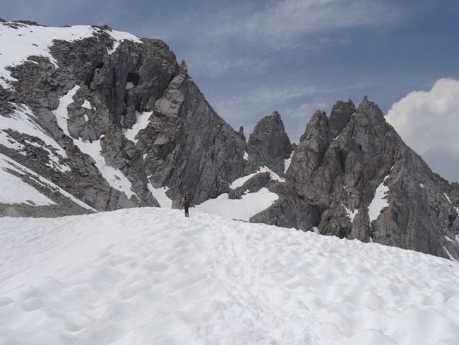
NPS Photo Mountains and CanyonsBetween these mighty mountains lie deep, spectacular canyons. Most significant is Kings Canyon. In the parks, Kings Canyon is a wide glacial valley featuring spectacular tall cliffs, a lovely meandering river, green vibrant meadows and beautiful waterfalls. A few miles outside the parks, Kings Canyon deepens and steepens becoming arguably the deepest canyon in North America for short distance. The confluence of the South Fork and Middle forks of the Kings River lies at 2,260 feet, while towering above the rivers on the north side of the canyon is Spanish Peak, which is 10,051 feet tall. The south side of this canyon above the confluence is significantly lower. Dozens of other canyons also await visitors to the two parks. This includes scenic Tokopah Valley above Lodgepole, Deep Canyon on the Marble Fork of the Kaweah River and deep in the parks' remote backcountry, Kern Canyon, which is more than 5,000 feet deep for 30 miles. The parks are headwaters for the Kaweah River, the Kern River, two forks of the Kings River and small areas of the San Joaquin and Tule river watersheds. Most of the mountains and canyons in the Sierra Nevada are formed in granitic rocks. These rocks, such as granite, diorite and monzonite, formed when molten rock cooled far beneath the surface of the earth. The molten rock was a by-product of a geologic process known as subduction. Powerful forces in the earth forced the landmass under the waters of the Pacific Ocean beneath and below an advancing North American Continent. Super-hot water driven from the subjecting ocean floor migrated upward and melted rock as it went. This process took place during the Cretaceous Period 100 million years ago. Granitic rocks have speckled salt and pepper appearance because they contain various minerals including quartz, feldspars and micas. Valhalla or the Angel Wings are prominent cliffs that rise above the headwaters of the Middle Fork of the Kaweah River. While geologists debate the details, it is clear that the Sierra Nevada is a young mountain range, probably not more than 10 million years old. Incredible forces in the earth, probably associated with the development of the Great Basin, forced the mountains to grow and climb toward the sky. During the 10 million years at least four periods of glacial advance have coated the mountains in a thick mantle of ice. Glaciers form and develop during long periods of cool and wet weather. Today, a few small glaciers remain in the parks. They are the southern-most glaciers in North America. Glaciers move through the mountains like slow-motion rivers carving deep valleys and craggy peaks. The extensive history of glaciation within the range and the erosion resistant nature of the granitic rocks that make up most of the Sierra Nevada have together created a spectacular landscape of hanging valleys, towering waterfalls, craggy peaks, alpine lakes and gigantic glacial canyons. 
Photo courtesy of Mandy Holmgren Growth and ErosionThe Sierra Nevada is still growing today. In fits and leaps the mountains gain height during earthquakes on the east side of the range near Bishop and Lone Pine. Rain and winter snows combined with the steep character of the landscape create an environment that includes massive movements of sediment and rapid erosion. The mountains are being removed by erosion almost as quickly as they grow. This erosion has created and deposited sediments thousands of feet thick on the floor of the San Joaquin and Sacramento Valleys. Small sections of the park contain areas of metamorphic (or changed) rocks. These rocks are the remnants of volcanic islands that were added to North America before the Sierra Nevada uplift. They include metamorphosed volcanic rocks, schist, quartzite, phyllite, and marble.

Photo courtesy of Dave Bunnell Marble Contains CavesSurprisingly, the marble rocks in the parks contain caves. Marble is metamorphosed limestone and Sequoia and Kings Canyon together contain more than 270 marble caves. Caves form only under special conditions including the right kind of rock, fractures or spaces in the rock and enough water to erode underground rooms and passages. The caves of the two parks include the longest cave in California, Lilburn Cave, with nearly 17 miles of surveyed passage. Lilburn is a very complex maze cave with beautiful blue- and white-banded marble. Nearby mines attest to the unusual geology in the Lilburn area and the cave has displays of rare and colorful minerals including green malachite and blue azurite. Beautiful Crystal Cave features a trail and lights for park visitors. This commercialized cave has seen millions of visitors since it first opened to the public in 1941. It has beautifully banded marble, many cave formations, large rooms, and the creative Spider Web Gate. Soldier's Cave has been a favorite with California cave explorers since its discovery in 1949. Three rope drops must be negotiated to reach the cave's lowest and most extensive level. Several outstanding formation areas exist, one of which has high quality "dog-tooth spar" crystals. This cave has suffered due to inadvertent damage by cave explorers. People have accidentally broken cave formations and muddied extensive areas of white flowstone. Soldiers Cave was the site of a restoration and cleaning project between 1992 and 1997. Learn more about how we manage park caves and about the geologic features and organisms in the parks' cave/karst systems. Learn More about Park Geology |
Last updated: August 25, 2025
