
Paradise Ranch Estates Fire Management Plan and Implementation Emergency Access & Fuel Reduction: Dover Road Back to Community Wildfire Protection Projects 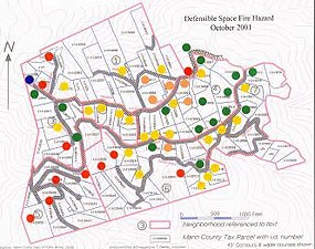
Paradise Ranch Estates Fuels ManagementCOMMUNITIES: Inverness Park INTERFACE: Point Reyes National Seashore FIRE DISTRICT: Marin County Fire Department / Point Reyes Station FUNDING PROVIDED: $167,500 (FY 2001) OBJECTIVE: Plan and implement a fuels management program. DESCRIPTION: This project will develop and implement a Fire Management Plan for Paradise Ranch Estates, a subdivision in Inverness Park. This will include roadside vegetation management zones ("fire apparatus clear zone"), firesafe access/egress improvements, wildland fuel modification zones, defensible space strategies, and a public education/outreach program. The fire apparatus clear zone and the access/egress improvements are necessary to provide safe evacuation, effective emergency response and to mitigate the fire hazard. A defensible space and public education/outreach program is critical to structure survivability and fire containment. Paradise Ranch Estates is located on the northeast-facing slope of Inverness Ridge and currently consists of approximately 150 homes. Homes in this subdivision were lost during the 1995 Vision Fire. This project involves two phases: planning ($10,000) and implementation ($157,500). NPS/FSM TASK AGREEMENT NO. 6 & 19 List of Projects | Top of Page Paradise Ranch Estates Fire Safety ImprovementsCOMMUNITIES: Inverness Park INTERFACE: Point Reyes National Seashore FIRE DISTRICT: Marin County Fire Department / Point Reyes Station FUNDING PROVIDED: $72,000 (FY 2002) OBJECTIVE: Increase fire safety and reduce the response times for emergency vehicles accessing the ridge areas of the Seashore. DESCRIPTION: This project will further implement the Paradise Ranch Estates Fire Management Plan that includes the design and implementation of fire-safe access/egress improvements, wildland fuel modification zones, defensible space strategies, and a public education/outreach program. The fire apparatus clear zone and the access/egress improvements are necessary to provide safe evacuation, effective emergency response and to mitigate the fire hazard. Eleven turnouts, four hydrants, and three backarounds, and two hammerheads will be installed within the Paradise Ranch Estates area. Inverness Park’s Paradise Ranch Estates subdivision is an unincorporated development located along the Inverness Ridge on the west side of Tomales Bay. It is located on the east slope of the Inverness Ridge between the ridge top and Sir Francis Drake Boulevard, the only road into the northern portion of Point Reyes National Seashore. The entire community is a wildland-urban interface. The area is heavily forested, and there are steep hillsides and canyons. Immediately to the west of the town is Point Reyes National Seashore. Much of this area is steep, very difficult to access, and characterized by decadent hazardous vegetation and decades of forest debris accumulation. The roads do not meet local, state or national fire-safe standards. They have insufficient width, excessively steep grades, and excessively tight turning radii. The roads also lack turnouts and turnarounds. NPS/FSM TASK AGREEMENT NO. 26 List of Projects | Top of Page 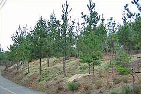
Paradise Ranch Estates Fuel Management ZonesCOMMUNITIES: Inverness Park INTERFACE: Point Reyes National Seashore FIRE DISTRICT: Marin County Fire Department / Point Reyes Station FUNDING PROVIDED: $140,000 (FY 2003) OBJECTIVE: Reduce fuels and improve fire safety and readiness. DESCRIPTION: This project will implement a fuel management program that includes the design and construction of a roadside vegetation management zone along 440 meters (1,450 feet) of Sir Francis Drake Boulevard and another fuel management zone along 2.6 kilometers (8,650 feet) of the Inverness Park-Point Reyes National Seashore boundary. These fuel treatments will provide a buffer zone that will reduce the ignition potential along the most likely ignition corridor. Inverness Park and Paradise Ranch Estates subdivision is an unincorporated development located along the Inverness Ridge. The entire community is a wildland-urban interface, with dense forests, steep hillsides and canyons, and narrow roads that do not meet local, state or national fire-safe standards. NPS/FSM TASK AGREEMENT NO. 44 List of Projects | Top of Page 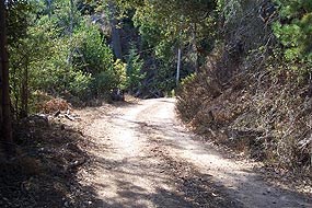
Dover Road Hazardous Fuel ReductionCOMMUNITIES: Inverness Park INTERFACE: Point Reyes National Seashore FIRE DISTRICT: Inverness Public Utility District FUNDING PROVIDED: $20,000 (FY 2004) OBJECTIVE: Reduce fuels and improve emergency access. DESCRIPTION: Apply vegetation management techniques to the western portion of Dover Road, including clearing to 3 meters (10 feet) on either side of the road. Repair or replace broken culverts and other impediments to emergency access. This project will be an adjunct to Task Agreement 019, which, among other things, called for treatment of roadside vegetation to a distance of 3 meters (10 feet) on either side of the roads in Paradise Ranch Estates. Dover road is found within Paradise Ranch Estates, which is located on the northeast-facing slope of Inverness Ridge and currently consists of approximately 150 homes. Homes in this subdivision were lost during the 1995 Vision Fire. NPS/FSM TASK AGREEMENT NO. 57 List of Projects | Top of Page 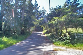
Drake's Summit / Balboa Emergency Access & Fuel RemovalCOMMUNITIES: Inverness Ridge INTERFACE: Point Reyes National Seashore FIRE DISTRICT: Marin County Fire Department / Point Reyes Station FUNDING PROVIDED: $15,000 (FY 2001), $642 (FY 2002), $13,333 (FY 2003) OBJECTIVE: Reduce fuels, improve emergency access, and provide public education. DESCRIPTION: This project involves design and implementation of roadside vegetation management zones (fire apparatus clear zone), firesafe access/egress improvements, wildland fuel modification zones, defensible space strategies, and a public education/outreach program. The Drake's Summit / Balboa subdivision includes 32 homes on a non-county maintained road near Inverness Ridge. Road access is heavily vegetated with very few turnouts and no secondary means of egress. Much of the area is steep, difficult to access and characterized by decadent hazardous vegetation from decades of forest debris accumulation. The roadways do not meet local, state or national fire-safe standards, due to insufficient width, steep grades, excessively tight turning radii, and a lack of turnouts. NPS/FSM TASK AGREEMENT NO. 15, 39 & 45 List of Projects | Top of Page 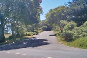
Fox Lane / Noren Way / McCarthy Court Emergency Access & Fuel RemovalCOMMUNITIES: Inverness / Inverness Park INTERFACE: Point Reyes National Seashore FIRE DISTRICT: Marin County Fire Department / Point Reyes Station FUNDING PROVIDED: $10,000 (FY 2001), $642 (FY 2002), $13,333 (FY 2003) OBJECTIVE: Reduce hazardous fuels, improve emergency access, and provide public education. DESCRIPTION: This project involves design and implementation of roadside vegetation management zones (fire apparatus clear zone), firesafe access/egress improvements, wildland fuel modification zones, defensible space strategies, and a public education/outreach program. The Fox Lane / Noren Way / McCarthy Court subdivision includes 15 homes on a non-county maintained road near Inverness Ridge. Road access is heavily vegetated with very few turnouts and no secondary means of egress. Much of the area is steep, difficult to access and characterized by decadent hazardous vegetation from decades of forest debris accumulation. The roadways do not meet local, state or national fire-safe standards, due to insufficient width, steep grades, excessively tight turning radii, and a lack of turnouts. NPS/FSM TASK AGREEMENT NO. 15, 39 & 45 List of Projects | Top of Page 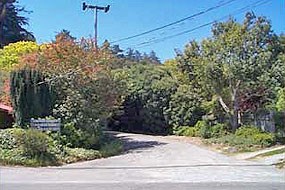
Laurel Street Emergency Access & Fuel ReductionCOMMUNITIES: Inverness Ridge INTERFACE: Point Reyes National Seashore FIRE DISTRICT: Marin County Fire Department / Point Reyes Station FUNDING PROVIDED: $15,000 (FY 2001), $642 (FY 2002), $13,333 (FY 2003) OBJECTIVE: Reduce fuels, improve emergency access, and provide public education. DESCRIPTION: This project involves design and implementation of roadside vegetation management zones (fire apparatus clear zone), firesafe access/egress improvements, wildland fuel modification zones, defensible space strategies, and a public education/outreach program. The Laurel Street subdivision consists of 28 homes on a non-county maintained road near Inverness Ridge. Road access is heavily vegetated with very few turnouts and no secondary means of egress. Much of the area is steep, difficult to access and characterized by decadent hazardous vegetation from decades of forest debris accumulation. The roadways do not meet local, state or national fire-safe standards, due to insufficient width, steep grades, excessively tight turning radii, and a lack of turnouts. NPS/FSM TASK AGREEMENT NO. 15, 39 & 45 List of Projects | Top of Page 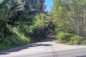
North & South Dream Farm Emergency Access & Fuel ReductionCOMMUNITIES: Inverness Ridge INTERFACE: Point Reyes National Seashore FIRE DISTRICT: Marin County Fire Department / Point Reyes Station FUNDING PROVIDED: $15,000 (FY 2001), $642 (FY 2002), $13,333 (FY 2003) OBJECTIVE: Reduce fuels, improve emergency access, and provide public education. DESCRIPTION: This project involves design and implementation of roadside vegetation management zones (fire apparatus clear zone), firesafe access/egress improvements, wildland fuel modification zones, defensible space strategies, and a public education/outreach program. The total treatment area is over 0.8 kilometers (0.5 miles) in length. The North and South Dream Farm subdivisions consist of 24 homes on a non-county maintained road near Inverness Ridge. Road access is heavily vegetated with very few turnouts and no secondary means of egress. Much of the area is steep, difficult to access and characterized by decadent hazardous vegetation from decades of forest debris accumulation. The roadways do not meet local, state or national fire-safe standards, due to insufficient width, steep grades, excessively tight turning radii, and a lack of turnouts. NPS/FSM TASK AGREEMENT NO. 8, 39 & 45 List of Projects | Top of Page 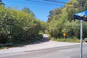
Redwood Drive Emergency Access & Fuel ReductionCOMMUNITIES: Inverness Ridge INTERFACE: Point Reyes National Seashore FIRE DISTRICT: Marin County Fire Department / Point Reyes Station FUNDING PROVIDED: $15,000 (FY 2001), $642 (FY 2002), $13,333 (FY 2003) OBJECTIVE: Reduce fuels, improve emergency access, and provide public education. DESCRIPTION: This project involves design and implementation of roadside vegetation management zones (fire apparatus clear zone), firesafe access/egress improvements, wildland fuel modification zones, defensible space strategies, and a public education/outreach program. The Redwood Drive subdivision consists of 8 homes on a non-county maintained road near Inverness Ridge. Road access is heavily vegetated with very few turnouts and no secondary means of egress. Much of the area is steep, difficult to access and characterized by decadent hazardous vegetation from decades of forest debris accumulation. The roadways do not meet local, state or national fire-safe standards, due to insufficient width, steep grades, excessively tight turning radii, and a lack of turnouts. NPS/FSM TASK AGREEMENT NO. 8, 39 & 45 List of Projects | Top of Page 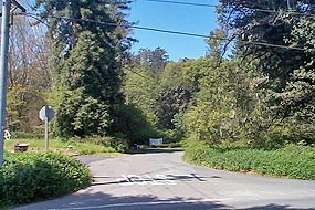
Silver Hills Emergency Access & Fuel ReductionCOMMUNITIES: Inverness Ridge INTERFACE: Point Reyes National Seashore FIRE DISTRICT: Marin County Fire Department / Point Reyes Station FUNDING PROVIDED: $20,000 (FY 2001), $642 (FY 2002), $13,333 (FY 2003) OBJECTIVE: Reduce fuels, improve emergency access, and provide public education. DESCRIPTION: This project involves design and implementation of roadside vegetation management zones (fire apparatus clear zone), firesafe access/egress improvements, wildland fuel modification zones, defensible space strategies, and a public education/outreach program. The Silver Hills subdivision consists of 19 homes on a non-county maintained, dead end road near Inverness ridge. Road access is heavily vegetated with very few turnouts and no secondary means of egress. Much of the area is steep, difficult to access and characterized by decadent hazardous vegetation from decades of forest debris accumulation. The roadways do not meet local, state or national firesafe standards, due to insufficient width, steep grades, excessively tight turning radii, and a lack of turnouts. NPS/FSM TASK AGREEMENT NO. 8, 39 & 45 List of Projects | Top of Page
|
Last updated: January 26, 2024
