Last updated: May 8, 2026
Place
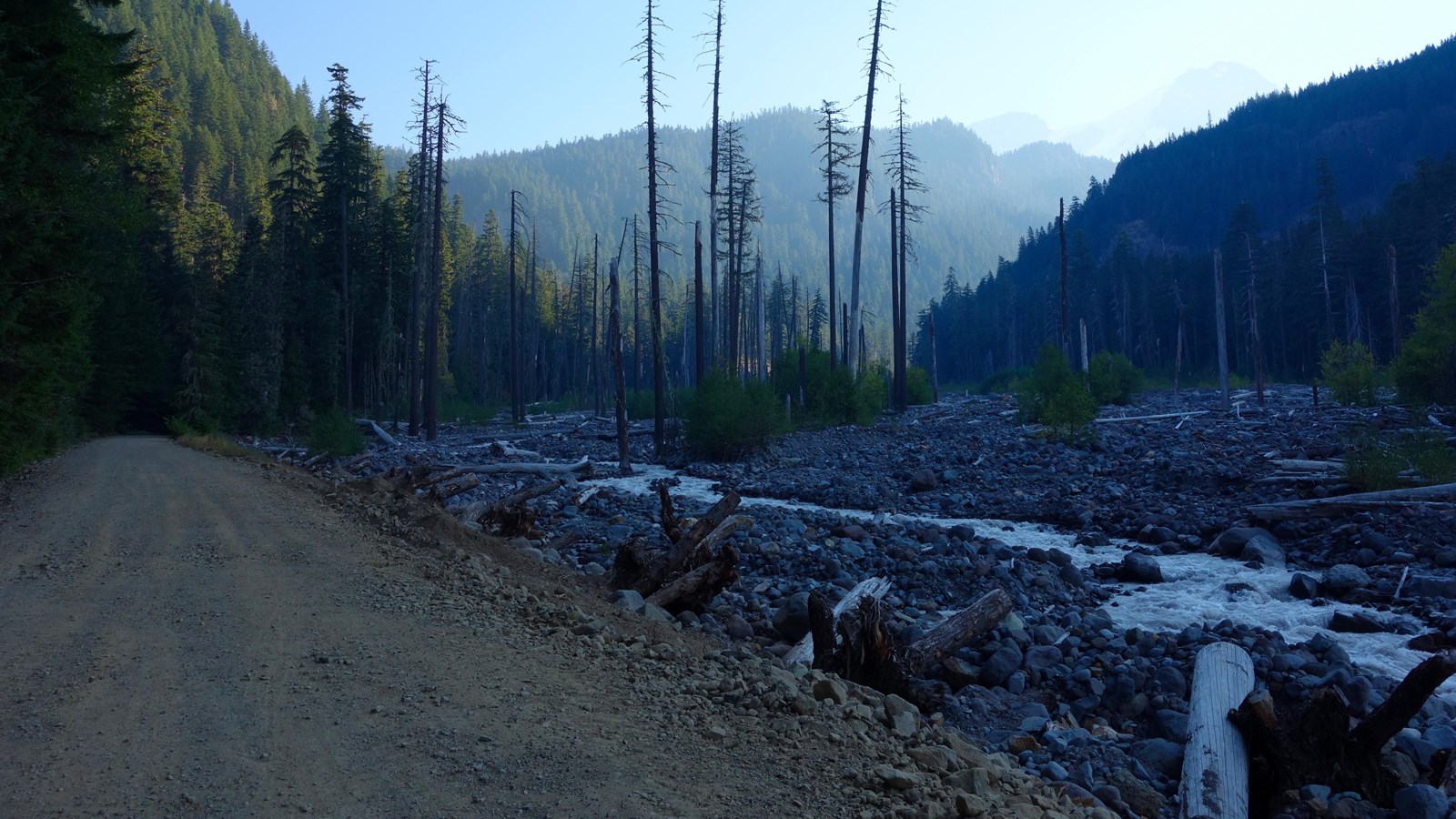
Westside Road: Dry Creek Trailhead
NPS Photo
Quick Facts
Location:
Westside Road is one mile from the Nisqually Entrance, in the southwest corner of the park.
Amenities
2 listed
Parking - Auto, Trailhead
Season: Summer Only (May - November)
Westside Road to the Dry Creek Trailhead is open to vehicles during the summer season only, typically May-November. During the winter, snowshoers and crosscountry skiers can still use the closed road from the winter trailhead.
Westside Road is one mile from the Nisqually Entrance, in the southwest corner of the park. Westside Road was originally envisioned as part of an “around-the-mountain” network of roads encircling Mount Rainier but was never completed. Frequent flooding and debris flows by Tahoma Creek closed all but the first three miles of the road to vehicles. There is a small parking area at Dry Creek at the end of this three-mile section. From Dry Creek, the gravel road climbs to Round Pass, descends into the South Puyallup River Valley, then climbs to Klapatche Point, where the road terminates. From Dry Creek to Klapatche Pass, the road is 9.25 miles long with an elevation change of approximately 2,100 feet. Please note that due to danger from rock fall, vehicles must park south of the barricade at Dry Creek. Hikers and bicyclists should travel through the area with caution and avoid lingering in the hazard zone. There are no restroom facilities along Westside Road. The closest comfort station is at Kautz Creek, approximately 5.5 miles from the Dry Creek parking lot on route to Longmire. Westside Road closes during the winter at the Nisqually to Longmire road junction.
Bicycling
Most of Westside Road is closed to vehicles but remains open for bicycling. Many mountain bikers park at Dry Creek and bike to various trailheads along the road, or to the road’s terminus at Klapatche Point. Only E-bikes possessing a motor of less than 750 watts (1 h.p) on which the motor only assists with pedal propulsion are permitted. Bicycles are not allowed on any trails. All trailheads along the road have bicycle racks.
Hiking
Several trails branch off of Westside Road.
Lake George & Gobbler’s Knob Trail begins at Round Pass, 3.8 miles from Dry Creek. The trailhead is to the west side of the pass next to a wide pullout. The hike to Lake George is easy with a gradual incline over 0.8 miles through the forest. Lake George is a pristine mountain lake nestled in the northwest shoulder of Mount Wow. There is a backcountry campsite and restroom facility. Lake George Cabin is one of the park’s historic patrol cabins. Continue an additional one mile to reach Gobblers Knob Fire Lookout, one the park’s four historic fire lookouts. The final stretch of the trail is very steep, with rocky switchbacks to reach the lookout, which has spectacular views of Mount Rainier’s southwestern slopes and the Tahoma and Puyallup Glaciers. Mount St. Helens, Mount Adams, and the Olympic Mountains can be spotted on clear days.
Round Pass is also the location of the Marine Memorial, which remembers the death of 32 U.S. Marines that died when their plane crashed into the South Tahoma glacier on Mount Rainier on December 10, 1946.
On the north side of Round Pass a 0.5-mile trail provides a short cut down to the South Puyallup Trailhead, or continue following Westside Road 1.2 miles (approximately 4.2 miles from Dry Creek). The South Puyallup Trail follows the South Puyallup River valley through forest to a backcountry campsite, then connects to the Wonderland Trail after 1.6 miles.
Continue about three miles on Westside Road from the South Puyallup River Trailhead, or approximately 7.2 miles from the Dry Creek parking area, to the St. Andrews Creek Trailhead. The trail starts on the right just past a rock bridge over St. Andrews Creek. On the left side of the bridge a short 0.3 mile loop trail leads to Denman Falls viewpoint. The historic St. Andrews Cabin is near the start of the St. Andrews Trail, before the trail climbs 2.6 miles up a ridge with long switchbacks up to the subalpine meadows of Klapatche Park and connects to the Wonderland Trail.
Climb the final 1.2 miles (9.2 miles from Westside Road) to the road’s terminus at Klapatche Point, which is on the western border of the park. Look south back towards Round Pass or over the rolling hills to the west. North Puyallup Trail starts from Klapatche Point and follows a forested ridgeline east to connect to the Wonderland Trail at the North Puyallup River camp.