Last updated: September 9, 2024
Place
Tolleston Dunes Overlook

NPS/J.Gruzalski
Accessible Sites, Benches/Seating, Cellular Signal, Historical/Interpretive Information/Exhibits, Parking - Auto, Picnic Table, Scenic View/Photo Spot, Wheelchair Accessible
Tolleston Dunes Overlook
The Tolleston Dunes Trail winds amid sand dunes that began forming about 4,700 years ago when Lake Michigan's water level was about 25 feet higher than today. Tolleston is the youngest of three distinct dune systems found within the national park. Together these dune ridges provide a glimpse into the changing shoreline of Lake Michigan. Tolleston Dunes has varied habitats ranging from globally rare black oak savanna to wetlands and plants such as prickly pear cactus (Opuntia humifusa), butterfly weed, and the wild blue lupine flower (Lupinus perennis) which grows in abundance.
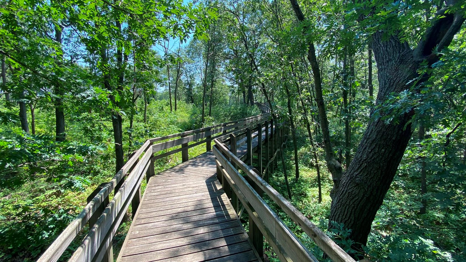
This short boardwalk leads to two shaded picnic table overlook areas that are accessible to wheelchairs. The boardwalk is located at a pull-off on U.S. Highway 12, approximately one-quarter mile west of the main parking lot. There are interpretive signs and a pleasant view of a large wetland within the Tolleston Dunes complex.
Overlook Features: Fall Colors, Wildflowers, Wildlife
History and Background
The word Tolleston (pronounced like tahl-eh-stun) comes from the name of an early community platted by German immigrant George Tolle in 1857. Etymologically, it is likely that "Tolle's town" became "Tolleston." The town, which stood a few miles west of here, was anexed by Gary in 1910.
Because sand dunes of a distinct age were prominent in historic Tolleston, its name was used to represent geomorphological features of a specific period. Geologically, this area is known as the Toleston Shoreline, so the park calls these trails and this area Tolleston Dunes.
The area of the Tolleston Dunes Overlook has been and remains a major transportation cooridor in the region. Trails used by Indigenous peoples spiderwebbed throughout the area. Some of these trails became the first roads through Indiana's duneland, like the early stagecoach road from Detroit to Chicago. Nearby railroads are reminders of an industrial past and present, and the tracks of the electric line harken back to 1908 when it first opened and made the region accessible to the masses. The opening of Dunes Highway (Route 12) in the early 1920s only accelerated access and interest in the area.
The main Tolleston Dunes parking lot is the site of former sand mining activities from before the park was created.
Getting There
Overlook Parking Lot5634 U.S. Highway 12 (Dunes Highway), Portage, IN 46368
Overlook GPS Coordinates
41.613499, -87.206679 (Decimal Degrees)
Need to Know
Hours & Information- Hours – Open daily from 6:00 am to 11:00 pm.
- Hike Length – 0.1 miles.
- Hike Time – 15 minutes.
- Difficulty – Easy.
- Trail Surface – wooden-planked boardwalk.
- Facilities – No restrooms or potable water.
- Pets – Permitted on a leash (6' or shorter).
- Prohibited – Littering, hunting, and removing plants.
- Prohibited – Bicycles and motorized vehicles.
- The Tolleston Dunes Overlook parking lot is paved.
- There are two picnic tables at the overlook. First come, first served. No advance reservations. Cooking fires are prohibited.
- Please stay on the trail and respect closed area signs. Going off trail damages fragile habitat.
- Ticks are present year-round. Take precautionary measures to prevent bites.
- Poison ivy can be present on the edges of the trail.
- Be prepared for changing weather conditions.
- In case of an emergency or to report a crime, call 1-800-PARK-TIP.
- The parking lot is paved. There is a wheelchair accessible ramp to the overlook.
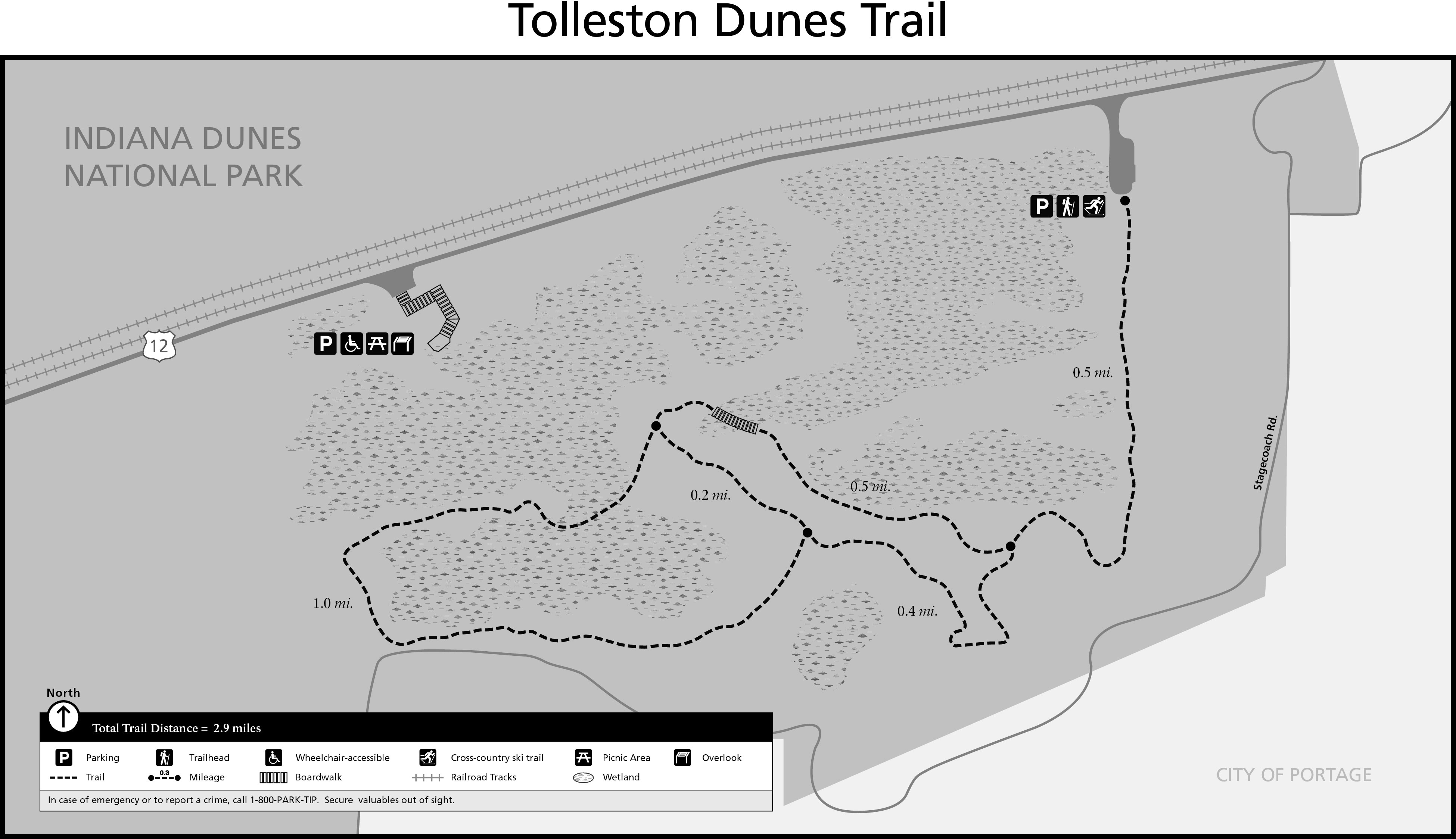
Trail Map
All hiking trail maps of the Indiana Dunes National Park are available online on our website or in paper at the trailhead kiosk or the Indiana Dunes Visitor Center.
Nearby Hikes
West BeachPaul H. Douglas (Miller Woods)
Portage Lakefront and Riverwalk
