



Last updated: July 9, 2026
Place
Sixth Crossing Visitor Center
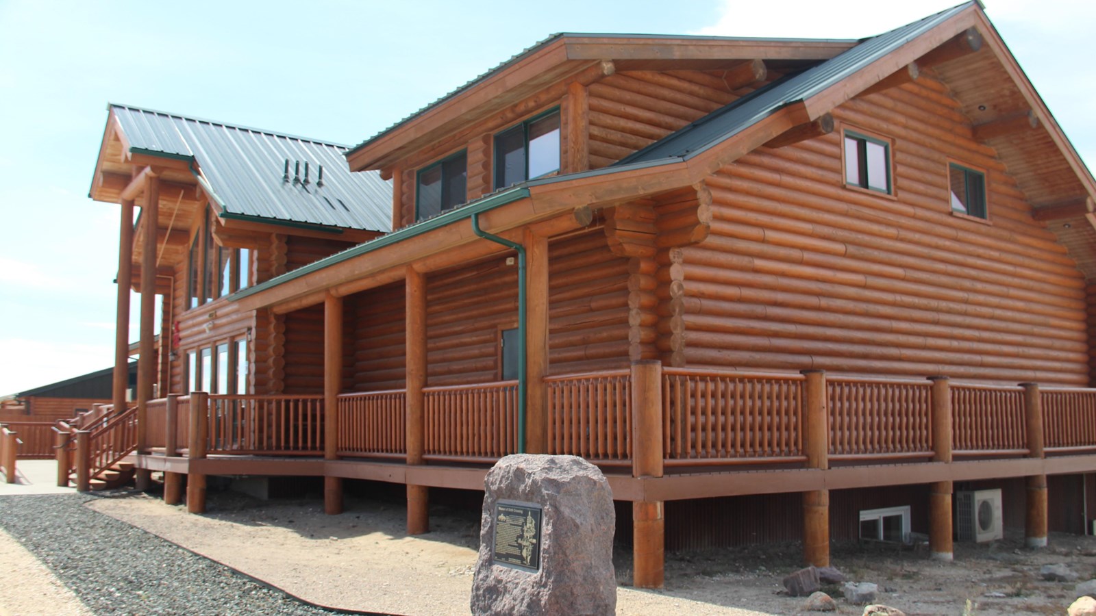
Photo/L. Kreutzer
Quick Facts
Location:
Sixth Crossing Visitors’ Center is at 4175 US-287/WY-789 (east of intersection with Sand Draw Rd), GPS 42.539395 -108.178567. To visit historic Sixth Crossing, follow the unpaved road from the center along the south side of the river to John Linford Grave monument, GPS 42.509755 -108.227372
Significance:
Emigrants on the combined corridor of the California, Mormon Pioneer, and Oregon trails camped on both sides of the Sixth Crossing of the Sweetwater River in this area. In October 1856, the Willie Handcart Company of Latter-day Saints camped here in severe conditions as they awaited rescue wagons to relieve them.
Designation:
Historic site on the California, Mormon Pioneer, and Oregon NHTs.
Amenities
8 listed
Cellular Signal, Historical/Interpretive Information/Exhibits, Parking - Auto, Parking - Bus/RV, Picnic Shelter/Pavilion, Scenic View/Photo Spot, Toilet - Flush, Water - Drinking/Potable
The Sixth Crossing Visitors’ Center (US-287/WY-789, a half mile east of Sweetwater Station, WY) offers interactive exhibits, replica handcarts, and a video about the ordeal and rescue of the 1856 Willie Handcart Company of Latter-day Saint pioneers.
Heavy snow caught the company of some 400 starving emigrants at the nearby Sixth Crossing of the Sweetwater River, where rescue wagons sent from Salt Lake City found and assisted them.
The center, open from May 1 to Labor Day, is operated by The Church of Jesus Christ of Latter-day Saints. Below and west of the center, a camping and picnicking area is open to the public in the summer. Nine members of the Willie Company who died between Oct. 19 and 21 are buried in 2 unmarked graves at the historic Sixth Crossing of the Sweetwater River. They are commemorated by a modest trailside monument, about 3 ½ miles from today's visitors’ center on the east side of the river, dedicated to emigrant John Linford and others who died in the area. (This is not a grave marker. The exact burial sites are unknown.)
More about the Linford family and stories of other Latter-day Saint pioneers in the 1856 handcart and wagon parties can be freely downloaded at Tell My Story Too, New - Handcart Pioneer Trek of 1856 - Digital Version. The book was compiled by researcher Jolene Allphin. Sixth Crossing also was a significant landmark for other travelers on the combined California, Oregon, and Mormon Pioneer trail corridor. From the 1840s through the 1860s, many emigrants camped on both sides of the river there and at other fording places along this stretch of the Sweetwater known collectively as Sixth Crossing.
Today the land surrounding Sixth Crossing ford is privately owned and not open to the public, but visitors can view the area from public lands on the east and south sides of the river and from the visitors’ center. Inquire at the visitors’ center for directions and road conditions.
Site Information
Location (Sixth Crossing Visitors’ Center is at 4175 US-287/WY-789 (east of intersection with Sand Draw Rd), GPS 42.539395 -108.178567. To visit historic Sixth Crossing, follow the unpaved road from the center along the south side of the river to John Linford Grave monument, GPS 42.509755 -108.227372)