Last updated: December 13, 2023
Place
Nine Young Men
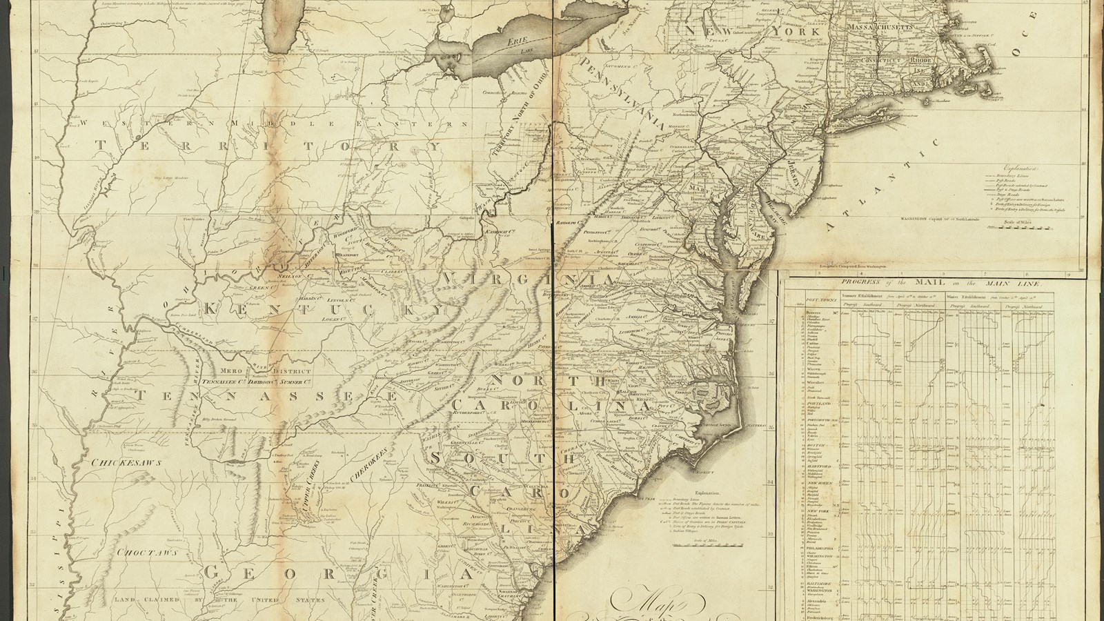
Abraham Bradley, William Harrison, William Barker, "A map of the United States"
Quick Facts
Location:
201 W Riverside Dr, Clarksville, IN 47129
Significance:
At the Falls of the Ohio, where William Clark’s older brother, George Rogers Clark, had settled on the north side of the river at a settlement known as Clarksville, Meriwether Lewis and his initial crew met up with Clark and the man that Clark enslaved, York. They recruited more men in the area before heading downstream on their journey.
Designation:
Lewis and Clark National Historic Trail
MANAGED BY:
Amenities
11 listed
Beach/Water Access, Boat Ramp, Historical/Interpretive Information/Exhibits, Parking - Auto, Picnic Table, Restroom, Restroom - Accessible, Toilet - Flush, Trailhead, Trash/Litter Receptacles, Wheelchair Accessible
Lewis and Clark NHT Visitor Centers and Museums
This map shows a range of features associated with the Lewis and Clark National Historic Trail, which commemorates the 1803-1806 Lewis and Clark Expedition. The trail spans a large portion of the North American continent, from the Ohio River in Pittsburgh, Pennsylvania, to the mouth of the Columbia River in Oregon and Washington. The trail is comprised of the historic route of the Lewis and Clark Expedition, an auto tour route, high potential historic sites (shown in black), visitor centers (shown in orange), and pivotal places (shown in green). These features can be selected on the map to reveal additional information. Also shown is a base map displaying state boundaries, cities, rivers, and highways. The map conveys how a significant area of the North American continent was traversed by the Lewis and Clark Expedition and indicates the many places where visitors can learn about their journey and experience the landscape through which they traveled.
Men in the party were a relatively diverse representation of the settler population: they spoke English, French, Shawnee, Omaha, and the sign language that was common among Indigenous people and non-Native traders across North America.
Some were already enlisted in the Army. Others enlisted when they signed up.
Kentucky was a place where White settlers were arriving and Shawnee, Delaware, and other Indigenous people were still living. Many of the men from Kentucky had experience surviving in the woods, as well as on the infrastructure left by Indigenous residents of the valley.
The men that William Clark recruited in Kentucky are often called the “Nine Young Men from Kentucky.” This term comes from the 1814 narrative of Lewis and Clark’s journey, published by Nicholas Biddle. It accounts for men who joined with Clark at the Falls of the Ohio between Louisville and Clarksville. It does not include York, even though York joined at this time and also lived in Kentucky, where he was enslaved by Clark.
York was about the same age as William Clark. Clark “inherited” York when Clark’s father died. York had a wife (he was one of only four expedition members who were married).
The lens through which we view the Lewis and Clark Expedition is often still influenced by those who wrote the journals and those who published accounts of them.
After the “Nine Young Men” (details on the individuals here), other recruits enlisted when the expedition was at Camp Dubois. A few other members joined at Fort Massac. The last people to join the party were Toussaint Charbonneau, Sacagawea, and their son, Jean Baptiste, all of whom joined at Fort Mandan.
About this article: This article is part of a series called “Pivotal Places: Stories from the Lewis and Clark National Historic Trail.”