Last updated: September 19, 2025
Place
Fort Massac, Illinois
Quick Facts
Location:
1308 E 5th St, Metropolis, IL 62960
Significance:
Meriwether Lewis and William Clark recruited three members of their expedition, Joseph Whitehouse, George Drouillard, and John Newman, at Fort Massac in 1803.
Designation:
Lewis and Clark National Historic Trail, National Register of Historic Places
MANAGED BY:
Amenities
22 listed
Benches/Seating, Boat Ramp, Dock/Pier, Electrical Hookup - Boat/RV, Grill, Historical/Interpretive Information/Exhibits, Information, Parking - Auto, Parking - Boat Trailer, Parking - Bus/RV, Picnic Shelter/Pavilion, Picnic Table, Playground, Restroom, Restroom - Accessible, Restroom - Family, Sewage Dump Station - Boat/RV, Sewer Hookups - Boat/RV, Showers, Tent Campsites, Trailhead, Water - Hookup - Boat/RV
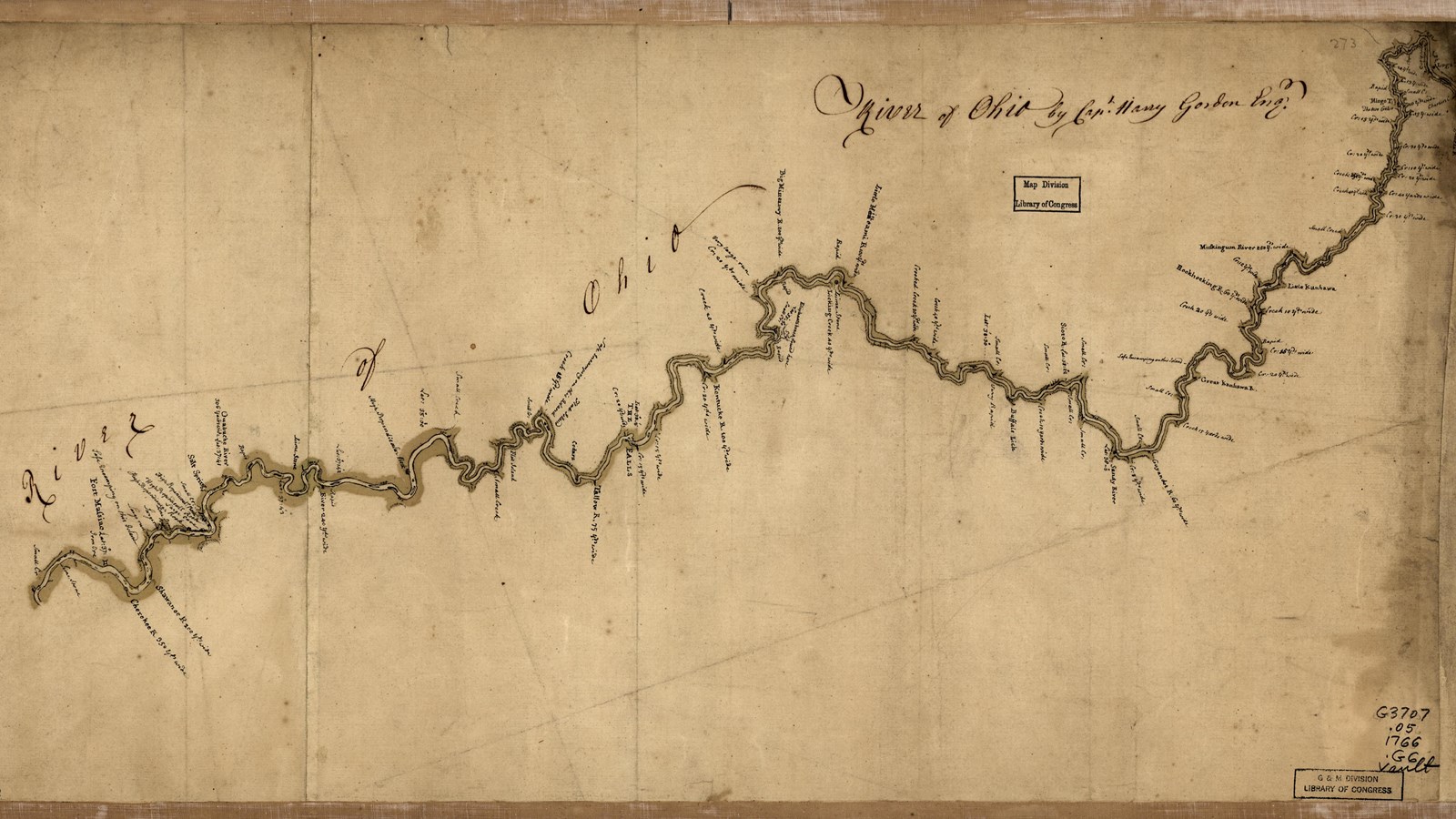
On the journey west to spend the winter at Camp Dubois, Meriwether Lewis and William Clark spent a few days at Fort Massac on the Ohio River. The French built the original fort in 1757, in an area where Chickasaw, Osage, and Shawnee people lived. In 1794, the U.S. military took it over and it became a stopping point for White American settlers moving west.
Here, Lewis and Clark sought men with a diversity of skills, including hunting and carpentry, to join their expedition. Language skills and cultural knowledge were especially important, since this was a diplomatic mission into Indigenous lands.
Two key members joined the party at Fort Massac: George Drouillard and Private Joseph Whitehouse. Drouillard, whose father was French-Canadian and mother was Shawnee, was hired as an interpreter. He spoke Shawnee, French, English, and the sign language that was common among Indigenous communities and non-Native traders across North America.
Whitehouse, who was already enlisted in the U.S. Army, was stationed at Fort Massac. Like many people living in the area, his family moved west to Kentucky during the wave of White settlers displacing Indigenous people. Whitehouse learned valuable skills during his time in the Kentucky woods, including hunting, curing meat, and preparing hides.
The expedition journals note many times when Whitehouse’s skills as a tailor and skin curer were useful to the crew. During the summer of 1805, Lewis tasked Whitehouse with preparing and sewing together elk skins for construction of his iron-framed boat.
Whitehouse was one of the only lower-ranking members of the expedition who was tasked with keeping a journal. In it, he often mentioned being asked to repair or make new clothing for the party. In Idaho, for example, he made caps from otter skins procured through trade.
Both Drouillard and Whitehouse brought skills critical to the Lewis and Clark Expedition.
About this article: This article is part of a series called “Pivotal Places: Stories from the Lewis and Clark National Historic Trail.”
Fort Massac is a High Potential Historic Site of the Lewis and Clark National Historic Trail. Here is the text from the HPHS report:
On November 11, 1803, the expedition arrived at Fort Massac. Lewis resumed regular journal entries, writing, “Arrived at Massac engaged George Drewyer in the public service as an Indian Interpreter, contracted to pay him 25 dollards pr. Month for his services.” Lewis and Clark recruited two men from the enlisted soldiers, John Newman and Joseph Whitehouse. Additional recruits from Fort Southwest Point in Tennessee had not arrived, and Lewis sent Drouillard to locate them. The expedition left Fort Massac around 5 p.m. on November 13.
The French built a fort at the mouth of Massac Creek in 1757 but abandoned the location at the end of the French and Indian War. Americans rebuilt the fort in 1794, and Fort Massac became the port of entry into the Illinois country. The fort was damaged in the 1811-1812 New Madrid earthquakes and decommissioned in 1814. The site of Fort Massac became the first state park in Illinois in 1908. It includes a replica of the 1802 American fort and the archaeological outline of the 1757 French fort, the original location of all iterations of Fort Massac.
Lewis and Clark NHT Visitor Centers and Museums
This map shows a range of features associated with the Lewis and Clark National Historic Trail, which commemorates the 1803-1806 Lewis and Clark Expedition. The trail spans a large portion of the North American continent, from the Ohio River in Pittsburgh, Pennsylvania, to the mouth of the Columbia River in Oregon and Washington. The trail is comprised of the historic route of the Lewis and Clark Expedition, an auto tour route, high potential historic sites (shown in black), visitor centers (shown in orange), and pivotal places (shown in green). These features can be selected on the map to reveal additional information. Also shown is a base map displaying state boundaries, cities, rivers, and highways. The map conveys how a significant area of the North American continent was traversed by the Lewis and Clark Expedition and indicates the many places where visitors can learn about their journey and experience the landscape through which they traveled.