Last updated: December 13, 2023
Place
Falls of the Ohio/Old Clarksville Site
John Filson, "A Map of Kentucky" (London: J. Stockade, 1793).
Quick Facts
Location:
201 W Riverside Dr, Clarksville, IN 47129
Significance:
At the Falls of the Ohio, where William Clark’s family had settled on the north and south sides of the river, Meriwether Lewis and his initial crew met up with Clark and York, the man that Clark enslaved. They recruited more men in the area before heading downstream and on their journey.
Designation:
Lewis and Clark National Historic Trail
MANAGED BY:
Amenities
12 listed
Beach/Water Access, Boat Ramp, Historical/Interpretive Information/Exhibits, Information - Ranger/Staff Member Present, Parking - Auto, Picnic Table, Restroom, Restroom - Accessible, Toilet - Flush, Trailhead, Trash/Litter Receptacles, Wheelchair Accessible
Lewis and Clark NHT Visitor Centers and Museums
This map shows a range of features associated with the Lewis and Clark National Historic Trail, which commemorates the 1803-1806 Lewis and Clark Expedition. The trail spans a large portion of the North American continent, from the Ohio River in Pittsburgh, Pennsylvania, to the mouth of the Columbia River in Oregon and Washington. The trail is comprised of the historic route of the Lewis and Clark Expedition, an auto tour route, high potential historic sites (shown in black), visitor centers (shown in orange), and pivotal places (shown in green). These features can be selected on the map to reveal additional information. Also shown is a base map displaying state boundaries, cities, rivers, and highways. The map conveys how a significant area of the North American continent was traversed by the Lewis and Clark Expedition and indicates the many places where visitors can learn about their journey and experience the landscape through which they traveled.
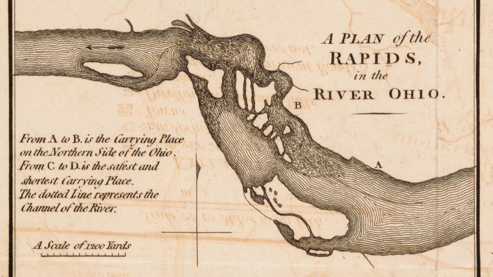
Near modern-day Louisville, the limestone bedrock is exposed for one short section. The river falls twenty-six feet in 2.5 miles, enough to make a canoe descent tumultuous at high water and impossible at low water.106 In 1805, Josiah Espy described the falls viewed from Clarksville as a “zigzag channel which is only navigable at high water.”
People who regularly traveled the busy Ohio River—whether French, American, Shawnee, Haudenosaunee, or Delaware—knew how to get around these rapids. They knew when the water was high enough to take a boat or canoe over them and when they needed to carry their vessels around the waterfalls (known as a portage).
William Clark’s family had settled near these falls. Here he met up with Meriwether Lewis here to begin their transcontinental journey.
The falls no longer look like they once did. Private interests constructed a canal and locks south of the falls starting in 1825, to improve navigation on the river. The federal government later enlarged the canal and added additional dams, so that by 1964, dams made the river no longer navigable at this point: all traffic had to go through the canal.
About this article: This article is part of a series called “Pivotal Places: Stories from the Lewis and Clark National Historic Trail.”