



Last updated: July 14, 2026
Place
Lombard Ferry at Green River
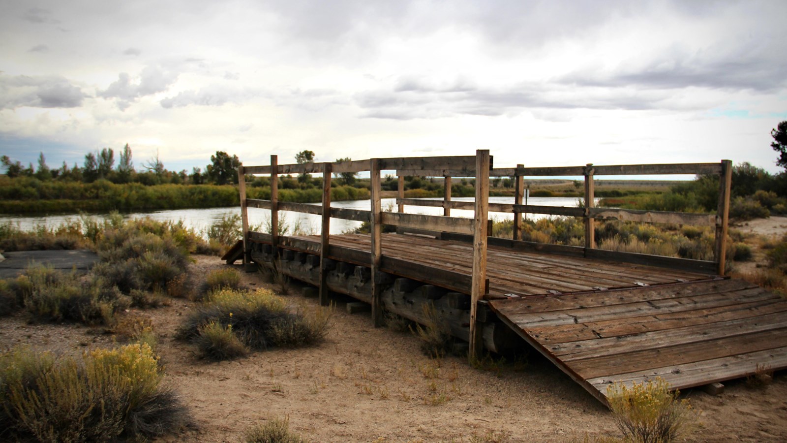
Photo/L. Kreutzer
Quick Facts
Location:
From Farson, WY, follow westbound WY-28 for 25.5 miles to the Green River. Turn left into the site immediately after crossing the Green River bridge. The site also can be reached from I-80 Exit 83. From the exit turn north on WY-372, drive 26.8 miles, and turn east (right) on WY-28. The site is about 2.5 miles ahead on the right. GPS 41.879778 -109.807517
Significance:
Numerous ferries operated along a 6 ½- mile stretch of the Green River during the emigration era. Most travelers on the Fort Bridger/Salt Lake City branch of the trail used this ferry, later named “Lombard,” when the river was too high to ford safely.
Designation:
Historic site on the California, Mormon Pioneer, and Oregon NHTs.
Amenities
7 listed
Historical/Interpretive Information/Exhibits, Information Kiosk/Bulletin Board, Parking - Auto, Parking - Bus/RV, Scenic View/Photo Spot, Trailhead, Wheelchair Accessible
“The Green River is dreaded by all who have to cross it,” Oregon-bound Rebecca Ketcham wrote in her journal on July 25, 1853. “It is wide, deep, and very rapid.” But all who went west on the primary overland trail corridor through Wyoming faced crossing this powerful stream, the largest tributary of the Colorado River. Travelers who reached its tree-lined banks during low-water months of summer could drive across, although some met disaster when their wagons struck a submerged hole and overturned in strong currents. Those who arrived while the Green River was swollen with spring runoff might try rafting or floating their wagons, but that was highly risky.
Sir Richard Burton, traveling in 1860, reported the river to be 330 feet wide and 3 feet deep in midsummer, but 800 feet wide and 6 feet deep during high water. “It is a swift flowing stream,” he observed, “running as if it had no time to lose. . .” Men from William Kelly's 1849 company, launching in a caulked wagon box, quickly found themselves “whirled round and round in the curling eddies, and hurried down with fearful rapidity.”
When the Green River raged, it was safest to cross on a ferry that was secured to ropes stretching from bank to bank. Numerous ferries operated on the Green River during the emigration era. Travelers on the trail to Fort Bridger typically boarded the one later known as Lombard Ferry, above the mouth of the Big Sandy River in present Seedskadee National Wildlife Refuge. Mountain men established a commercial ferry in this vicinity in 1843, the year of the first big overland immigration to Oregon. The 1847 vanguard of Latter-day Saints, on their way to Utah, built their own rafts to float their wagons over, then assigned some men to stay and earn money by ferrying other companies.
In the early 1850's, Latter-day Saints from Utah used a combination of armed force and payment to pry the original operation away from the mountain men. It became known as the Green River Mormon Ferry until 1889, when William Lombard took it over. In the busy season, wagon traffic backed up and waited in line 2 to 3 days to cross. Often, immigrants were renting a dilapidated floating platform while having to do all the work themselves. Even so, proprietors demanded $1 to $8 per wagon, depending on the ferocity of the river currents. That higher fare is the equivalent of about $2,524 in 2025 dollars. To avoid additional fees, men and boys on horseback swam the livestock across. Drownings were not uncommon.
Today the Lombard Ferry site, 18 miles southwest of Farson on WY-28, offers a paved interpretive path with 6 wayside exhibits. A wooden replica ferry rests along the riverbank where the original ferry operated, with wheel ruts created by departing wagons winding south through the sagebrush.
Site Information
Location (From Farson, WY, follow westbound WY-28 for 25.5 miles to the Green River. Turn left into the site immediately after crossing the Green River bridge. The site also can be reached from I-80 Exit 83. From the exit turn north on WY-372, drive 26.8 miles, and turn east (right) on WY-28. The site is about 2.5 miles ahead on the right. GPS 41.879778 -109.807517)