Last updated: April 2, 2026
Place
Lobanillo Swales
Photo/NPS
Quick Facts
Location:
on State Hwy. 21 W 2 miles west of Geneva, Texas (near the Sabine-San Augustine county line)
Significance:
The sandy soil at Lobanillo Swales displays the impact of thousands of travelers over hundreds of years, allowing visitors to follow in the footsteps of the diverse populations that used El Camino Real de los Tejas.
Designation:
Certified site
MANAGED BY:
Amenities
2 listed
Historical/Interpretive Information/Exhibits, Trailhead
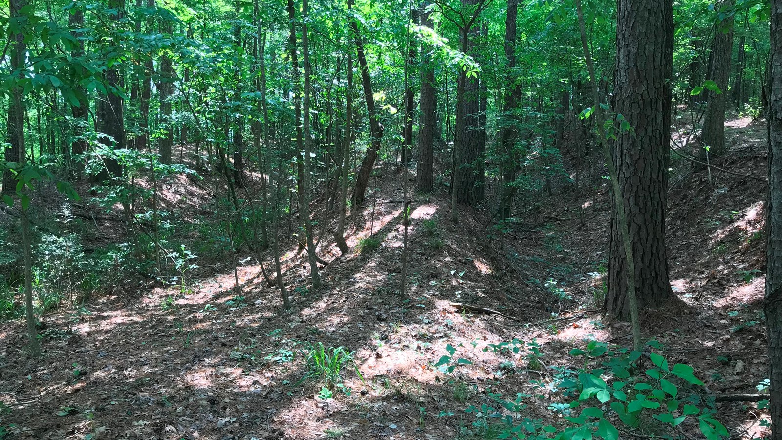
The Lobanillo Swales are among the largest known physical remnants of El Camino Real de Los Tejas. Located near the modern town of Geneva in Sabine County, Texas, these parallel ruts measure 18 feet deep by 12 feet wide and extend for nearly a quarter mile into the adjacent pine forest. Created through years of travel by foot, horse, and cart, the swales sit at a historic intersection of two branches of El Camino Real, which converge to form the main route to San Antonio. Historical and archaeological evidence indicates that that this route was used until as late as the early 1900s, with generations of settlers and explorers contributing to the formation of this historic landmark.[1]
The first to walk this path, however, were the local Caddo people. Estimated to have pioneered the trail thousands of years ago, the Caddo had long traveled this path through the Lobanillo Swales to trade with other Native American groups. It was upon this route that the Caddo first made contact with the Spanish exploratory party of Luis de Moscoso Alvarado in the 1540s, with whom they traded for furs, guns, and horses.[2]
After Alvarado, several other soldiers, priests, and merchants from Spain traveled this same route. Army commander Alonso de León and Padre Damián Massanet passed through the swales on their 1690 expedition to establish the Christian missions of East Texas, while the Marques de San Miguel Aguayo led his armed militia along the very same path on his 1722 campaign to retake presidios abandoned to the French. Numerous other soldiers, settlers, and priests also utilized the route, with references to the path existing in multiple accounts from the period. During his region-wide inspection of the missions in Texas in 1767, Fray Gaspar José de Solís wrote the following concerning the swale area in his travel diary: “On the 6th we crossed Carrizo Creek, also that of Palo Cacho; both very leafy and having good water and many trees. We reached the Ranch of Lobanillo de Gil; here we dined. There is a creek with plenty of good water, much woods, thick pin oaks, pines, post oaks, elms, sassafras, strawberries, chestnuts, blackberries, persimmon, viperine, deer. In the evening we came to the Creek of Gonzalitos, also leafy and surrounded by trees of the above-mentioned kind. Here we slept.”[3]
The “Ranch of Lobanillo de Gil” mentioned by Solis, the closest settlement to the swales founded by famed settler and merchant Antonio Gil Ibarvo, was more commonly known as El Lobanillo,. A former resident of Los Adaes, Ibarvo had been forced to leave the settlement alongside his fellow settlers by order of the Spanish government in 1773. The Spanish authorities determined that Los Adaes, the former capital of the province of Texas, was no longer a strategic asset and closed it to conserve government resources. Ibarvo would eventually found the town of Nacogdoches on the Texas-Louisiana border. Prior to this, however, he led the displaced people of Los Adaes to his rancho, El Lobanillo, near the swales. Upon his departure to Nacogdoches, Ibarvo’s land was given to fellow rancher Juan Ignacio Pifermo as a land grant in 1794, later inherited by American settler John Maximillian in the 1800s.[4]
While the territory of Texas changed hands from Spain to Mexico to the United States during the 19th century, the Lobanillo Swales endured as one of the region’s most important crossroads. It is likely that Stephen F. Austin and his contingent of 300 other American colonists passed through the area en route to their new settlements in Texas in 1821. Shortly after the breakout of the Mexican-American War in 1846, in part due to the American annexation of Texas the year prior, soldiers led by General Zachary Taylor crossed through the Lobanillo Swales area to assume defensive positions on the Texas frontier.[5]
Today, the swales are privately owned by El Camino Real de los Tejas National Historic Trail Association and are open to the public. Visitors can hike the short trail along the swales and be a part of the long and diverse group of travelers on this historic route.
Site Information
Location (on State Hwy. 21 W 2 miles west of Geneva, Texas (near the Sabine-San Augustine county line))
Two sets of deep and parallel swales extend about one-quarter mile through the forest. One set of swales has seven parallel ruts reaching a depth of 18 feet and 12 feet wide. The quiet surroundings and tall pine trees give a sense of what the area was like hundreds of years ago.
El Camino Real de Los Tejas National Historic Trail Association
El Camino Real de los Tejas National Historic Trail
[1] National Park Service, “National Register of Historic Places Continuation Sheet: Lobanillo Swales,” October 2, 2015, 7.
[2] Ibid., 9.
[3] Margret Kenney Kress, “Diary of a Visit of Inspection of the Texas Mission Made by Fray Gaspar Jose de Solis in the Year 1776–68,” Southwestern Historical Quarterly, Vol. 35, July 1931–April 1932, 66.
[4] National Park Service, “National Register of Historic Places,” 10.
[5] Ibid., 10-11.
Visit our keyboard shortcuts docs for details
- Duration:
- 1 minute, 6 seconds
Take a short hike among the greatest concentration of El Camino Real de los Tejas National Historic Trail swales in the nation. These parallel ruts are up to 18 feet deep and 12 feet wide, and were created by thousands of people, animals, carts, and wagons traveling the Trail between Mexico City and what is today Louisiana. This site is privately owned and managed by El Camino Real de los Tejas NHT Association.