Last updated: April 18, 2024
Place
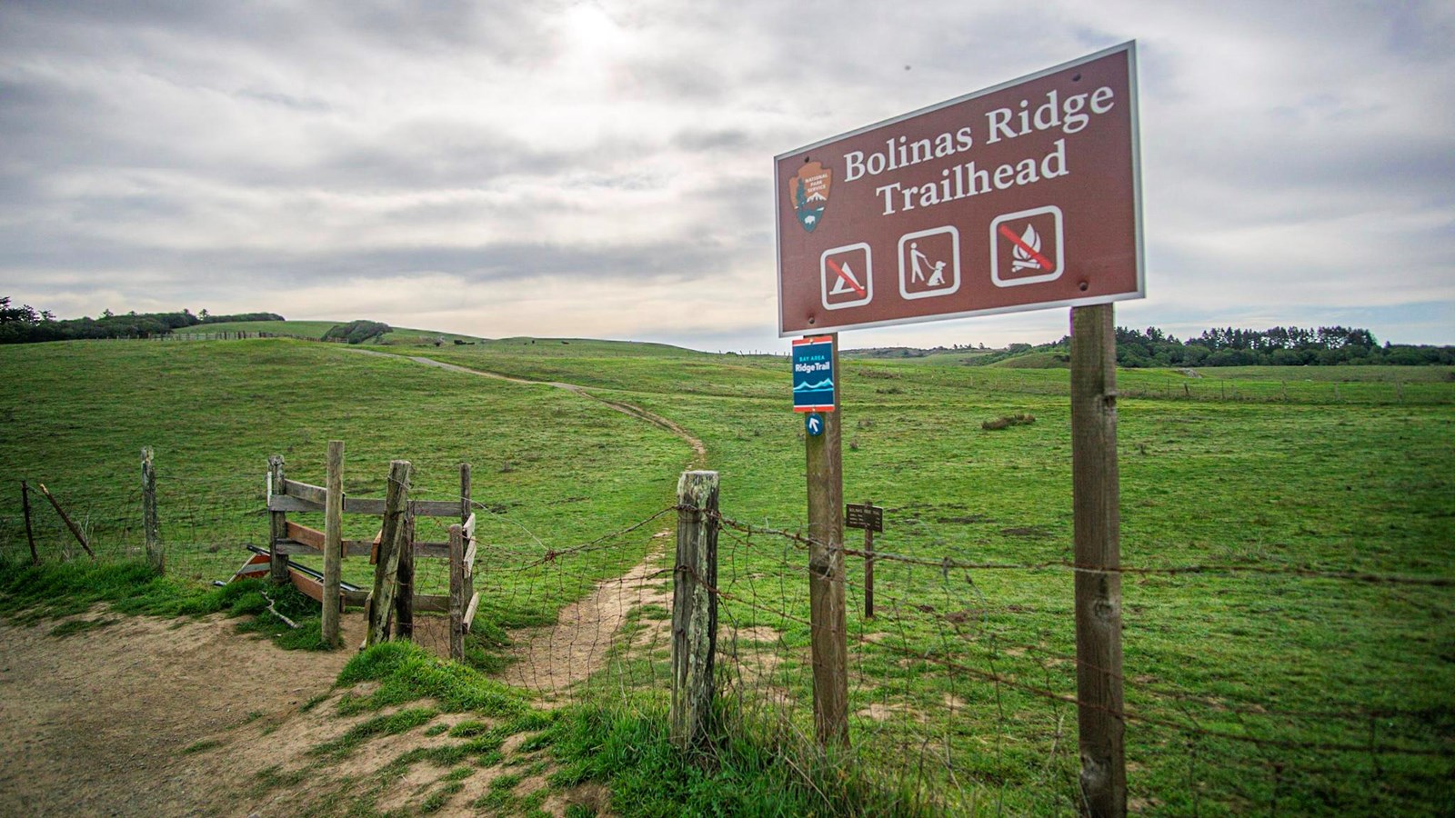
Bolinas Ridge Trailhead
NPS Photo / A. Kopshever
Quick Facts
Location:
Bolinas Ridge Trailhead along Sir Francis Drake Boulevard, Golden Gate National Recreation Area, Marin County, California, Geographic Coordinates: 38.0464, -122.7705
Amenities
3 listed
Parking - Auto, Pets Allowed, Trailhead
This trailhead is at the northern end of the multi-use, dog-friendly Bolinas Ridge Trail. The Bolinas Ridge Trail passes through pastureland in which cattle graze. Between Sir Francis Drake Boulevard and the Fairfax-Bolinas Road, the 11-mile-long (17-km-long) Bolinas Ridge Trail connects with the Jewell Trail, the Shafter Grade Trail/Road, the Randall Trail, and the McCurdy Trail.
Suggested routes from this trailhead
Hike the Bolinas Ridge Trail: 2 to 22 miles (3 to 35 km) round trip, moderate to difficult
Bike the Bolinas Ridge Trail: 2 to 22 miles (3 to 35 km) round trip, moderate to difficult
Park Regulations
- Take only pictures; leave only footprints: Almost everything one finds at Point Reyes National Seashore and Golden Gate National Recreation Area is protected by law, including shells, rocks, fossils, flowers, and artifacts.
- Please only travel on authorized trails, respect posted signs and practice Leave No Trace principles when recreating in the park.
- Check current conditions and trail advisories and closures before your visit.
- Bicycles are permitted on the Bolinas Ridge Trail. Please ride responsibly and yield to hikers and horseback riders.
- Pets are permitted on the Bolinas Ridge Trail, but must remain on a leash (shorter than 6 feet) at all times.
- Horses and pack animals are permitted on most park trails, including the Bolinas Ridge Trail. However, the gate at the Bolinas Ridge Trailhead is too narrow for horses to pass through and the limited road-side parking would not be conducive to unloading and loading horses from trailers. Horse riders are welcome to get to the Bolinas Ridge Trail via the Jewell Trail, the Shafter Grade Trail/Road, the Randall Trail, and the McCurdy Trail. Please visit Point Reyes National Seashore's Horse Riding page for more information.
- Drones are not permitted anywhere in Point Reyes National Seashore or Golden Gate National Recreation Area.
Parking
Space for parking at the Bolinas Ridge Trailhead consists of an approximately 300-foot-long (90-meter-long) paved shoulder and an approximately 200-foot-long (60-meter-long) gravel shoulder along the sides of Sir Francis Drake Boulevard 1.1 miles (1.7 km) east of Olema. This trailhead is approximately 5 minutes by car from the Bear Valley Visitor Center. Space is limited. Please make sure your vehicle is entirely out of the lane of travel.
Directions to Bear Valley
Directions from Bear Valley to the Bolinas Ridge Trailhead