Place
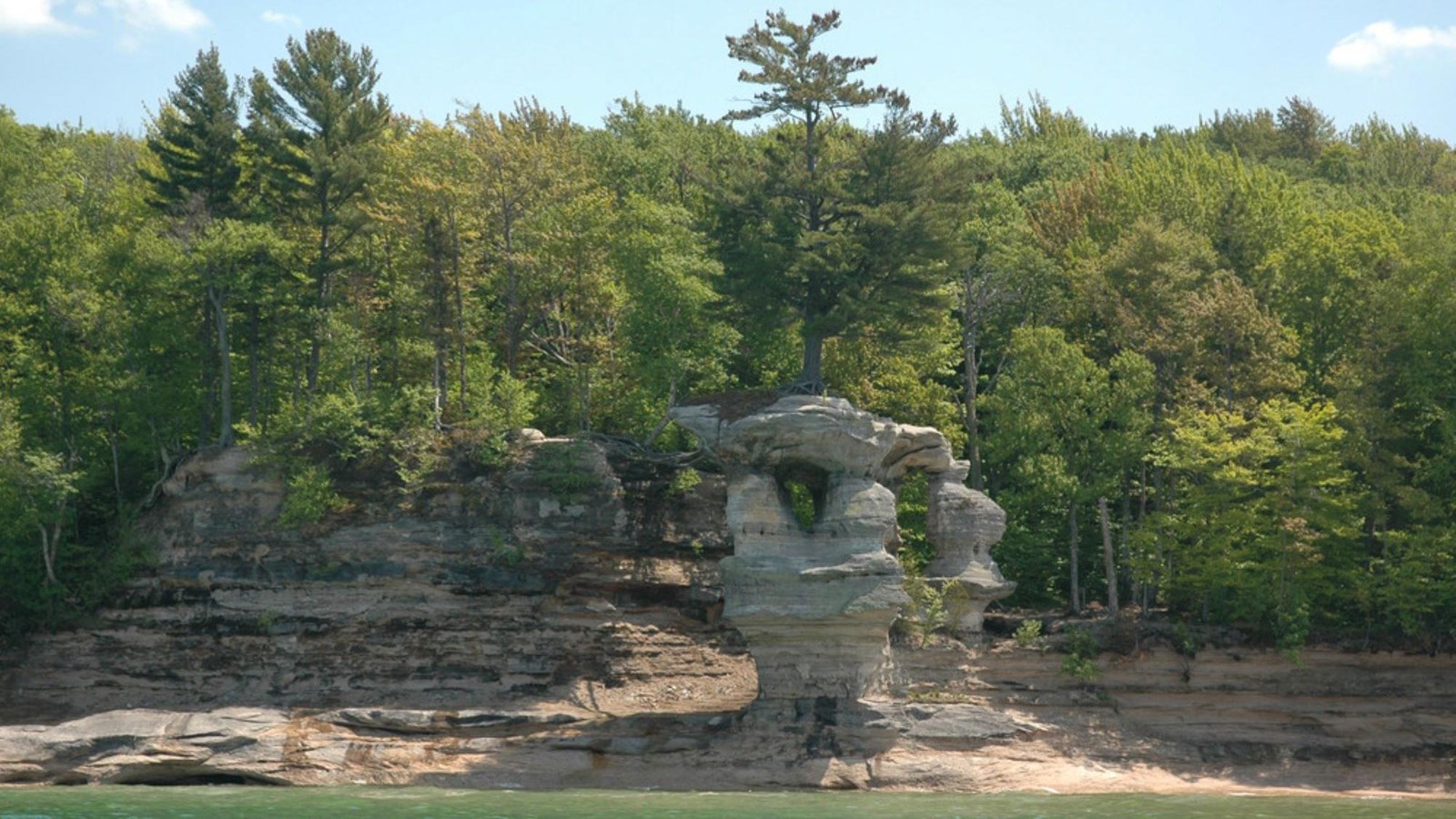
Chapel Rock
NPS Photo
Quick Facts
Amenities
1 listed
Beach/Water Access
Drive about 15 miles east of Munising on Alger County Road H-58; turn left and drive 5 miles north on Chapel Road to the end. From the trailhead, hike 3 miles to Lake Superior to reach Chapel Rock and Beach, with views of Chapel Lake and beautiful Chapel Falls along the way.
Note: Chapel Road is a rough, backcountry road that sees heavy congestion in summer and early fall. The parking lot at the trailhead fills very quickly, often by 9 am.
The Chapel area was named by early European explorers and is found on early maps as La Chappelle. Chapel Rock is a remnant of Cambrian age sandstone that was carved by Lake Nipissing high water some 3800 years ago. Continual erosion has carved the rock into the beautiful sculpture it is today. There once was an archway connecting the rock to the mainland. The arch collapsed in the 1940s. The lone white pine on Chapel Rock is estimated to be about 250 years old.
Chapel Beach and the mouth of Chapel River is adjacent to Chapel Rock. The area invites hikers and boaters to linger, and a popular backcountry campsite is found here. Click here for a map of the Chapel area hiking trails.
Pets are prohibited on all trails in the Chapel area. There is a vault toilet at the trailhead. There is no drinking water available.