Last updated: October 17, 2023
Place
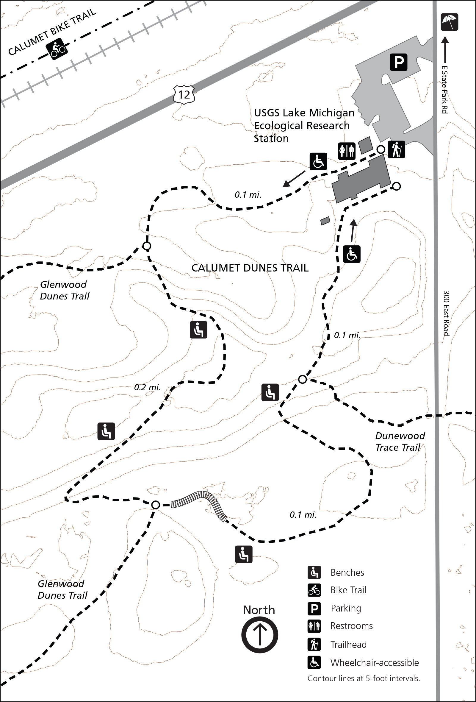
Calumet Dunes Trail
NPS Photo / Steven M. Rossi
Quick Facts
Location:
Chesterton, IN
Amenities
14 listed
Bicycle - Rack, Cellular Signal, Historical/Interpretive Information/Exhibits, Information Kiosk/Bulletin Board, Parking - Auto, Restroom, Restroom - Accessible, Restroom - Seasonal, Toilet - Flush, Trailhead, Trash/Litter Receptacles, Water - Bottle-Filling Station, Water - Drinking/Potable, Wheelchair Accessible
Calumet Dunes Paved Trail
0.5 miles, 32 feet of elevation gain, 2% average grade, 5% maximum grade
Hike time: 20 minutes
This featured hike is a loop trail and is wheelchair accessible. Starting at the parking lot trailhead, hike the trail loop in a counter-clockwise direction. The path is easy to follow. Please be aware of trail junctions. Stick to the left at each junction. The first two junctions are the north and south entrances to the Glenwood Dunes Trail system. Note that no pets are allowed on this portion of the Glenwood Dunes Trail. The last trail junction is with the Dunewood Trace Campground Trail. Again, stay left. The trail ends on the opposite side of the building from where you started. Walk around the front of the building.
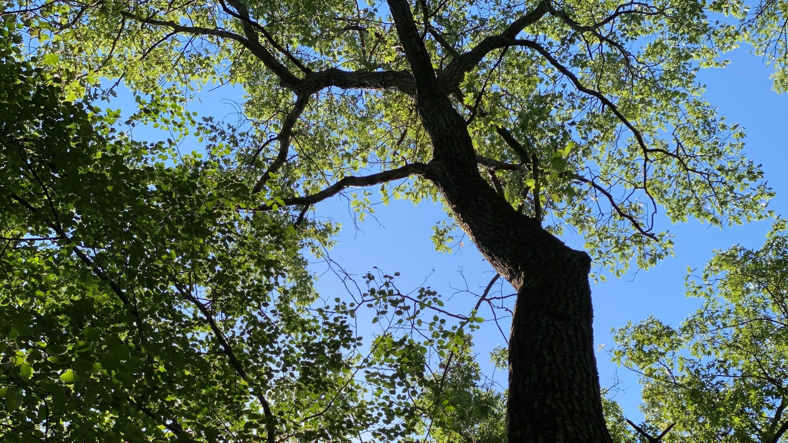
Trail Features: Fall Colors, Wildlife
History and Background
The building at the parking lot has an interesting history. The ground breaking ceremony for the building took place in 1959 and opened on November 13, 1960 as the Presbyterian Church of the Dunes [An interesting side note is that the church had owned and held services in the Old North Church building in Beverly Shores (from the 1933 Chicago World's Fair) from 1938 until 1960]. The last service in the building was held on August 30, 1970 and the National Park Service purchased the land and building shortly afterwards. The building became the park's headquarters and visitor center in 1971. The headquarters moved out of the building to the abondoned Nike missle base on Mineral Springs Road in 1977. The visitor center stayed in the building until November 15, 2006, when the current Indiana Dunes Visitor Center on State Road 49 was opened. The building is currently serving as the United States Geological Survey's (USGS) Lake Michigan Ecological Research Station.
Getting There
Trailhead Parking Lot
1596 North Kemil Road (300E), Chesterton, IN 46304 (Intersection of Kemil Road and U.S. Highway 12)
Note: Kemil Road is called East State Park Road north of U.S. Highway 12.
Note: This is the location of the old visitor center for the park. The building is now USGS Lake Michigan Ecological Research Station.
Trailhead GPS Coordinates
41.661836, -87.010109 (Decimal Degrees)
Need to Know
Hours & Information- Hours – Open daily from 6:00 am to 11:00 pm.
- Hike Length – 0.5 miles.
- Hike Time – 20 minutes.
- Difficulty – Easy with some elevation change.
- Trail Surface – Paved.
- Facilities – Year-round restrooms and potable water.
- Pets – Permitted on a leash (6' or shorter). Pets are prohibited on the equestrian portion of the Glenwood Dunes Trail.
- Prohibited – Littering, hunting, and removing plants.
- Prohibited – Bicycles and motorized vehicles.
- The parking lot is paved.
- In the winter, this trail is popular with cross-country skiers.
- The Calumet Dunes Trail is interconnected with the large Glenwood Dunes Trail system and the Dunewood Trace Campground Trail. Click here for information on the Glenwood Dunes Trail system.
- Please stay on the trail and respect closed area signs. Going off trail damages fragile habitat.
- Ticks are present year-round. Take precautionary measures to prevent bites.
- Poison ivy can be present on the edges of the trail.
- Mosquitoes and flies can be bad in summer months.
- Be prepared for changing weather conditions.
- In case of an emergency or to report a crime, call 1-800-PARK-TIP.
- Trail is paved but slopes exceed ADA limits. Trail is wheelchair accessible with proper support. Restrooms are accessible.
Trail Map
All hiking trail maps of the Indiana Dunes National Park are available online on our website or in paper at the trailhead kiosk or the Indiana Dunes Visitor Center.
Nearby Hikes
Great MarshDune Ridge
Glenwood Dunes