



Last updated: July 14, 2026
Place
Bear River Crossing - Beartown
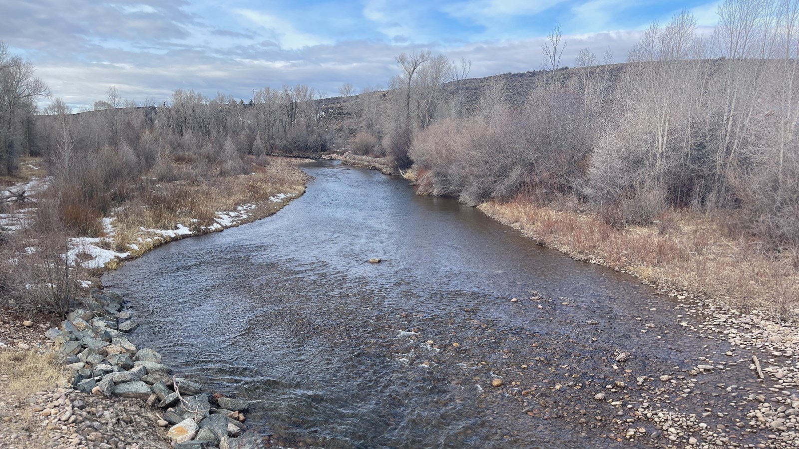
Photo/L. Kreutzer
Quick Facts
Location:
Several markers, monuments, and sites are along a 2-mile stretch of WY-150 S, beginning at the Bear River bridge about 7.75 highway miles south of I-80 Exit 5, Evanston. Beginning of the stretch: River Crossing view from bridge is at GPS 41.168217 -110.87571; Nardone station marker post GPS 41.166438 -110.873375; 1924 Brigham Young monument GPS 41.165926 -110.869341; Bear River City historical marker and kiosk GPS 41.157881 -110.850866; end of stretch, view of MOPI 1847 Sulphur Creek Camp and later Hell-on-Wheels town Bear River City (aka Beartown) GPS 41.155631 -110.848470
Significance:
Brigham Young fell seriously ill at the vanguard’s camp at Sulphur Creek on the evening of July 11, 1847, causing him to lag behind and be among the last of his company to enter the Great Salt Lake Valley. The emigrant trail crossed the Bear River about 1 ½ miles west of the campsite; an Overland Stage station (1858-1868) and Pony Express relay and home station (1860-1861) operated south of the crossing; and a transcontinental railroad “Hell-on-Wheels” town briefly existed there in 1868.
Designation:
Historic site on the California, Mormon Pioneer, and Pony Express NHTs.
OPEN TO PUBLIC:
No
MANAGED BY:
Private
Amenities
4 listed
Historical/Interpretive Information/Exhibits, Parking - Auto, Parking - Bus/RV, Wheelchair Accessible
Several places related to the Mormon Pioneer, Pony Express, and California trails are along this 2-mile stretch of highway southeast of Evanston, WY. From Evanston, take I-80 Exit 5 onto southbound WY-150 and drive 9 miles to the highway bridge over the Bear River. Pause there to look south (right) to view the Bear River Crossing below the bridge, where wagons, handcarts, and mule trains forded the stream or crossed on ferries or bridges during the 1840s-1860s. California-bound Edwin Bryant, crossing with pack mules in 1846, described the ford as about 50 yards wide, “with a rapid current of limpid water foaming over a bed so unequal and rocky, that it was difficult, if not dangerous to the limbs of our mules, when fording it.” Continue south for 0.3 mile to a gravel turnout on the left. Beyond the livestock loading ramp at the edge of a ranch yard stands a silver post marking the approximate location of 1860-1861 Pony Express Bear River Station, which also served the Overland Stage from 1858 to 1868.
Nothing of the station remains; please do not enter the private yard. Return to the highway and continue for ¼ mile to enter gravel drive on the left. There, view a stone monument honoring the 1847 Latter-day Saint pioneers. Behind the monument stands a granite marker that tells about the Pony Express and Overland Stage Bear River Station, and nearby lies a simple stone moment to a Willie Handcart Company emigrant who died in 1856. Return to the highway and turn left. A mile ahead, a brown sign points to a state historic sign for Bear River City, on the left. A series of historical signs there tell about this rowdy “Hell-on-Wheels” town that served Union Pacific laborers working to build the transcontinental railroad in 1868.
Nothing remains at the townsite today except leveled ground and modern, privately owned buildings. Turn left onto the highway. At the curve about 300 yards ahead, pull over and look north (left). The original trail corridor approached from that direction before abruptly turning right along today’s highway alignment. The pasture to the south (right) figures importantly in the Mormon Pioneer Trail story.
After an 18-mile trek through mountainous country, Brigham Young’s company stopped here July 10-11, 1847. Mountain man Miles Goodyear visited the camp, offering encouragement and useful travel advice. While there, Brigham Young and others fell ill with “mountain fever,” a tick-borne disease that causes high fevers, severe headaches, body aches, delirium, and sometimes death. Camp scribe William Clayton noted that the leader had grown “insensible and raving” but was “a little better” in the morning. Young’s sufferings over the next 2 weeks caused him to fall 1-2 days behind the rest, making him among the last of the vanguard company to enter the Great Salt Lake Valley. Many other wagon parties camped at this location through the 1840s-1860s.
This is the last of the trail-related historical sites on this stretch of highway.
Site Information
Location (Several markers, monuments, and sites are along a 2-mile stretch of WY-150 S, beginning at the Bear River bridge about 7.75 highway miles south of I-80 Exit 5, Evanston. Beginning of the stretch: River Crossing view from bridge is at GPS 41.168217 -110.87571; Nardone station marker post GPS 41.166438 -110.873375; 1924 Brigham Young monument GPS 41.165926 -110.869341; Bear River City historical marker and kiosk GPS 41.157881 -110.850866; end of stretch, view of MOPI 1847 Sulphur Creek Camp and later Hell-on-Wheels town Bear River City (aka Beartown) GPS 41.155631 -110.848470)