Last updated: January 24, 2023
Place
Scotts Bluff National Monument, the Oregon Trail

Historical/Interpretive Information/Exhibits, Trailhead
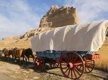
The bluffs of Scotts Bluff National Monument rise directly from the North Platte River, blocking wagon travel along the river's south bank. At first, emigrants had to take a detour south and use Robidoux Pass, a natural gateway, to get through the bluffs. This mostly stopped in 1850 when a new route was opened at Mitchell Pass. Located close to the North Platte River, this route saved emigrants nearly 15 miles of travel. The route, though, was narrow, due to the land's geography. As such, more than 300,000 emigrants, and their wagons and livestock, had to travel on the same strip of land. Eventually, deep ruts formed as a result of this traffic. These ruts are still visible today and are now a part of Scotts Bluff National Monument. A section of them has been developed into a walking trail with interpretive waysides.
Emigrant Remarks
In 1845, General Philip St. George Cooke marveled at the strange formation that rose before him.
"Looming afar over river and plain was 'Scott's Bluff,' a Nebraska Gibralter; surmounted by a colossal fortress and a royal castle, it jutted on the water. . . . This morning marched three miles still nearer to that mysterious mountain . . . without being disenchanted of its colossal ruins and phantom occupants."
Site Information
Location (Three miles west of Gering, Nebraska on Old Oregon Trail (Highway 92 West))
