Last updated: April 5, 2024
Place
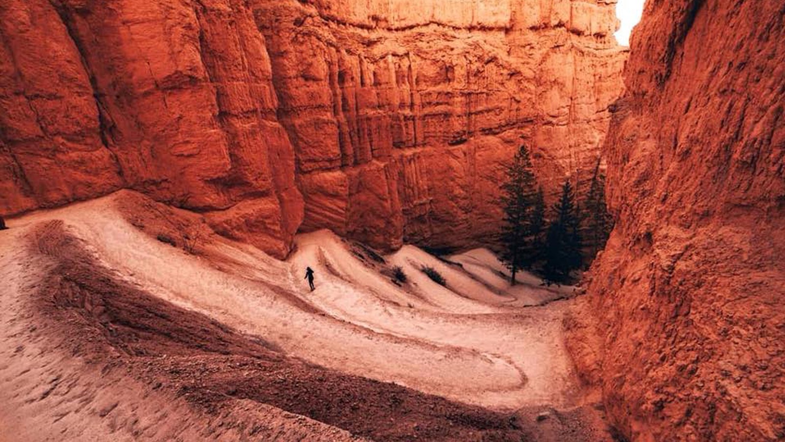
Navajo Loop Trailhead
@eylenepirez
Quick Facts
Location:
Beside Sunset Point
Significance:
One of the park's most popular trails descending in the Bryce Amphitheater
Designation:
Added to Bryce Canyon National Park Scenic Trails Historic District on April 25, 1995
Amenities
1 listed
Trailhead
Navajo Loop
Difficulty: Moderate
Total Distance: 1.3 miles (2.2 km)
Elevation change: 550 feet (168 m)
Average time: 1-2 hours
The iconic Navajo Loop Trail begins and ends at Sunset Point, travelling by switchbacks down between narrow walls of colorful limestone with views of towering Douglas-fir trees and the park's most famous hoodoo: Thor's hammer. The loop has two sides, the Two Bridges side and the Wall Street side.
The Two Bridges side is open year-round, however the Wall Street side is closed in months when precipitation combines with freezing overnight temperatures.
More about the trail
Combination Loops
This trail can be combined with the Queen's Garden to form the 2.9 mile (4.6 km) Queen's / Navajo Combination Loop and the Peekaboo Loop to form the 6.4 mile (10.2 km) Figure-8 Combination Loop.
Queen's / Navajo Combination Loop
Difficulty: Moderate
Total Distance: 2.9 miles (4.6 km)
Elevation change: 600 feet (138 m)
Average time: 2-3 hours
Perhaps the park's most popular and iconic trail, the Queen's / Navajo Combination Loop can begin at either Sunrise or Sunset Point but is recommended in a clockwise direction; this is done by descending on the Queen's Garden Trail and ascending the Navajo Loop Trail (Two Bridges side recommended for year-round use and iconic views of Thor's Hammer; Wall Street side is only open in summer). Whether one begins at Sunset or Sunrise Point, these two viewpoints are connected by a flat, 0.5 mile (0.8 km) section of the Rim Trail that completes the loop. If one begins at Sunset Point, they should begin by hiking this section of the Rim Trail to Sunrise Point.
More about the trail
Navajo / Peekaboo Combination Loop
Difficulty: Strenuous
Total Distance: 4.9 miles (7.8 km)
Elevation change: 1581 feet (482 m)
Average time: 3-4 hours
Like the Figure-8 Combination below, this hike combines two loops into one longer hike. This combination begins at Sunset Point with a descent of the Navajo Loop trail. It is recommended to descend along the Wall Street side of the loop (Wall Street side closes in winter, in which case one should use the Two Bridges side to descend and return). After reaching the bottom of the Navajo Loop a short connecting trail leads from here across Bryce Creek to the Peekaboo Loop Trail. Keeping left will take hikers in a clockwise direction around the strenuous Peekaboo Loop and return them to the intersection of Navajo and Queen's Garden Trails. From here hikers ascend back up to Sunset Point (Two Bridges side recommended for year-round use).
Figure-8 Combination Loop
Difficulty: Strenuous
Total Distance: 6.4 miles (10.2 km)
Elevation change: 320 feet (98 m)
Average time: 4-5 hours
The Figure-8 Combination combines the Peekaboo Loop Trail with the Queen's / Navajo Combination Loop to create a 6.4 mile (10.2 km) combination of two loops. Like the Queen's / Navajo Combination Loop, the Peekaboo Loop should be hiked in a clockwise direction. One can begin at either Sunset or Sunrise Point. From Sunset Point, one would begin by first hiking the 0.5 mile (0.8 km) section of the Rim Trail that leads north to Sunrise Point, then descend the Queen's Garden Trail to its intersection with the Navajo Loop. A short connecting trail leads from here across Bryce Creek to the Peekaboo Loop Trail. Keeping left will take hikers in a clockwise direction around the strenuous Peekaboo Loop and return them to the intersection of Navajo and Queen's Garden Trails. From here hikers ascend back up to Sunset Point (Two Bridges side recommended for year-round use; Wall Street only open in summer).
I Hiked the Hoodoos
Hiking is great exercise and Bryce Canyon's "I Hiked the Hoodoos!" program is not just hiking, it's also a scavenger hunt with a special reward!
1. Hike a minimum of 3 mi / 4.8 km, or find at least 3 benchmarks and complete steps 2 through 4 below.
2. Each individual must have either a pencil rubbing of the benchmark (see Jr. Ranger Book) or a"selfie"with the benchmark.
3. Only special "I Hiked the Hoodoos" benchmarks qualify for the reward.
4. Rewards are available at the Visitor Center!
See your park newspaper or Junior Ranger book for more information. Benchmarks are located on Mossy Cave, Rim Trail, Tower Bridge, Queen's Garden, Navajo Loop, Peekaboo Loop, Sheep Creek, and the Bristlecone Loop trails.