Geology

green and orange stone hill and blue sky
Glorieta Mesa (sometimes called Rowe Mesa) is a prominent feature that stands out in background. You can see the various layers of rock as they poke out between the strands of vegetation.

NPS Photo / VIP Laura Reich


Past and present geological processes shaped the upper Pecos River Valley and its abundance of natural resources. In addition, the valley has been a significant migration corridor for people traveling the southern terminus of the Rocky Mountains, connecting the Great Plains with the Rio Grande Valley. Over 700 years ago, Pueblo people settled on a ridge in the middle of the valley that was surrounded by water sources, farmable land and building materials.


Geographic Setting


Pecos National Historical Park is situated in the upper Pecos River Valley which is bound to the north by the Sangre de Cristo Mountains, to the east by the Tecolote Range and to the south-southwest by Glorieta Mesa (known locally as Rowe Mesa). The valley has an average elevation of 7,000 feet above sea level and encompasses roughly 18 square miles. Glorieta Mesa is over 25 miles long, and the highest point, Cerro de Escobas is 8,212 feet above sea level. The topographic relief between valley floor and mesa top can be over 1,000 feet and dramatically divides the landscape.
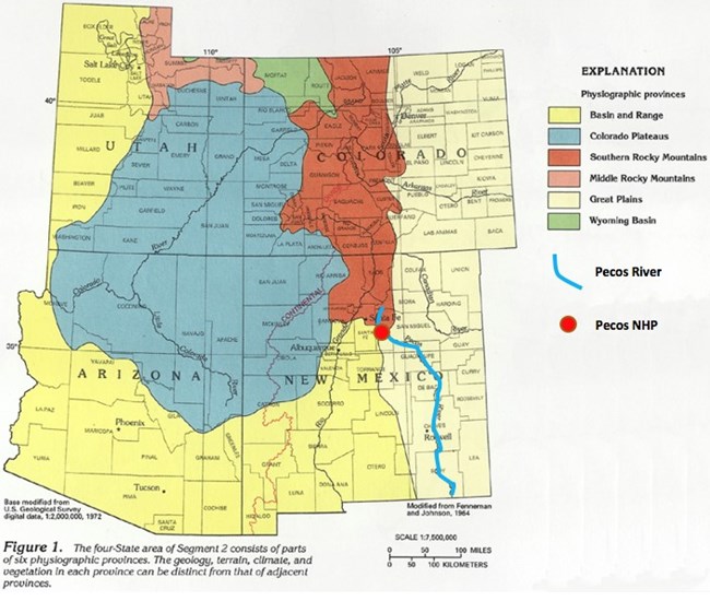
 
physiographic map of utah, colorado, arizona, and new mexico
Physiographic map of the four corners region. The single red marker indicates where Pecos NHP is located within the map.

Modified from U. S. Geological Survey publication HA 730-C

Regional Geologic Setting


Three geologic provinces, which are regions with similar attributes, strongly influenced the creation of the Upper Pecos Valley: the Southern Rocky Mountains, Great Plains, and Basin & Range (which includes the Rio Grande Rift and River). Throughout history, people and animals migrated through and lived in the resource-rich valley.


Local Geology

Prior to the current Sangre de Cristo and Southern Rocky Mountains, there were Ancestral Rocky Mountains. These earlier mountains formed approximately 300 million years ago during the Late Pennsylvanian and Early Permian geologic periods at the time of the super continent called Pangea. Following uplift of the Ancestral Rockies, erosional processes gave way to alluvial fans, deserts, river deltas, beaches and shallow seas, evidence of which can be seen in the rock layers of Glorieta Mesa. Eventually the Ancestral Rocky Mountains eroded completely and a shallow continental sea took their place during the Late Cretaceous geologic period (85 million years ago).
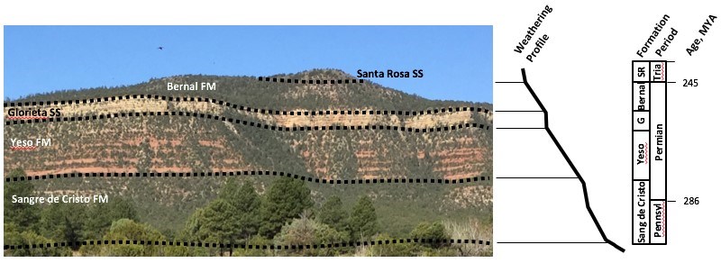
 
layers of soil labeled on hillside
Generalized stratigraphy of Glorieta Mesa, as seen from Kozlowski’s Trading Post on NM State Highway 63.

NPS Photo / VIP Laura Reich

Brief descriptions of Glorieta Mesa stratigraphy (rock layers, top to bottom, youngest to oldest):
  • Santa Rosa Formation: Sandstone and conglomeratic river deposits with petrified wood

  • Bernal Formation: Fine silt, salt and gypsum desert deposits (underlain by a thin interval of San Andres Limestone which was a warm shallow sea and is filled with fossils)

  • Glorieta Sandstone: Well sorted and well cemented shallow marine and beach sand deposits

  • Yeso Formation: Fine grained sands, silts and muds deposited further from mountains in an arid environment

  • Sangre de Cristo Formation: Coarse grained arkosic (detrital) sandstone with large pink (feldspar) and white (quartz) rock fragments that indicate river and fan deposition near the parent rock source (mountains)


The Sangre de Cristo and Rocky Mountains you see today formed 70-40 million years ago during the Laramide Orogeny which was the last major period of mountain building in the interior western US.

Glorieta Mesa is a transitional feature between the Southern Rocky Mountains and the Great Plains and was uplifted about 10 million years ago during the Miocene geologic period. The modern Pecos Canyon and River formed as a result of melting alpine glaciers high in the mountains during the Pleistocene Ice Age, 700,000 to 12,000 years ago. Erosion from the river and creeks greatly influenced the shapes of the valley and mesa you see today.

 
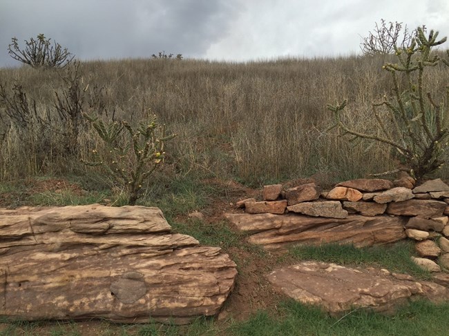
rocks stacked on top of each other
The Pecos Pueblo used materials around them to build their homes. In this picture, you can see the sandstone on the left shows the natural building rock the pueblo was built upon while the rocks on the right shows a human-made portion of the pueblo.

NPS Photo / VIP Laura Reich

Local Building Rock

The Pecos people primarily constructed their dwellings using rocks from the Sangre de Cristo Formation that were found on the valley floor. This same sandstone forms the rock wall in front of the park’s visitor center.
Initial erosion of the Ancestral Rockies, 290 million years ago, formed poorly sorted and coarse-grained sandstones of the Sangre de Cristo Formation. Visible red angular rock fragments indicate the river deposits were very near the mountains.

 
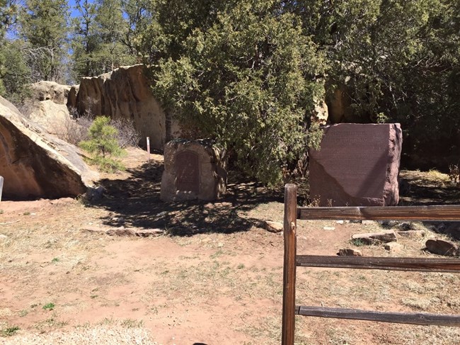
two stone monuments
Geology wasn't just a part of the Pecos Pueblo, but also the Battle of Glorieta Pass and the Civil War. You can see the giant slab of sandstone behind the Civil War monuments. You can visit the monuments along Hwy 50 today.

NPS Photo / VIP Laura Reich

Geology and the Battle of Glorieta Pass (U.S. Civil War)

As you drive New Mexico State Highway 50 between Interstate-25 exit #299 and the Village of Pecos, Sangre de Cristo Sandstone outcrops can be seen along the road. The many small ravines and ridges that formed the eroded sandstone served as the backdrop during the 3-day battle of Glorieta Pass. Sharpshooter’s Ridge, located in the park’s Glorieta Unit, is the most famous sandstone bluff used during the battle.

Conclusion


The Upper Pecos Valley is a critical route through the southernmost Rocky Mountains where people inhabited the land for thousands of years. The multiple ecosystems, defined by topography and climate, surrounding Pecos National Historical Park provide a suitable and sustainable environment for civilization to prosper. People of Pecos Pueblo had easy access to prominent lookouts, building materials, water, soils, and tool-making stones which led to a complex and resilient culture.

 
Loading results...

    Last updated: June 17, 2022

    Park footer

    Contact Info

    Mailing Address:

    Pecos National Historical Park
    P.O. Box 418

    Pecos, NM 87552

    Phone:

    505 757-7241

    Contact Us