PU'UHONUA O HONAUNAU NHP
A Cultural History of Three Traditional Hawaiian Sites
on the West Coast of Hawai'i Island

|
PU'UKOHOLA HEIAU NHS • KALOKO-HONOKOHAU NHP • PU'UHONUA O HONAUNAU NHP A Cultural History of Three Traditional Hawaiian Sites on the West Coast of Hawai'i Island |

|
|
Site Histories, Resource Descriptions, and Management Recommendations |
CHAPTER VIII:
KALOKO-HONOKOHAU NATIONAL HISTORICAL PARK (continued)
G. Description of Resources (continued)
2. Heiau
Other important resources within the park and nearby vicinity are the several heiau located between Wawahiwa'a Point in Kohanaiki and the Alula Bay area in Kealakehe, The two most important of these are Maka'opio (Hale-o-Lono) on Alula Bay and Pu'u'oina (Hale-o-Mano) south of 'Ai'opio Fishtrap. [69]
a) Maka'opio Heiau
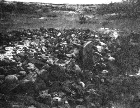
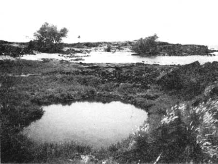
The fisherman's heiau known as Maka'opio, a Hale-o-Lono class of heiau, is a low rectangular platform built out into a shallow, ponded area. Its outstanding features are two great upright stone slabs, measuring over six feet five inches in height, that rise above the pavement perpendicular to the seaward face. The stones, one of which bears a petroglyph of a man about twenty-four inches high, may have represented fishermen's gods. Also present is a small ko'a (fishing shrine) comprising a large, smooth stone (ku'ula) standing on a platform. [70] Nearby are ancient house sites, petroglyphs, and bathing pools.
 |
|
Illustration 116. Map of Keahole, Hawai'i, 1928. Note
houses and church in Honokohau Settlement. Courtesy Hawaii State
Library, Honolulu. (click on image for an enlargement in a new window) |
b) Pu'u'oina (Hale-o-Mano) Heiau
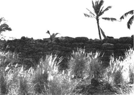
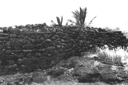
Pu'u'oina temple, sometimes referred to as Hale-o-Mano, stands just inland from Maliu Point and measures about 50 by 145 feet. It is considered the finest example of a platform heiau in Kona. Oral tradition states that this was an operations and dwelling area for warrior priests. [71] Standing on the south shore of Honokohau Bay, at the south side of 'Ai'opio Fishtrap, the heiau's huge waterworn boulders form an impressive structure. Some appropriation of stones for construction of a fence has taken place, and stone from the north side has been used to build nearby houses. Steps are located in the structure's east wall. The surface of the temple is divided into several segments, including raised platforms, a paved depression, and an area of waterworn boulders. Some later alterations are apparent in the structure. Found on the surface level at the east end are a house platform and a canoe platform. The heiau may have utilized the small brackish pool on its south side in connection with its ceremonies. Northwest of the heiau is a large burial platform and just north of the graves a platform ruin lies in the water. The seawall of 'Ai'opio Fishtrap begins at the heiau's northeast corner. Another small platform ruin exists in the water a few yards east. Another platform, on which a hut has been erected, is located at the east end of the seawall. [72] There is no known documented relationship between the fishtrap and this temple, although oral tradition presented earlier did identify the trap as a holding area supervised by the chief living at Pu'u'oina.
It is thought that Pu'u'oina was an important base of operations for those governing Honokohau and North Kona. Its importance derived from its location near the ocean and the 'Ai'opio Fishtrap, which facilitated directing the community's important fishing activities. [73]
 |
| Illustration 118. Pu'u'oina Heiau, east end. Area of walled fishtrap enclosures is in foreground. NPS photo, 1989. |
 |
| Illustration 119. Fishermen's huts at west end of Pu'u'oina Heiau. NPS photo, 1989. |
  |
| Illustration 120. South wall of Pu'u'onia Heiau. Note differences in wall construction. NPS photos, 1989. |
 |
| Illustration 121. Maka'opio Heiau, view east. NPS photo, 1989. |
 |
| Illustration 122. Maka'opio Heiau, view southwest. NPS photo, 1989. |
| <<< Previous | <<< Contents >>> | Next >>> |