| ||
 | ||
 | ||
 | ||
 | ||
 | ||
 | ||
 | ||
 | ||
 | ||
 | ||
 | ||
 | ||
 | ||
 | ||
 | ||
 |
 |
 |
Colonial Parkway
Jamestown, Williamsburg, Yorktown, Virginia
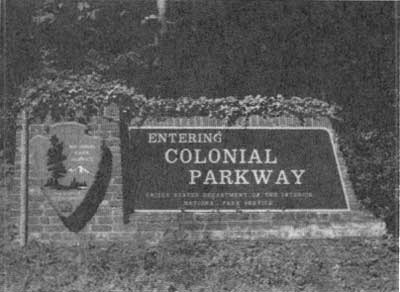
Entrance sign, installed for 1976 Bicentennial. (COLO) |
REGION, PARK AND PARKWAY
Colonial Parkway is a meticulously crafted landscape that integrates the region's natural and cultural resources into a memorial roadway of the American colonial experience. It marks an important change in the history of National Park Service (NPS) road-building traditions as the first NPS-designed parkway that unifies dispersed sites as part of a cohesive national park.
Its function as a unifying factor transcends mere considerations of transportation. Its location and design should contribute, as far as practicable, to the general commemorative purposes of the Monument.
— Colonial Parkway Outline of Development, 1933
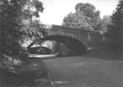
Interstate 64 bridges arch over Colonial Parkway. (Jack Boucher, HAER, 1995.) |
Authorized in 1930, Colonial National Historical Park is a 10,221-acre unit of the NPS located between the James and York rivers in Virginia. Originally designated a national monument (becoming a national historical park in 1936), Colonial NHP administers and interprets the sites of Jamestown Island and the Yorktown Battlefield. Central to the original legislation which created Colonial NHP was a plan for a scenic highway to link the sites into a "single coherent reservation." Free of any "modern" commercial development, the parkway was designed to provide continuity to the visitor experience of motoring through nearly 400 years of American colonial history. Traversing a diverse environment, the parkway provides visitors with dramatic open vistas of rivers and tidal estuaries as well as shady passageways through pine and hardwood forests.
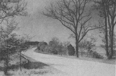
Colonial Parkway curving around the York River, just after completion of the parkway, 1936. (COLO) |
| Introduction | Acadia | Blue Ridge Parkway | Colonial Parkway | Generals Highway | George Washington Memorial Parkway | Great Smoky Mountains | Mount Rainier | Rock Creek and Potomac Parkway | Shenandoah's Skyline Drive | Southwest Circle Tour | Vicksburg | Yellowstone | Yosemite | Discover History |