NPS - J. Axel
The Mt. Bangs summit trail is accessed via several routes including two through Grand Canyon-Parashant National Monument. The trail and Mt. Bangs are part of the BLM Arizona Strip Field Office. This trail is best done in the late Spring through early Fall. The trail will be snowed over usually by early December and will have snow on it until some time in March. In addition, the BLM1004 road over Black Rock Mountain is closed and impassible in winter due to snow, ice, and mud. 
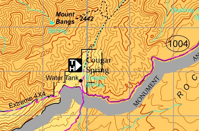
The other route to the trailhead is from Mesquite, NV via Lime Kiln Pass. Take road 242 over Lime Kiln to the 4-way intersection with BLM1041 and Mohave County Road 101. Take BLM1041 north to BLM1004. Continue on BLM1004 north to the Cougar Springs spur. This route can be rougher but will be shorter for those coming from Mesquite or Las Vegas. Total Trail Distance: 5 miles/8 kilometers round trip Total Trail Elevation: 1,692 feet/516 meters Trailhead Elevation: 6,320ft/1,926m Summit: 8012ft/2,442m The trail has 3 distinct sections. The first two follow an old roadbed. Section 1 Gentle ascent up the canyon floor from the trailhead over colorful stream-rounded rocks to an historic cattle watering pond at a topographic saddle that drops back down to the Virgin River canyon to the north. Distance: 1.4 miles/2.2 km one way Elevation Gain: 627ft/191m Section 2 Steep ascent on switchbacks. Trail is mostly clay. Once you reach the area where the trail leaves the old roadbed and the rock scrambling starts, hikers can enjoy the views to the west without having to do the rock scramble to the summit. See the Viewpoint label on the map below. There are shade trees and level ground in this area. It is a great spot to enjoy the quiet of the Paiute Wilderness. Distance: 0.9 miles/1.4 km one way Elevation Gain: 630ft/192m Section 3 Rock scramble to the Summit. Leather gloves recommended for this section as the rocks are sharp and crystalline. This section requires some hand over hand climbing up or across large boulders. Distance: 0.25 miles/0.4 km one way Elevation Gain: 435ft/133m If you would like to learn more about the amazing geologic story of the region before or after your hike, see our Geology section. The top of Mt. Bangs is made of 1.7 billion year old Precambrian rock, which is the same age as similar Vishnu schist rock at the bottom of the Grand Canyon! As you rest while bouldering, look for tiny green crystals in the boulders. These are green beryl, which formed in what is known as a pegmatite, a type of volcanic intrusion that pushed its way into the ancient Precambrian rocks at the summit. 
|
Last updated: April 5, 2024
