Estimated Float Times

A person uses a sharpie to draw on a park map.
Many quality float trips exist along the Current and Jacks Fork rivers within Ozark National Scenic Riverways. Knowing the duration of your trip lets you better plan meals, activities, and leisure.

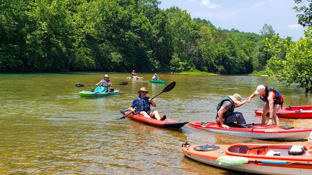
NPS Photo / Wil Marischen


Factors Affecting Times

Whether it be a quick float or an overnight adventure, you need to be aware of how long your float will take. Please see the list of estimated float times below. These times are averages, but it is always a good idea to call your outfitter for the most recent floating information. Float times vary based on a number of factors:

  • Stops or breaks along the river.
  • Personal paddling speed - if you don't paddle, expect a much longer float time.
  • Type of vessel - rafts and tubes take 25-50% longer than kayaks or canoes.
  • River level - higher water levels increase speed and danger.
  • Wind speeds - strong winds can increase or decrease floating time, especially in rafts.

Using a Raft or Tube?

The times below are written for canoes and kayaks. For rafts or tubes, add 25-50% to the total estimated time. For example, a 4 hour float in a kayak will take 6 hours on a raft.

Upper Current River

The most popular floats are highlighted in yellow. Pulltite to Round Spring is our most recommended float for families.

Range
(start to end)

Distance
(in Miles)

Float Time
(in Hours)

Baptist to Cedar Grove

8

3

Cedar Grove to Akers

7.7

3

Akers to Pulltite

9.5

5

Pulltite to Round Spring

9

4

Round Spring to Jerktail

~11.1

5

Jerktail to Two Rivers

~6.2

3

Jacks Fork River

The most popular floats are highlighted in yellow. These are considered the easiest to reach, as they are closer to town.

Range
(start to end)

Distance
(in Miles)

Float Time
(in Hours)

Prongs to Highway 17

~5

4

Highway 17 to Blue Spring

~1.5

1

Blue Spring to Rymers

6.6

4

Rymers to Bay Creek

~7.6

5

Bay Creek to Alley

5.5

4

Alley to Eminence

6.3

4

Eminence to Two Rivers

7.3

4

Lower Current River

The most popular floats are highlighted in yellow.

Range
(start to end)

Distance
(in Miles)

Float Time
(in Hours)

Two Rivers to Powder Mill

7.2

3

Powder Mill to Log Yard

8.2

3

Log Yard to Waymeyer

10.8

4

Waymeyer to Van Buren

7.2

3

Van Buren to Big Spring

4.3

2

Big Spring to Cataract

8.8

4

Cataract to Gooseneck

6.2

3

 
A group of kayakers pull off to the side of a river.
Floating in the Ozarks

Find an outfitter and get on the river!

A river flows towards a hill then curves out of view.
River Levels

Check river levels and stay safe in extreme conditions.

A park ranger floats in a river. Trees cover the background.
River Safety

Learn about safe floating on the riverways!

Last updated: April 22, 2024

Park footer

Contact Info

Mailing Address:

P.O. Box 490
Van Buren, MO 63965

Phone:

(573) 323-4236
Call (573) 323-4236 for Big Spring Entrance Station, located south of Van Buren, MO. Call (573) 226-3945 for the Alley Spring General Store, located west of Eminence, MO. Call (573) 858-3297 for Round Spring Ranger Station, located north of Eminence, MO.

Contact Us