News Release
You are viewing ARCHIVED content published online before January 20, 2025.
Please note that this content is NOT UPDATED, and links may not work. For current information,
visit https://www.nps.gov/aboutus/news/index.htm.

NPS Photo
|
Subscribe
|
Contact: Dena Matteson, 573-323-4814
Van Buren, MO - Ozark National Scenic Riverways announces updates to river access and operations at several locations for 2020.Due to erosion of the riverbank at the Waymeyer access point there is not enough room to safely accommodate the unloading of both commercial and non-commercial vessels at that location on summer weekends. As a solution for potential crowding and safety issues, Waymeyer will continue to serve as a river access for non-commercial floaters only. Waymeyer access is located approximately 10 miles north of Van Buren on State Route M.
The former Pin Oak campground will be the primary access point for National Park Service (NPS)- permitted commercial operators on the lower Current River. From Friday through Sunday, use of the Pin Oak access will be limited to the NPS-permitted commercial operators. From Monday through Thursday (except for holidays) non-commercial vessels can use either the Waymeyer location or the Pin Oak access. For the holiday weekends, Pin Oak access will be limited to NPS-permitted commercial operators from Friday through Monday. This includes the extended weekends of July 3-6 and September 4-7.
Pin Oak will serve as a loading/unloading site only, with all vehicles moved out of the area or parked at the Chilton Creek boat ramp overflow parking area. Chilton Creek Boat ramp will continue to provide river access for motorized vessels only. Chilton Creek boat ramp and Pin Oak are located approximately 12 miles north of Van Buren on Route M.
Raftyard will remain a river access for commercial and non-commercial tube use only. Raftyard is located 5 miles north of Van Buren on Route M.
Powder Mill campground and river access point have reopened for use this summer. Both areas were severely damaged during the major flood of 2017. The access point has been repaired to once again allow river access for motorized and non-motorized vessels. The gravel bar has changed significantly from previous years, and vehicles are advised to use caution to avoid getting stuck in loose gravel. Additional repairs to the river access and road will be scheduled in cooperation with the Federal Highway Administration at a future date.
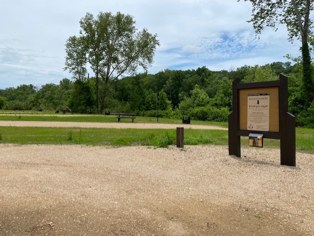
Campsites and associated amenities have been restored at Powder Mill campground. There are eight sites in the campground, available for a nightly fee of $5.00. The flush restroom was replaced with a flood-resistant concrete vault toilet in 2019. Powder Mill is located near the Current River bridge on Highway 106, approximately 14 miles west of Ellington or 13 miles east of Eminence.
The Round Spring lower river access and boat ramp were severely damaged during massive flooding that occurred along Spring Valley Creek in early May. The access road and parking lot have been repaired to allow vehicle access so users can launch or retrieve non-motorized vessels, but the launch ramp for motorized boats is too damaged for use this season. The gravel bar has changed significantly from previous years, and vehicles are advised to use caution to avoid getting stuck in loose gravel. Motorized boats should plan to use the middle landing at Round Spring, located near Group Campsite 9, as a launch point.
As a reminder for non-motorized vessels, when the rivers are above the posted flood levels, temporary river closures are implemented to ensure visitor safety. These closures apply to both commercial and non-commercial vessels. When closures are in place, the closure information is posted on the park’s Facebook page by 9 a.m. or can be obtained by calling 573-323-4236 or 844-460-3604. Any non-motorized vessels on the rivers during a closure are in violation and can be cited.
For more information, contact park headquarters at (573)323-4236, visit the park’s Facebook page, or website at www.nps.gov/ozar.
Ozark National Scenic Riverways preserves the free-flowing Current and Jacks Fork Rivers, the surrounding resources, and the unique cultural heritage of the Ozark people.
www.nps.gov/ozar
Ozark National Scenic Riverways preserves 134 miles of the free-flowing Current and Jacks Fork rivers, the surrounding resources, and the unique cultural heritage of the Ozark people.
Learn more at www.nps.gov/ozar. Find us on Facebook @ozarkriverways and on Instagram @ozarkriverwaysnps.
Ozark National Scenic Riverways preserves 134 miles of the free-flowing Current and Jacks Fork rivers, the surrounding resources, and the unique cultural heritage of the Ozark people.
Learn more at www.nps.gov/ozar. Find us on Facebook @ozarkriverways and on Instagram @ozarkriverwaysnps.
Last updated: June 12, 2020
