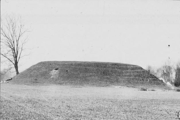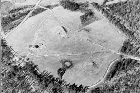
Joseph Coke The material culture of the people associated with the Lamar site included a pottery that incorporated decorative elements of both the ancient Woodland complicated stamping tradition and later traits such as incised designs on the shoulder of “cazuela” bowl forms. Aside from its unique ceramics, the culture is characterized by numerous compact towns with paired mounds separated by open courts, and certain artifacts that are diagnostic of the Southeastern Ceremonial Complex, which reached its zenith around 1250 CE. The Lamar village was set up near the river and fortified by a stockade of upright logs. Swamps surrounded it and the inhabitants cultivated agricultural fields throughout the floodplain. Here the people built two mounds for their temples, facing each other across a central plaza. Lamar’s spiral mound is unique in all of America. The ramp to the summit of the mound circles counterclockwise in four complete traverses. They also built rectangular houses grouped about the mounds and nearby court. The house construction consisted of a framework of light poles interlaced with cane, which was plastered with clay and roofed with a variety of grass thatch or sometimes covered with sod. Some homes, possibly those of the headmen or rulers, were raised on low earthen platforms. Lamar cultural life continued in an uninterrupted fashion until the arrival of Spaniard Hernando de Soto’s expedition into the interior of the southeast in 1540. This exposure to foreigners left a legacy of depopulation among native inhabitants. It is believed that epidemic diseases introduced by the Europeans decimated as much as three-fourths of the original Lamar population. The survivors of this catastrophe and their descendants banded together to form the groups that historically were known to the early English settlers as the Ochese Creeks and today are known as Muscogee Creeks. 
Joseph Coke |
Last updated: July 26, 2023
