Many of the paved roads in the preserve were constructed decades ago, and are showing their wear with narrow shoulders, drop offs, and recurring potholes. Use at your own risk, drive carefully.
The National Park Service is actively working towards a major repair and rehabilitation project for Kelso Cima and South Kelbaker Roads. See Go.nps.gov/MojavePEPC
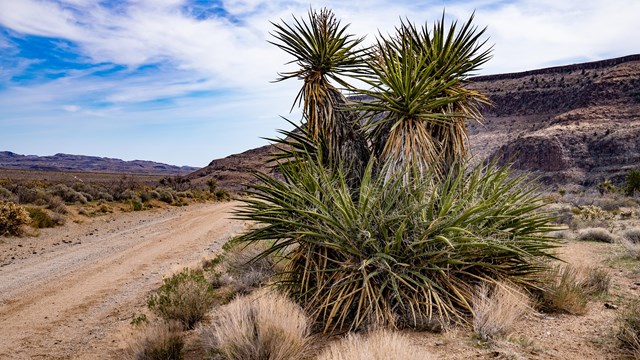
Natural Soundscapes, Clear night skies, and clean air define the Mojave Desert - a refuge from speed.
NPS / Artwork by Raymond G Perez Design
Effective January 26th 2024
Road
Status
Notes
Black Canyon Road
OPEN
Road open, some washboard
Essex Road
OPEN
Road open, use this road accessible to Mitchell Caverns and Hole in the Wall Visitor Center. Please ignore closed status on third party navigation and GPS applications/devices. Do not follow GPS directions onto a dirt road.
Ivanpah/Lanfair Road
OPEN
Some washboard
Kelbaker Road
OPEN
Open, Watch for potholes, Travel with caution. CAUTION: Subject to 1 Hour delays at Kelso railroad crossing
Cedar Canyon
OPEN
Some washboard and bumps
Kelso-Cima Road
OPEN
Use caution, Drive 55, watch for tortoise on roadway. Limited restroom facilities available at Kelso Depot parking area.
Cima Road
OPEN
Watch for wildlife on the road.
Morningstar Mine Road
OPEN
Use caution, drive 55, watch for tortoise on roadway
Zzyzx Road
OPEN
Use caution in small gravel section with potholes and ruts
Backcountry Roads
Trips off pavement require an extra level of preparedness for all sorts of rocky, sandy, and other tire-puncturing terrain. Highway-legal vehicles are allowed to travel on existing unpaved roads, but services are non-existent and self-reliance is essential. UTVs, ATVs are prohibited on all roads.
NPS/K. Lewandowski
All Backcountry Roads May Have Unknown Damage - Travel at Your Own Risk
Many unimproved and backcountry roads in the preserve require high clearance of 8" or more and 4-wheel drive with a low range transfercase and heavy duty tires. All-wheel-drive SUVs and other similar vehicles may not be appropriate for many preserve backcountry routes.
Road conditions can change quickly. Check back here at go.nps.gov/MojaveRoads for latest conditions on the specific roads you plan to travel before you leave the pavement.
Cell phone service is unreliable or nonexistent in most of Mojave National Preserve. Plan on being self-reliant for emergencies.
DO NOT make drive off established roads or make new roads by driving around washed out or damaged areas. You could be held financially liable for repairing resource damages and/or citation for breaking federal regulations.
Report any adverse conditions you notice to a ranger with images and GPS coordinates and description, and e-mail us
Road
Status
Description
Aiken Mine (Lava Tube Access)
OPEN
2WD high clearnance route from Kelbaker Road and Aiken Mine Road is OPEN
Black Canyon
OPEN
Some washboarded areas.
Brannigan Mine
4WD ONLY
deep washouts, may be impassible to even expereinced 4WD vehicle operators.
Castle Mountains
4WD ONLY
Very rough roads.
Cedar Canyon
OPEN
Rough road with washouts and washboarding
Clark Mountains
4WD ONLY
All roads need 4WD and high clearance.
Colosseum Mine
4WD ONLY
Beyond BLM boundary. Steep grades, impassable in sections.
Carruthers Canyon
OPEN - Watch for Road Crews
Carruthers Canyon is now open as of 3-25-2024. Road repair crews will be in the area doing final repairs this week. Please stay on established roads vs illegal vehicle tracks in the area.
Deer Springs
4WD ONLY
Sandy with deep washouts.
Fort Piute
4WD ONLY
Very rocky; no street tires. The rocks are sharp and pointy, likely to puncture a tire.
Globe Mine
4WD ONLY
Sandy in spots.
Green Wells Cutoff
4WD ONLY
Rocky with washouts.
Hart Mine Road
4WD ONLY
Heavy road damage and missing wooden culverts have created hazardous conditions. Travel with extreme caution.
Hidden Hills
4WD ONLY
Sandy with washouts.
Ivanpah
OPEN
Between Morning Star Mine Road to Lanfair to Goffs Schoolhouse.
Kelso Dunes
OPEN, Washboard and potholes; 4WD ONLY PAST DUNES TRAILHEAD
Drive SLOW & watch for tortoise!. Some washboard and potholes. 2WD accessible to the main trailhead and undevelopted camping area. 4WD, high clearance required west of camping area and along powerline road.
Lanfair
OPEN
Potholes in pavement section. Sandy in the washes, but with no flooding a two-wheel drive could make it to the junction with Ivanpah. Use caution.
Macedonia Canyon
4WD ONLY; LIMITED OVERHEAD CLEARANCE
Sandy and rocky. Many vehicles (even Jeeps with external gear) will not be able to fit under train tressle towards Kelso-Cima Road to access this drive.
Mojave Road
4WD ONLY
4WD with heavy duty tires, 4L low range transfer case, and high clearance required for safe travel. Not appropriate for All Wheel Drive SUVs.
New York Mountains
4WD ONLY
Valley View
4WD ONLY
2WD until you reach the ranch. Afterwards its 4WD and high clearance beyond the ranch.
Vulcan Mine
4WD ONLY
Very rough on east side.
Walking Box Ranch (Castle Mountains NM)
OPEN
Well graded gravel road suitable for most vehicles
Wildhorse Canyon
4WD ONLY
Sandy, rocky, and uneven breaks in some sections.
Wood Wash
4WD ONLY
Sandy with washouts.
Desert Driving Pro Tips
Required knowledge for a successful desert adventure.
Do not rely solely on automated mapping and driver assisted applications, they often lead you astray in and around the preserve. Bring an old-timey paper map or atlas for backup and to teach the crew the ways of the ranger. Check here for updated road conditions from the National Park Service. 🗺️ Don't rely on your phone for in the preserve for navigation where coverage is spotty at best, except for pictures at scenic locales!
Cities for GPS
Kelso, California
Hole-in-the-Wall, California
Avoid using Mojave, California. This will take you 168 miles away from the park!
Directions to Kelso Depot From I-15: Exit Kelbaker Road at Baker, California, and drive south 34 miles to Kelso Depot. From I-40: Exit Kelbaker Road (28 miles east of Ludlow, California) and drive north 22 miles to Kelso Depot.
Directions to Hole-in-the-Wall
From I-40: Exit Essex Road and drive north 10 miles to the junction with Black Canyon Road. Hole-in-the-Wall is 10 miles north on Black Canyon Road.
Mojave's rugged nature, large size, and remote locations make assessing, designing, and repairing roads a constant challenge for park maintenance crews. Roads are closed by the superintendent for public safety or to preserve the character of the road bed.
Please do not move barricades or bypass signed or coned-off closures. Park rangers are patrolling closed roads, turning back travelers, and issuing citations.
Speed Limits on the paved roads are 55 mph or less. Please obey posted speed limits for your safety and help keep wildlife alive.
Tortoises and Traffic
Tortoises travel long distances in search of food and water and will cross highways through their territory.
Slow your roll. Motorists must observe posted speed limits.
Keep an eye out. Watch for tortoises crossing the road, especially during rainy weather. Tortoises are attracted to puddles that form on roadways during rainstorms.
Always look under your car before driving away. Tortoises enjoy resting in the shade of parked cars.
Keep vehicles on established roads only. Vehicles will crush tortoise burrows, killing the tortoises and eggs within.
Be a tortoise crossing guard! Never pick up a tortoise unless it is immediate danger. From a distance where the animal's behavior remains unchanged, watch to ensure the tortoise makes it across the road safely. Take a GPS from your phone and email your sighting to neal_darby@nps.gov. Every tortoise is important as they are threatened. The NPS is currently monitoring desert tortoises and relies on sightings from the field to help protect this cool animal.
Enjoy a stress free vacation by not worrying about running out of gasoline. Gas is not sold in Mojave National Preserve. In addition, there are no gas stations where Kelbaker Road meets Interstate 40.
Visitors to the north side of the preserve can fill up in Barstow, Baker, Cima, Primm, Jean, Henderson, or Las Vegas.
Visitors coming from the south should fill up near 29 Palms, Amboy, or take a detour on Interstate 40 to the nearest gas stations in Fenner or Ludlow. Needles (east) or Barstow (west) are farther but also have gasoline. The preserve is filled with long inclines and mountains that will drain your tank, so it's best to come with a full tank if you want to explore without running on E.
There are no food or beverages sold in the preserve. The nearest restaurants and grocery stores are often a half day's drive away. Come prepared with all of your necessary snacks and meals!
The long and winding road takes constant maintenance.
Left image
A road near Hole In the Wall Visitor Center
Credit: NPS/J. Petruncio
Right image
The same road after maintenance
Credit: NPS/J. Petruncio
The preserve encompasses 1.6 million rugged acres intersected by long, bumpy, old-timey historic and lonesome roads. NPS maintenance crews are working on maintaining these roads so visitors here may recreate and explore safely. Please help the NPS by slowing down, obeying speed limits, and watching out for wildlife.