
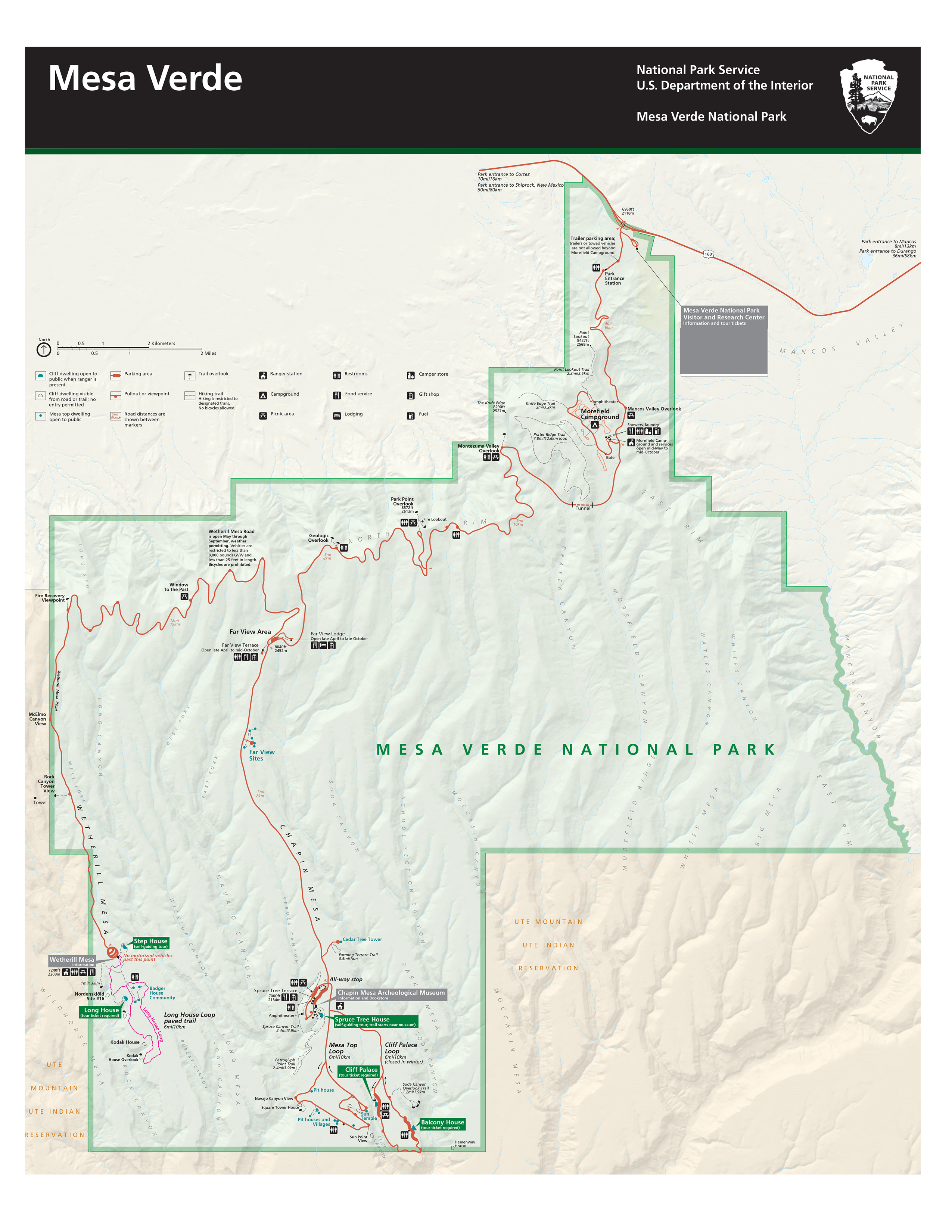
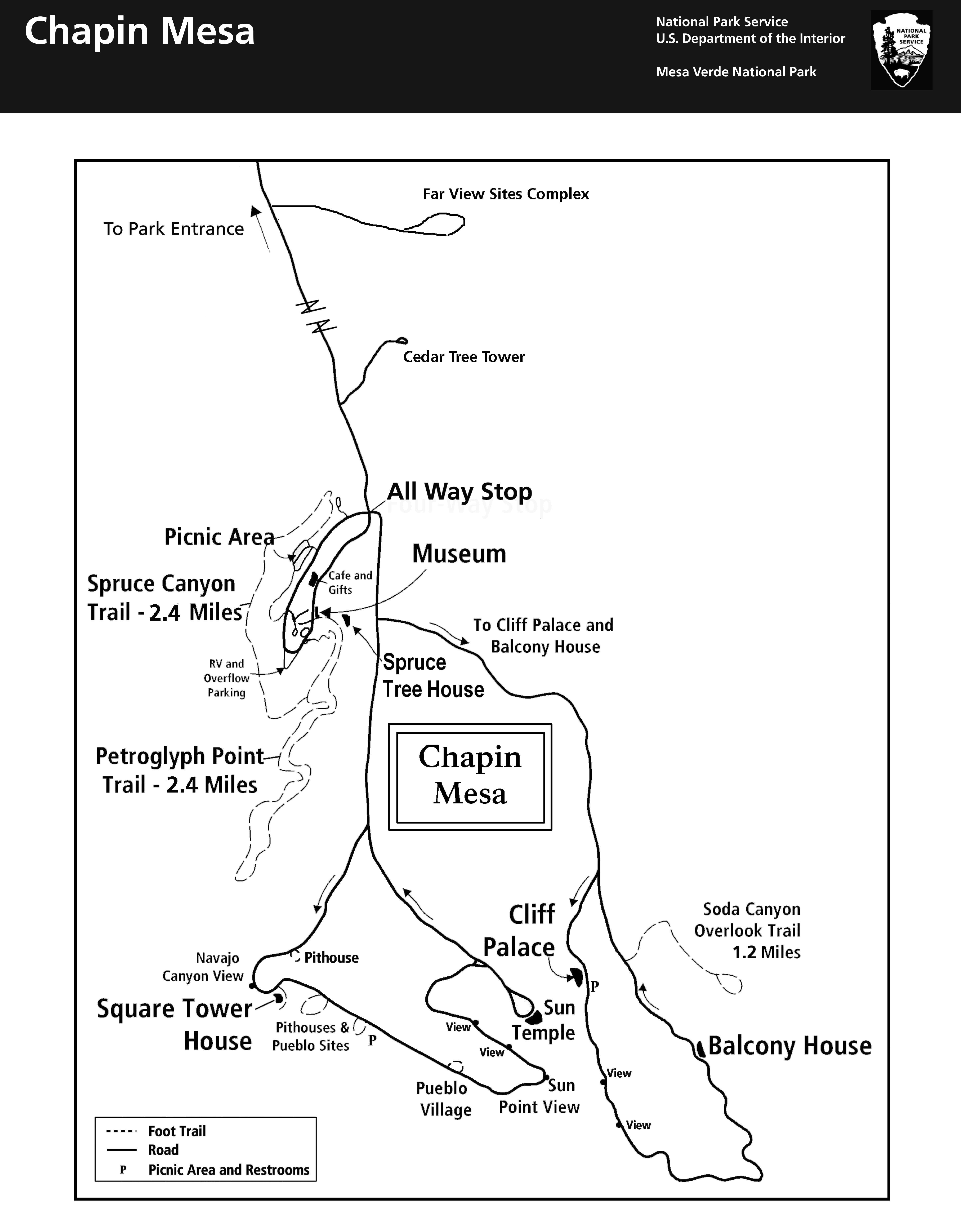
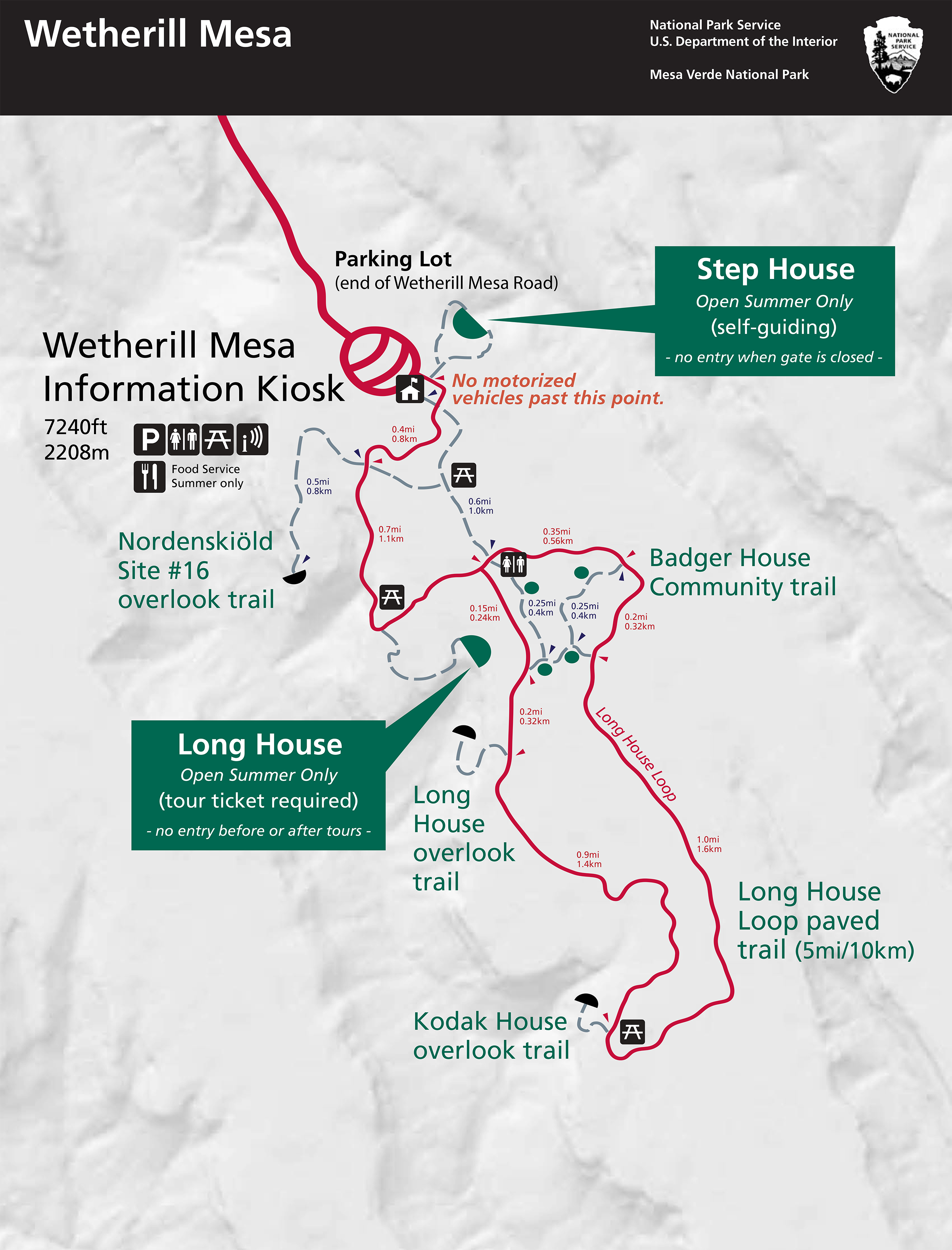
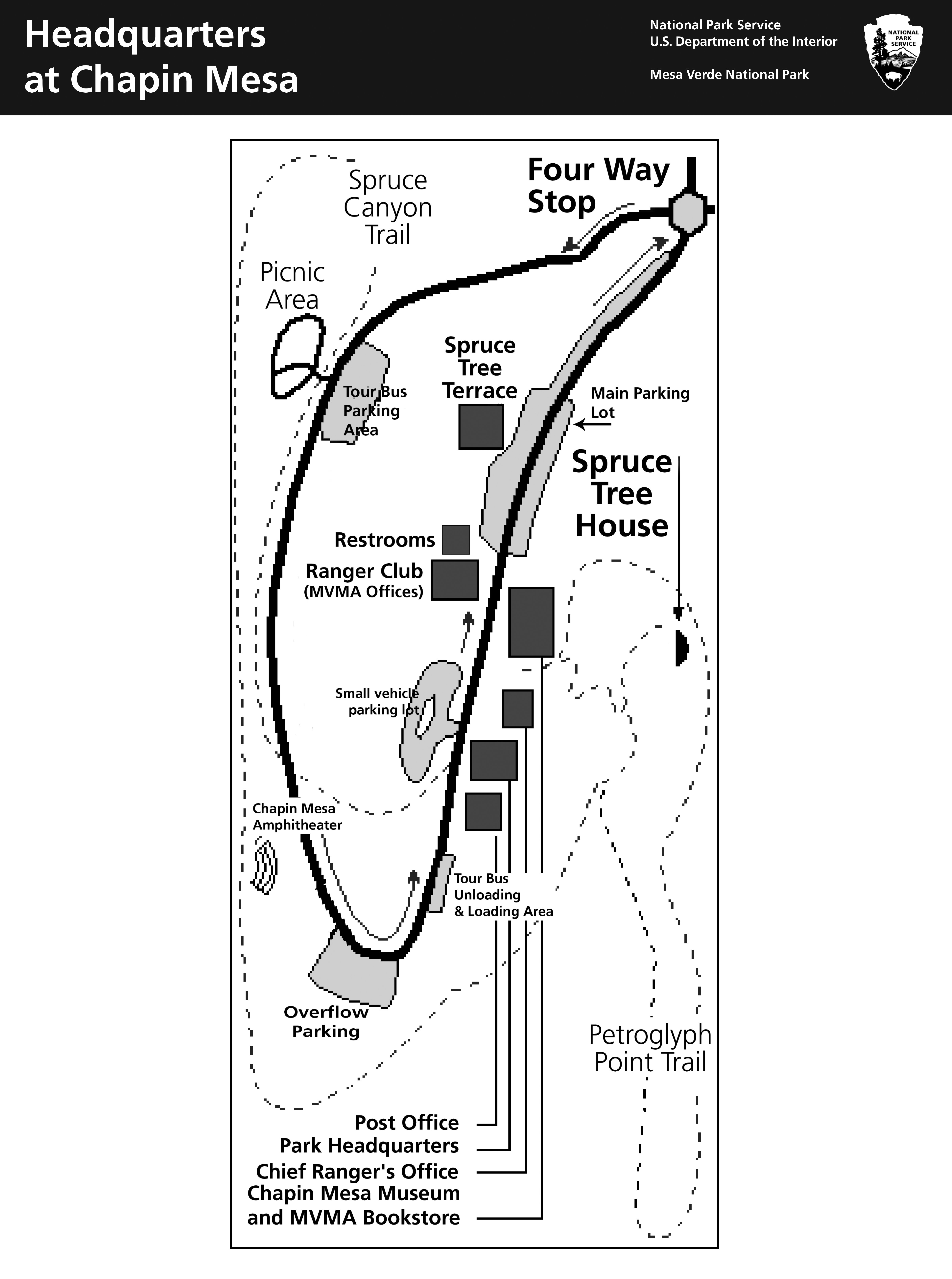
Click on the map above to view a larger version. Copies of the park brochure map may be downloaded below. Printed copies are available at the park entrance station, visitor centers, and upon request. You can explore an interactive park map below. Switch the toggle in the top left corner of the interactive map to the more detailed Brochure Map. Download Park MapsMesa Verde National Park map (printable 8.5 x 11") (jpg, 5.4 mb) Chapin Mesa map (jpg, 2.3 mb) Wetherill Mesa map (jpg, 2.1 mb) Headquarters and Chapin Museum area map (jpg, 2.3 mb) |
Last updated: April 21, 2025