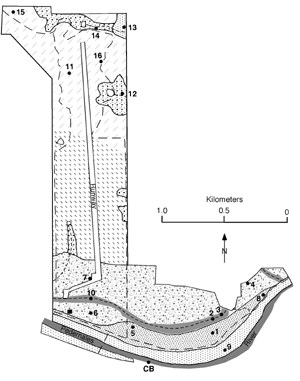
L Nordt Geologically, the region is different and distinctive from the rest of Texas. The river valley cuts through a geologic region known as the Llano Uplift, which is bounded on the south and west by the Edwards Plateau and on the east by the central Texas Hill Country. The hills are capped by Cretaceous limestone underlain by sands and shales of the Cretaceous era. The Llano Uplift is a structural high dome of very old igneous and metamorphic Precambrian rocks. To the north, local Precambrian granite heights of the Llano Uplift have been identified as upward protruding "knobs." Because of the differences in limestone/marl weathering, the landscape has a stairstepped or benched appearance. |
Last updated: February 24, 2015
