
NPS Photo - Andrew Cattoir Hiking in Lake Mead National Recreation AreaAlthough most visitors are attracted to Lake Mead National Recreation Area because of lakes Mead and Mohave, more than 87% of the park protects a vast area of the eastern Mojave Desert. Perhaps the best way to explore this diverse ecosystem is on foot, traveling across open expanses of rock formations that contain all the colors of the rainbow. 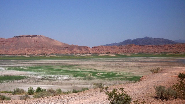
Hikes Around Lake Mead
Lake Mead has several trails that boast history and magnificent views. 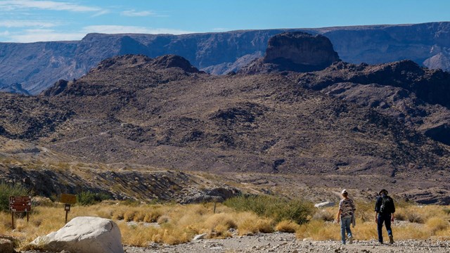
Hikes Around Lake Mohave & Black Canyon
Lake Mohave has several hikes through the Black Canyon region and down close to Katherine Landing. INFORMATION
Hiking in the desert can be an enjoyable experience. It can also be a hazardous adventure if you travel unprepared. Never hike alone, and tell someone where you are going and when you plan to return. Carry plenty of water, at least one gallon of water per person. Drink often.
Signs of heat exhaustion include cool, moist, pale or red skin, headache, nausea, dizziness and exhaustion. Treatment includes moving the victim to a cool shaded area and giving him water to drink. If heat exhaustion progresses, the body temperature will continue to rise and the victim may suffer from heat stroke, a serious condition. Know your limits. Hiking in the desert often means traveling over rough, steep terrain with frequent elevation changes. Try to pick a route that best suits your abilities. Distances are often deceiving. Be sure to check the weather forecast before departure. Sudden storms can cause local flash flooding. Seek high ground if thunderstorms threaten, even in the distance, and be prepared to take cover from lightning.
Essential equipment includes sturdy walking shoes and proper clothing. Long pants are suggested for protection from rocks and cactus. A hat, sunscreen, and sunglasses are recommended. Carry a small daypack to hold such items as water, lunch, first aid kit, map, jacket, and flashlight. Remember, never hike alone and leave your itinerary with someone.
Watch for signs of animals along the way. Because desert regions have such harsh climates, animals often spend the daylight hours sleeping in burrows or resting in shaded areas. Antelope ground squirrels, often confused with chipmunks, are more tolerant of the heat and may be seen scurrying under the bushes.
Desert bighorn sheep may be observed walking along rocky ledges in small groups of two or three. Venomous animals such as snakes, spiders and scorpions are not often seen because they are most active after dark. Speckled rattlesnakes are common but not aggressive. Scorpion stings are no more harmful than a bee sting unless you are allergic. Black widow spiders are shy and secretive and are most often found around man-made structures. Bites and stings may be more harmful to small children. Watch where you place your hands and feet and don't disturb obvious hiding places.
Many desert soils are fragile and take a long time to recover if disturbed. Darker surfaces that crumble easily indicate cryptogamic soils. Here mosses, lichens, and bacteria bind the soil surface, forming a crust that serves to prevent wind and water erosion so that seeds are protected. Take special care to avoid any damage to these areas.
Gypsum soils are often marked by light colored barren areas and are an ideal habitat for the endangered Las Vegas bear poppy and the sunray, one of the most impressive members of the sunflower family. Walk gently here! Canyons and washes accessible from the lakeshores often contain a surprising diversity of plants. Wildflowers are most abundant during the spring. Desert springs support a unique community of plants and animals. These springs are often the only source of water for many miles. Be careful not to contaminate them with trash and other human waste. Because the park is a protected area, rockhounding and collecting plants or animals is prohibited. The national recreation area contains a wealth of cultural resources, including petroglyphs, pictures carved on the rocks many hundreds of years ago by early Native American inhabitants. Although the meaning of these rock carvings are the subject of much debate, they are an irreplaceable key to the past. If you see anyone defacing a petroglyph or damaging an archeological site, please report it to the Lake Mead Communications Center at (702) 293-8998. Help protect the desert and the plants by cleaning up your trash, treading lightly wherever you explore, and taking only memories of the park when you leave. Leave No Trace.
Weather in the recreation area is unpredictable. Flash floods may occur during summer and fall thunderstorms. Visitors should keep an eye on the weather and seek high ground if thunderstorms threaten. Hikers should avoid deep canyons and dry washes during strong or threatening weather. Sudden high winds can occur. Extreme summer temperatures can reach 120F degrees, making water an important supply to keep on hand while traveling in the desert. Summer hiking is not advised.
Lake Mead National Recreation Area has few established hiking trails. When cooler weather prevails from November through March, National Park Service guided hikes and walks are conducted in various areas throughout the recreation area. 
|
Last updated: December 13, 2025