
Written in RockThe outstanding rock formations that surround lakes Mead and Mohave tell the story of spectacular geologic events. These stories are revealed as if in chapters in a book, each one building on the last and leading to the next. From shallow seas that covered today’s dry and barren desert to cataclysmic volcanic activity that shook the earth, this land has been transformed by stretching, pulling, and cutting to create the rock we see today. It was also these events that set the stage for a river to be born. While mountain building and volcanic activity appear to have ended, geologic processes such as erosion continue to transform the landscape. The geologic story of the landscape surrounding lakes Mead and Mohave began more than a billion years ago when this area was a shallow sea. Sediments from this ancient ocean were invaded and contorted by molten rock, some of which made it to the surface as lava flows. The mix of molten rock, sediments and lava cooled to become the 1.7 billion-year-old gneiss, schist, and granite as seen at places like Saddle Island. These are among the lake’s oldest rocks. This early history marks the long prelude to chapter one in the geologic story. 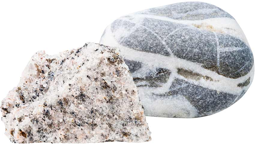
Schist (Left); Gneiss (Right) Chapter OneAncient Seas and Ancient SandsOver 500 million years ago, Southern Nevada was covered by a shallow sea. This sea expanded and retreated several times for 250 million years in the area where lakes Mead and Mohave now lie. Over the next 200 million years the sea retreated as the western edge of North America was formed. The new landscape included shallow rivers, ocean shorelines, and distant volcanoes. The limestone and shale formations seen today were created as the remains of plants and animals that lived and died on the sea’s shores were incorporated with sediments eroded from older rocks. But this story is not only about water. When the sea retreated, a sea of sand was left behind and howling winds lifted that sand into the air, blew it around, and created enormous dunes. Remnants of the dunes can be seen today in the magnificent and brightly colored Aztec sandstone seen in the Bowl of Fire and other formations dotting the lake’s landscape. 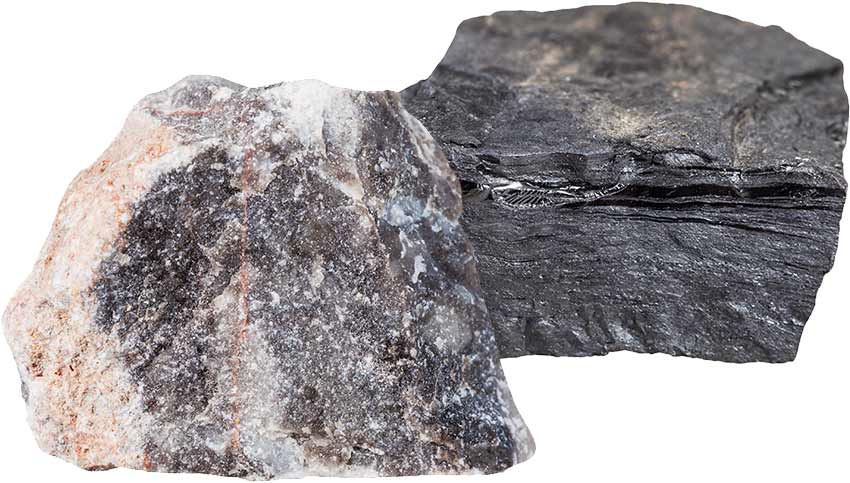
Limestone (Left); Shale (Right) 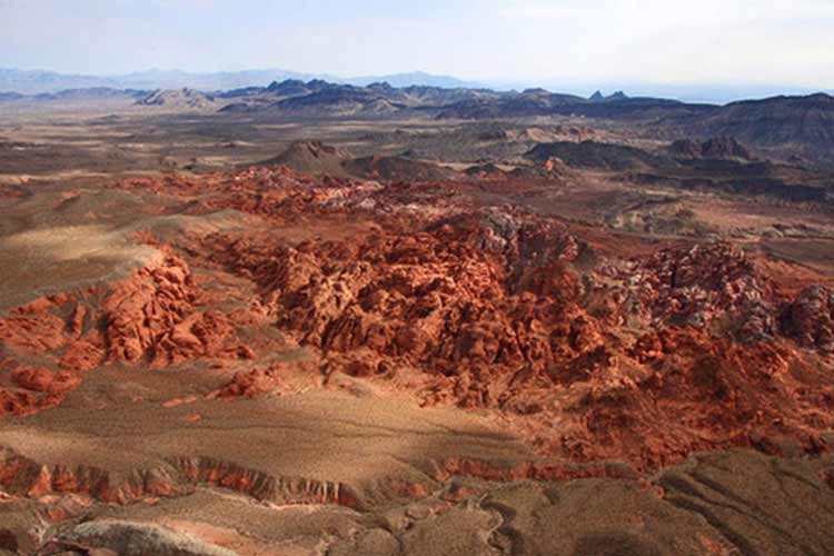
Photo: Bowl of Fire (Sandstone) Chapter TwoStretchAround seventeen million years ago, the earth’s crust began to stretch. This stretching thinned the crust and created cracks formed by multiple earthquakes—the cracks grew and offset rocks up and down across them, forming normal faults. Accompanied by strike-slip faulting, in which rocks slid laterally along large faults, mountains were lifted up while valleys dropped down, forming the familiar basin and range topography we see today. The thinning and cracking nearby eventually caused splitting of the earth’s crust and enormous blocks began to break off, rotate and slide along faults. Some of these fractures became paths for hot magma to rise up and what happened next would be the most dramatic yet. 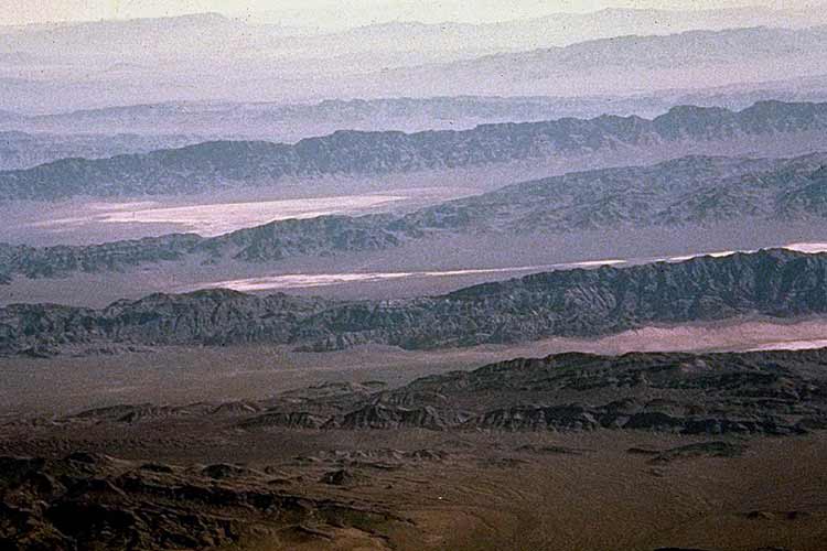
Photo: Basin Range Chapter Three Boom!Volcanic activity began some 20 million years ago as hot magma bubbled up from deep chambers beneath Earth’s surface and volcanic eruptions began covering the landscape with ash, volcanic debris and lava. The stretching of the Earth’s crust that began 17 million years ago created fractures that provided additional pathways for a huge increase in the amounts of magma reaching the surface, peaking about 15 million years ago. Black Canyon below Hoover Dam and the River Mountains by Boulder City are dramatic examples of this interplay between volcanic activity and fracturing. As the stretching ended, a last bit of magma ascended from the Earth’s mantle and poured over the land, creating the iconic dark basalt-capped mesas of Fortification Hill and Callville Mesa. Over time, this dramatic episode quieted, paving the way for water to cut through cliffs and collect in the forming lakes or playas in low lying areas. This would further change the terrain forever. 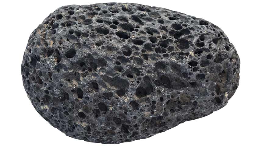
Volcanic Lava Rock 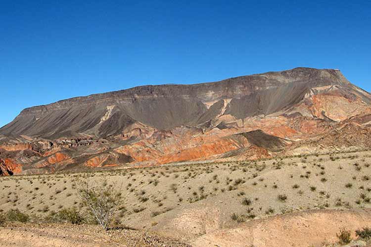
Photo: Fortification Hill Chapter FourThe Birth of a RiverMuch of the topography we see today is a result of the Basin and Range deformation. That deformation created the iconic jumbled geology seen along Northshore Drive today. As the deformation ended, water collected in low areas to form lakes. As these lakes filled and spilled over, they ran down along fractured areas, and into the next basin which resulted in down-cutting of the original dam area until a uniform river gradient was achieved. The constant wearing down of the rock by this ancient river removed basin sediments further exposing millions of years of geologic history in the depths of Black Canyon, Boulder Canyon, and Virgin Canyon. The birth of the Colorado River marks the end of a long era of building up the mountainous landscape and has ushered in a time of cutting down the terrain and eroding away the land. 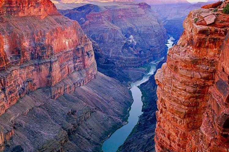
Photo: Colorado River / Grand Canyon EpilogueThe long geologic history of the area surrounding lakes Mead and Mohave is not yet a complete story. Today, weathering continues to cut down the landscape and erosion further breaks down the earth’s crust. New variables are always being introduced, such as human impact and climate change. These additions will likely complicate the tale of our landscape and only time will reveal the new chapters which will be written in the stone. Visit the pages below to read more on specific Lake Mead and Lake Mohave geologic features: |
Last updated: January 10, 2026


