My first Exit Glacier experience was in mid-April. The entire valley was blanketed in feet of snow; the creeks, rocks, and crevasses were all hidden, buried. It was hard to imagine the glacier was retreating.
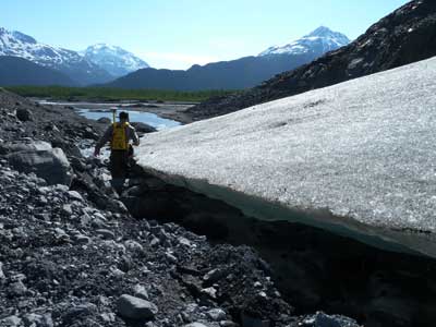
Today, amid the full sunshine and strong katabatic winds, Deb Kurtz and I mapped Exit Glacier's terminus with a high precision Global Positioning System unit. We carefully walked the glacier's edge, stepping on newly deposited rocks, mud, and gravel. Some of this material may have travelled for miles over many decades within the glacier's mass before being exposed here in the past couple months.
Our efforts today indicate that Exit Glacier retreated 21m (68ft) from September and 44m (144ft) from last June! This is nearly the same retreat rate measured in the previous 12-month period.
Just think, while Seward was experiencing a colder than average (~30yr sample) winter (which made for all that snow I experienced in mid-April), Exit Glacier was continuing to lose ice mass during the coldest months of the year.

Mapping the terminus of Exit Glacier. (Photo: NPS/DKurtz)

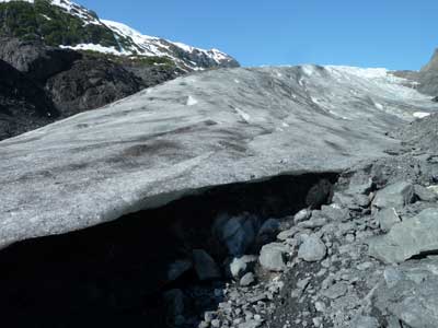
Cavities (glacial caves) developing under Exit Glacier's terminus. (Photo: NPS/DKurtz)
