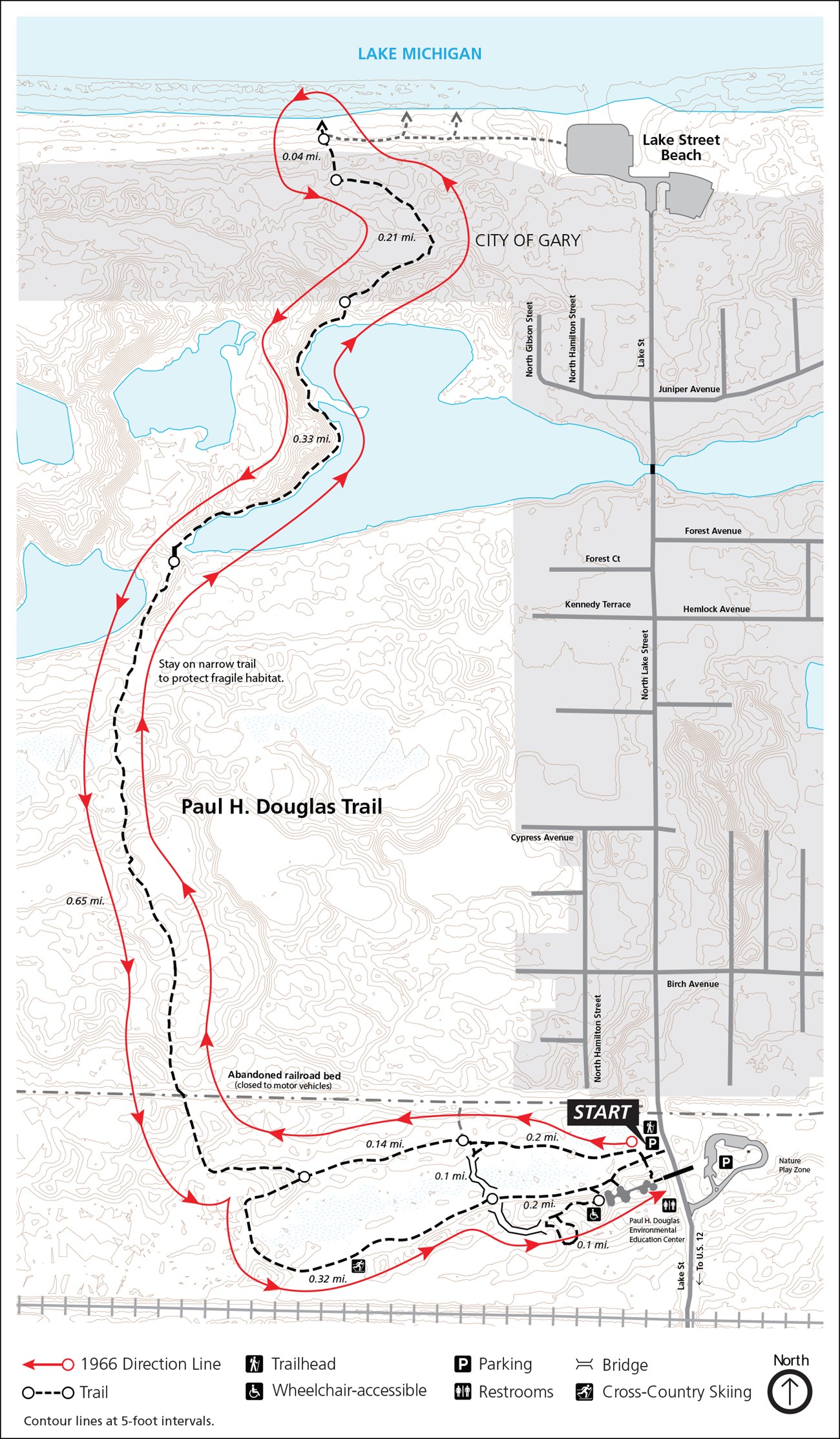
With a unique pattern of alternating sand ridges and lush wetlands, Miller Woods is an enchanting landscape of diversity. Delight your senses as you wander through this globally-rare topography known as ridge and swale. The beach ridges near the parking area formed over 3,000 years ago when Lake Michigan’s waves roared here. Each ridge you cross on your way to the beach represents a younger shoreline, built by waves. Catch the crimson shimmer of a red-headed woodpecker on a black oak, or turquoise flash of a six-lined race runner lizard dashing across the hot sand. The 1966 Hiking Challenge is comprised of 19 hikes that cover 66 miles of trail in the park- celebrating the park’s founding in 1966. The ranger-led hike for this trail meets at the Paul H. Douglas Center's parking lot. For more information, including specific dates and trail locations, visit this Thing to Do and scroll down. Do not worry if you cannot make each of the 19 ranger-led hikes. A check-off sheet will be available at the Visitor Center or the the Paul H. Douglas Center for those who complete the hikes on their own. REMINDER: Information found on this page is specific to the 1966 Hiking Challenge
BE PREPARED
Getting ThereTrailhead Parking Lots100 North Lake Street, Gary, IN 46403 Trailhead GPS Coordinates 41.606466, -87.268527 (Decimal Degrees) Need to Know

Hike to the beach and back and loop the wetland. |
Last updated: April 14, 2025
