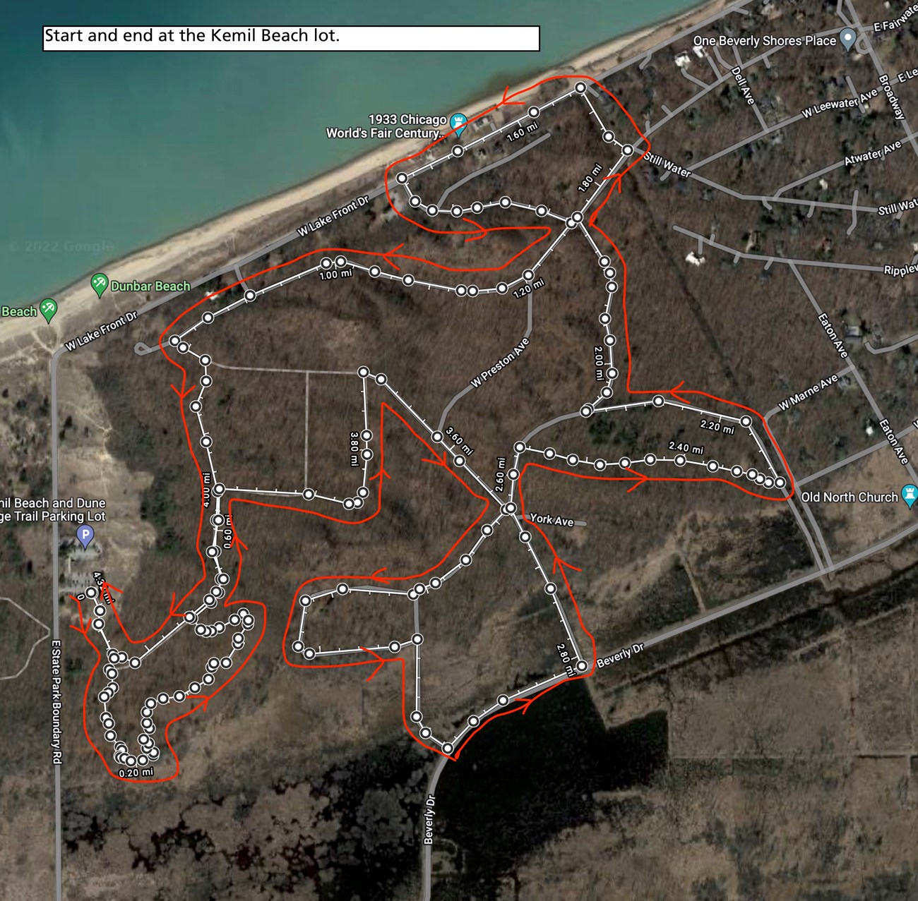
Joseph Gruzalski This hike begins in a blowout formation, an iconic dune-system landform characterized by open sand, grassy vegetation, and a lack of trees. They are typically U-shaped and form from strong unidirectional winds. Travel up and over the blowout to reach dunes with more established, woodland vegetation. The Dune Ridge Trail brings visitors through the oak woodland to the top of a scenic dune crest that offers extensive Great Marsh views to the south. The trail also dips down to the edge of the marsh. The 1966 Hiking Challenge is comprised of 19 hikes that cover 66 miles of trail in the park- celebrating the park’s founding in 1966. The ranger-led hike for this trail meets at the Kemil Beach parking lot. For more information, including specific dates and trail locations, visit this Thing to Do and scroll down. Do not worry if you cannot make each of the 19 ranger-led hikes. A check-off sheet will be available at the Visitor Center or the the Paul H. Douglas Center for those who complete the hikes on their own. REMINDER: Information found on this page is specific to the 1966 Hiking Challenge
BE PREPARED
Getting ThereDune Ridge Trailhead and Kemil Beach Parking Lot Need to Know

Start and end at the Kemil Beach parking lot. |
Last updated: April 14, 2025
